Property Record
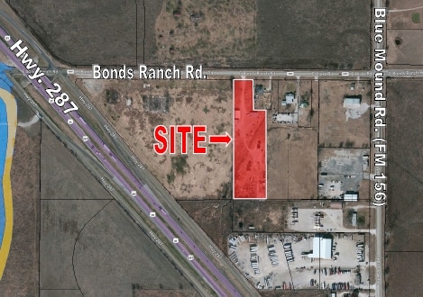
648 E Bonds Ranch Rd, Fort Worth, TX 76131

Property Detail
648 E Bonds Ranch Rd
Dallas-Fort Worth-Arlington, TX
REDFIELD, WILLIAM SURVEY ABSTRACT 1348 TRACT 1F BOUNDARY SPLIT
04906209
TARRANT
Commercialnec
Texas
B and X Area of moderate flood hazard, usually the area between the limits of the 100-year and 500-year floods.
0.30 AC
2024
Alliance
2025
Dallas/Ft Worth
113930
NEARBY LISTINGS FOR SALE OR LEASE
DEMOGRAPHICS near 648 E Bonds Ranch Rd
1 mile
3 mile
5 mile
2025 Total Population
7,607
62,603
205,877
2030 Population
8,233
67,822
219,954
Pop Growth 2025-2030
+ 8.23%
+ 8.34%
+ 6.84%
Average Age
34
35
35
2025 Total Households
2,366
20,613
66,919
HH Growth 2025-2030
+ 8.45%
+ 8.52%
+ 7.02%
Median Household Inc
$119,843
$117,675
$113,608
Avg Household Size
3.20
3.00
3.00
2025 Avg HH Vehicles
2.00
2.00
2.00
Median Home Value
$368,176
$387,304
$366,792
Median Year Built
2011
2010
2008
Nearby Places
Map Layers
Map Styles
 Street
 Aerial
Transit
 Traffic
 Biking
Places
Listings with unknown addresses are not visible on the map
- Restaurants
- Banks
- Shops
- Fitness
- Groceries
PUBLIC TRANSPORTATION
AIRPORT
Dallas-Fort Worth International
Drive
Walk
Distance
Dallas-Fort Worth International
36 min
28.0 mi
Dallas Love Field
Drive
Walk
Distance
Dallas Love Field
47 min
36.7 mi
Freight Ports
Port of Shreveport
Drive
Walk
Distance
Port of Shreveport
257 min
235.9 mi
SALE & LEASE HISTORY
LISTING DATE
SALE/LEASE

Sep 24, 2016
For Sale
Jun 14, 2017
For Sale
Jan 07, 2025
For Sale
Nearby Properties
Address
Land Use
TOTAL SIZE
Lot Size
Zoning
Address
Land Use
TOTAL SIZE
Lot Size
Zoning
348,270 SF
39.34 AC
Address
Land Use
TOTAL SIZE
Lot Size
Zoning
553,605 SF
81.10 AC
Address
Land Use
TOTAL SIZE
Lot Size
Zoning
252,365 SF
20.53 AC
Address
Land Use
TOTAL SIZE
Lot Size
Zoning
681,942 SF
29.37 AC
Address
Land Use
TOTAL SIZE
Lot Size
Zoning
305,697 SF
42.24 AC
Address
Land Use
TOTAL SIZE
Lot Size
Zoning
391,529 SF
17.23 AC
Address
Land Use
TOTAL SIZE
Lot Size
Zoning
362,688 SF
34.18 AC
Address
Land Use
TOTAL SIZE
Lot Size
Zoning
266,008 SF
33 AC
Address
Land Use
TOTAL SIZE
Lot Size
Zoning
422,682 SF
22.66 AC
Address
Land Use
TOTAL SIZE
Lot Size
Zoning
504,000 SF
26.39 AC
Address
Land Use
TOTAL SIZE
Lot Size
Zoning
436,875 SF
11.14 AC
Address
Land Use
TOTAL SIZE
Lot Size
Zoning
314,766 SF
17.34 AC
Address
Land Use
TOTAL SIZE
Lot Size
Zoning
270,000 SF
42.20 AC
Address
Land Use
TOTAL SIZE
Lot Size
Zoning
377,934 SF
16.02 AC
Address
Land Use
TOTAL SIZE
Lot Size
Zoning
372,886 SF
19.33 AC
Address
Land Use
TOTAL SIZE
Lot Size
Zoning
353,678 SF
13.57 AC
Address
Land Use
TOTAL SIZE
Lot Size
Zoning
359,225 SF
14.26 AC
Address
Land Use
TOTAL SIZE
Lot Size
Zoning
332,287 SF
11.72 AC
Address
Land Use
TOTAL SIZE
Lot Size
Zoning
311,100 SF
17.11 AC
Address
Land Use
TOTAL SIZE
Lot Size
Zoning
727,900 SF
40.15 AC
Address
Land Use
TOTAL SIZE
Lot Size
Zoning
412,258 SF
12.62 AC
Address
Land Use
TOTAL SIZE
Lot Size
Zoning
707,940 SF
35.33 AC
Address
Land Use
TOTAL SIZE
Lot Size
Zoning
268,573 SF
11.09 AC
Address
Land Use
TOTAL SIZE
Lot Size
Zoning
225,743 SF
19.54 AC
Address
Land Use
TOTAL SIZE
Lot Size
Zoning
267,831 SF
17.40 AC
Address
Land Use
TOTAL SIZE
Lot Size
Zoning
222,672 SF
8.73 AC
Address
Land Use
TOTAL SIZE
Lot Size
Zoning
236,072 SF
14.74 AC
Address
Land Use
TOTAL SIZE
Lot Size
Zoning
418,271 SF
43.10 AC
Address
Land Use
TOTAL SIZE
Lot Size
Zoning
553,280 SF
30.11 AC
Address
Land Use
TOTAL SIZE
Lot Size
Zoning
249,997 SF
11.47 AC
The World's #1 Commercial Real Estate Marketplace
Connect with us
© 2026 CoStar Group
The information above has been obtained from sources believed reliable. While we do not doubt its accuracy we have not verified it and make no guarantee, warranty or representation about it. It is your responsibility to independently confirm its accuracy and completeness. Any projections, opinions, assumptions, or estimates used are for example only and do not represent the current or future performance of the property. The value of this transaction to you depends on tax and other factors which should be evaluated by your tax, financial, and legal advisors. You and your advisors should conduct a careful, independent investigation of the property to determine to your satisfaction the suitability of the property for your needs.