Property Record
6485 Us Highway 1, Rockledge, FL 32955


NEARBY LISTINGS FOR SALE OR LEASE
Property Detail
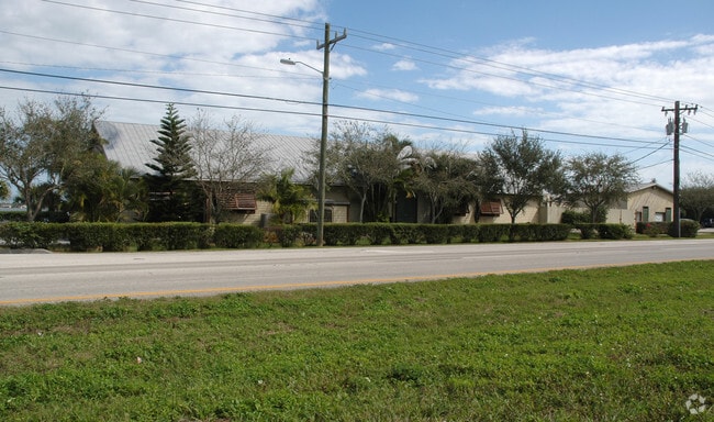
6485 Us Highway 1
Palm Bay-Melbourne-Titusville, FL
Pineda
26-36-12-DE-00006.0-0001.00
PINEDA PART OF BLK 6, LAND DESC IN DB 398 PG 450,PART OF DEARBORN RESERVE AS DESC IN ORB 4008 PG 2769, ALL OF VAC DEARBORN AVE & N1/2 OF VAC EUGENE AVE AS DESC IN ORB 113 PG 775 ALL LYING E OF US HWY 1
Restaurantbuilding
Brevard
AE
Florida
12009C0510H
1
2024
1.93 AC
2025
Brevard County
062800
Orlando
10,252 SF
DEMOGRAPHICS near 6485 Us Highway 1
1 Mile
3 Mile
5 Mile
2024 Total Population
3,602
28,024
82,925
2029 Population
3,996
30,548
91,149
Pop Growth 2024-2029
+ 10.94%
+ 9.01%
+ 9.92%
Average Age
51
48
46
2024 Total Households
1,665
12,012
34,397
HH Growth 2024-2029
+ 11.11%
+ 8.94%
+ 9.59%
Median Household Inc
$70,136
$99,970
$91,628
Avg Household Size
2.10
2.30
2.40
2024 Avg HH Vehicles
2.00
2.00
2.00
Median Home Value
$301,119
$349,808
$373,873
Median Year Built
1993
1996
1997
Nearby Places
Map Layers
Map Styles
 Street
 Aerial
- Restaurants
- Banks
- Shops
- Fitness
- Groceries
PUBLIC TRANSPORTATION
AIRPORT
Melbourne Orlando International
DRIVE
WALK
Distance
Melbourne Orlando International
25 min
12.6 mi
Freight Ports
Port Canaveral
DRIVE
WALK
Distance
Port Canaveral
33 min
21.3 mi
Nearby Properties
Address
Land Use
TOTAL SIZE
Lot Size
Zoning
Address
Land Use
TOTAL SIZE
Lot Size
Zoning
354,864 SF
26.76 AC
PIP
Address
Land Use
TOTAL SIZE
Lot Size
Zoning
406,986 SF
30.50 AC
PUD
Address
Land Use
TOTAL SIZE
Lot Size
Zoning
269,541 SF
17.80 AC
PUD
Address
Land Use
TOTAL SIZE
Lot Size
Zoning
134,562 SF
18.25 AC
BU1
Address
Land Use
TOTAL SIZE
Lot Size
Zoning
113,498 SF
37.57 AC
PUD
Address
Land Use
TOTAL SIZE
Lot Size
Zoning
96,110 SF
49.65 AC
INH
Address
Land Use
TOTAL SIZE
Lot Size
Zoning
133,137 SF
10.59 AC
PUD
Address
Land Use
TOTAL SIZE
Lot Size
Zoning
135,320 SF
16.54 AC
BU1
Address
Land Use
TOTAL SIZE
Lot Size
Zoning
97,430 SF
51.89 AC
BU1
Address
Land Use
TOTAL SIZE
Lot Size
Zoning
69,560 SF
9 AC
PUD
Address
Land Use
TOTAL SIZE
Lot Size
Zoning
170,721 SF
28.52 AC
PIP
Address
Land Use
TOTAL SIZE
Lot Size
Zoning
83,420 SF
5.94 AC
PUD
Address
Land Use
TOTAL SIZE
Lot Size
Zoning
91,470 SF
3.01 AC
BU1
Address
Land Use
TOTAL SIZE
Lot Size
Zoning
178,191 SF
18.19 AC
TU-2
Address
Land Use
TOTAL SIZE
Lot Size
Zoning
54,114 SF
11.48 AC
Address
Land Use
TOTAL SIZE
Lot Size
Zoning
120,600 SF
2.76 AC
Address
Land Use
TOTAL SIZE
Lot Size
Zoning
222,414 SF
13.13 AC
BU1
Address
Land Use
TOTAL SIZE
Lot Size
Zoning
82,494 SF
11.49 AC
BU1
Address
Land Use
TOTAL SIZE
Lot Size
Zoning
51,042 SF
1.70 AC
TU-2
Address
Land Use
TOTAL SIZE
Lot Size
Zoning
57,069 SF
5.89 AC
Address
Land Use
TOTAL SIZE
Lot Size
Zoning
67,313 SF
335.11 AC
PUD
Address
Land Use
TOTAL SIZE
Lot Size
Zoning
79,972 SF
7.20 AC
TU-2
Address
Land Use
TOTAL SIZE
Lot Size
Zoning
112,250 SF
6.76 AC
IU
Address
Land Use
TOTAL SIZE
Lot Size
Zoning
168,229 SF
20.36 AC
BU1/BU2
Address
Land Use
TOTAL SIZE
Lot Size
Zoning
2.61 AC
PUD
Address
Land Use
TOTAL SIZE
Lot Size
Zoning
73,100 SF
5.67 AC
C2
Address
Land Use
TOTAL SIZE
Lot Size
Zoning
128,415 SF
9.98 AC
BU2
Address
Land Use
TOTAL SIZE
Lot Size
Zoning
1.10 AC
BU-1
Address
Land Use
TOTAL SIZE
Lot Size
Zoning
62,431 SF
16.51 AC
BU-1
Address
Land Use
TOTAL SIZE
Lot Size
Zoning
94,217 SF
9.74 AC
PUD
The World's #1 Commercial Real Estate Marketplace
Connect with us
© 2026 CoStar Group
The information above has been obtained from sources believed reliable. While we do not doubt its accuracy we have not verified it and make no guarantee, warranty or representation about it. It is your responsibility to independently confirm its accuracy and completeness. Any projections, opinions, assumptions, or estimates used are for example only and do not represent the current or future performance of the property. The value of this transaction to you depends on tax and other factors which should be evaluated by your tax, financial, and legal advisors. You and your advisors should conduct a careful, independent investigation of the property to determine to your satisfaction the suitability of the property for your needs.