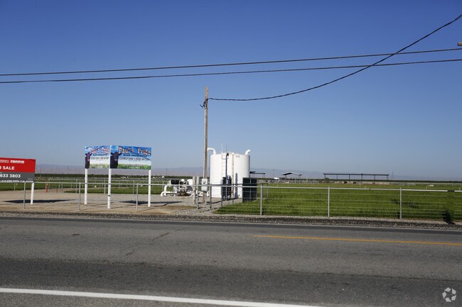
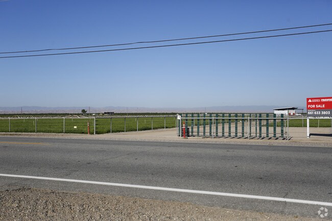
Property Record
649 Enos Ln, Bakersfield, CA 93314

Property Detail
649 Enos Ln
104-420-16-00-6
SECTION 35 , TOWNSHIP 29 , RANGE 25 , QUARTER
Livestock
KERN
A
California
B and X Area of moderate flood hazard, usually the area between the limits of the 100-year and 500-year floods.
19.86 AC
2024
NW Outlying Kern County
2025
Bakersfield
006600
Bakersfield-Delano, CA
NEARBY LISTINGS FOR SALE OR LEASE
-
-
View all Bakersfield listings for sale on LoopNet.com
DEMOGRAPHICS near 649 Enos Ln
1 mile
3 mile
5 mile
2025 Total Population
46
857
12,949
2030 Population
47
875
13,329
Pop Growth 2025-2030
+ 2.17%
+ 2.10%
+ 2.93%
Average Age
39
38
36
2025 Total Households
14
258
3,769
HH Growth 2025-2030
0.00%
+ 1.94%
+ 2.87%
Median Household Inc
$143,749
$129,310
$133,629
Avg Household Size
3.30
3.30
3.30
2025 Avg HH Vehicles
3.00
3.00
3.00
Median Home Value
$785,714
$724,056
$590,243
Median Year Built
1994
1990
2005
Nearby Places
Map Layers
Map Styles
 Street
 Aerial
Layers
 Traffic
 Biking
Places
Listings with unknown addresses are not visible on the map
- Restaurants
- Banks
- Shops
- Fitness
- Groceries
PUBLIC TRANSPORTATION
AIRPORT
Meadows Field
Drive
Walk
Distance
Meadows Field
29 min
17.4 mi
Freight Ports
The Port of Hueneme
Drive
Walk
Distance
The Port of Hueneme
158 min
127.0 mi
SALE & LEASE HISTORY
LISTING DATE
SALE/LEASE

May 04, 2017
For Sale
Nearby Properties
Address
Land Use
TOTAL SIZE
Lot Size
Zoning
Address
Land Use
TOTAL SIZE
Lot Size
Zoning
307.76 AC
A
Address
Land Use
TOTAL SIZE
Lot Size
Zoning
318.18 AC
A
Address
Land Use
TOTAL SIZE
Lot Size
Zoning
116.97 AC
A
Address
Land Use
TOTAL SIZE
Lot Size
Zoning
6,250 SF
19.12 AC
NR
Address
Land Use
TOTAL SIZE
Lot Size
Zoning
6,000 SF
5.61 AC
M2/PD
Address
Land Use
TOTAL SIZE
Lot Size
Zoning
4,800 SF
25.70 AC
Address
Land Use
TOTAL SIZE
Lot Size
Zoning
4,100 SF
2.40 AC
A-1
Address
Land Use
TOTAL SIZE
Lot Size
Zoning
317.56 AC
A
Address
Land Use
TOTAL SIZE
Lot Size
Zoning
6,000 SF
4.60 AC
M-1
Address
Land Use
TOTAL SIZE
Lot Size
Zoning
19.34 AC
A
Address
Land Use
TOTAL SIZE
Lot Size
Zoning
79.09 AC
A
Address
Land Use
TOTAL SIZE
Lot Size
Zoning
64.89 AC
A
Address
Land Use
TOTAL SIZE
Lot Size
Zoning
156.36 AC
A
Address
Land Use
TOTAL SIZE
Lot Size
Zoning
306.33 AC
A
Address
Land Use
TOTAL SIZE
Lot Size
Zoning
4,000 SF
26.74 AC
M-3
Address
Land Use
TOTAL SIZE
Lot Size
Zoning
3,458 SF
160 AC
A
Address
Land Use
TOTAL SIZE
Lot Size
Zoning
5,000 SF
7.34 AC
M2
Address
Land Use
TOTAL SIZE
Lot Size
Zoning
2,400 SF
8.43 AC
A
Address
Land Use
TOTAL SIZE
Lot Size
Zoning
2,637 SF
4.73 AC
M1PD
Address
Land Use
TOTAL SIZE
Lot Size
Zoning
78.77 AC
A
Address
Land Use
TOTAL SIZE
Lot Size
Zoning
9,875 SF
4.18 AC
A-1
Address
Land Use
TOTAL SIZE
Lot Size
Zoning
8,000 SF
4.64 AC
NR(5)PD
Address
Land Use
TOTAL SIZE
Lot Size
Zoning
164.47 AC
A
Address
Land Use
TOTAL SIZE
Lot Size
Zoning
8,687 SF
20.78 AC
A
Address
Land Use
TOTAL SIZE
Lot Size
Zoning
78.18 AC
A
Address
Land Use
TOTAL SIZE
Lot Size
Zoning
3,831 SF
38.18 AC
A
Address
Land Use
TOTAL SIZE
Lot Size
Zoning
161.75 AC
A
Address
Land Use
TOTAL SIZE
Lot Size
Zoning
8,660 SF
20.78 AC
A
Address
Land Use
TOTAL SIZE
Lot Size
Zoning
159.82 AC
A
The World's #1 Commercial Real Estate Marketplace
Connect with us
© 2026 CoStar Group
The information above has been obtained from sources believed reliable. While we do not doubt its accuracy we have not verified it and make no guarantee, warranty or representation about it. It is your responsibility to independently confirm its accuracy and completeness. Any projections, opinions, assumptions, or estimates used are for example only and do not represent the current or future performance of the property. The value of this transaction to you depends on tax and other factors which should be evaluated by your tax, financial, and legal advisors. You and your advisors should conduct a careful, independent investigation of the property to determine to your satisfaction the suitability of the property for your needs.