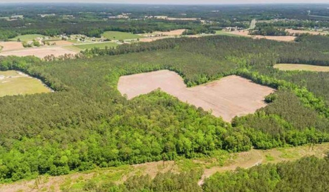
Property Record
649 Howell Rd, Princeton, NC 27569

NEARBY LISTINGS FOR SALE OR LEASE
Property Detail
649 Howell Rd
Raleigh-Cary, NC
Eliza Massey Division
04O11004A
ALBERT DAUGHTRY LB9/37
Realpropertynec
Johnston
X
North Carolina
3720262200K
50.46 AC
2025
Johnston County
2025
Raleigh/Durham
040501
DEMOGRAPHICS near 649 Howell Rd
1 Mile
3 Mile
5 Mile
2024 Total Population
425
5,938
13,624
2029 Population
516
7,176
16,462
Pop Growth 2024-2029
+ 21.41%
+ 20.85%
+ 20.83%
Average Age
39
39
40
2024 Total Households
155
2,244
5,193
HH Growth 2024-2029
+ 21.29%
+ 20.94%
+ 20.95%
Median Household Inc
$65,625
$64,363
$64,310
Avg Household Size
2.70
2.60
2.60
2024 Avg HH Vehicles
3.00
2.00
2.00
Median Home Value
$210,000
$178,942
$165,713
Median Year Built
1994
1988
1990
Nearby Places
Map Layers
Map Styles
 Street
 Aerial
- Restaurants
- Banks
- Shops
- Fitness
- Groceries
PUBLIC TRANSPORTATION
COMMUTER RAIL
Selma (Carolinian - Amtrak, Palmetto - Amtrak)
DRIVE
WALK
Distance
Selma (Carolinian - Amtrak, Palmetto - Amtrak)
11 min
6.9 mi
Freight Ports
Port of Wilmington
DRIVE
WALK
Distance
Port of Wilmington
133 min
106.1 mi
SALE & LEASE HISTORY
LISTING DATE
SALE/LEASE

May 08, 2019
For Sale
Nearby Properties
Address
Land Use
TOTAL SIZE
Lot Size
Zoning
Address
Land Use
TOTAL SIZE
Lot Size
Zoning
17,000 SF
33.85 AC
RAG
Address
Land Use
TOTAL SIZE
Lot Size
Zoning
19,854 SF
7.86 AC
COM
Address
Land Use
TOTAL SIZE
Lot Size
Zoning
3,840 SF
3.05 AC
REW
Address
Land Use
TOTAL SIZE
Lot Size
Zoning
19,778 SF
0.77 AC
REW
Address
Land Use
TOTAL SIZE
Lot Size
Zoning
34.19 AC
IND
Address
Land Use
TOTAL SIZE
Lot Size
Zoning
312.73 AC
RAG
Address
Land Use
TOTAL SIZE
Lot Size
Zoning
286.62 AC
IND
Address
Land Use
TOTAL SIZE
Lot Size
Zoning
13,080 SF
4.40 AC
REW
Address
Land Use
TOTAL SIZE
Lot Size
Zoning
15.76 AC
IND
Address
Land Use
TOTAL SIZE
Lot Size
Zoning
3,750 SF
3.69 AC
COW
Address
Land Use
TOTAL SIZE
Lot Size
Zoning
32,374 SF
26.45 AC
COW
Address
Land Use
TOTAL SIZE
Lot Size
Zoning
14,848 SF
3.17 AC
RAG
Address
Land Use
TOTAL SIZE
Lot Size
Zoning
21,860 SF
5.31 AC
COW
Address
Land Use
TOTAL SIZE
Lot Size
Zoning
4,000 SF
3.54 AC
COW
Address
Land Use
TOTAL SIZE
Lot Size
Zoning
3,065 SF
2.24 AC
RES
Address
Land Use
TOTAL SIZE
Lot Size
Zoning
11,918 SF
2.73 AC
IND
Address
Land Use
TOTAL SIZE
Lot Size
Zoning
10,576 SF
1.65 AC
COW
Address
Land Use
TOTAL SIZE
Lot Size
Zoning
7,675 SF
70.58 AC
COM
Address
Land Use
TOTAL SIZE
Lot Size
Zoning
9,720 SF
13.12 AC
RAG
Address
Land Use
TOTAL SIZE
Lot Size
Zoning
129 AC
IND
Address
Land Use
TOTAL SIZE
Lot Size
Zoning
8,745 SF
6.37 AC
COW
Address
Land Use
TOTAL SIZE
Lot Size
Zoning
10,666 SF
1.90 AC
COM
Address
Land Use
TOTAL SIZE
Lot Size
Zoning
7,050 SF
6.01 AC
COM
Address
Land Use
TOTAL SIZE
Lot Size
Zoning
8,730 SF
1.51 AC
REW
Address
Land Use
TOTAL SIZE
Lot Size
Zoning
3,456 SF
22.68 AC
RAG
Address
Land Use
TOTAL SIZE
Lot Size
Zoning
4,131 SF
0.75 AC
COW
Address
Land Use
TOTAL SIZE
Lot Size
Zoning
159.77 AC
RAG
Address
Land Use
TOTAL SIZE
Lot Size
Zoning
2,601 SF
1.38 AC
RES
Address
Land Use
TOTAL SIZE
Lot Size
Zoning
1,600 SF
193.11 AC
RAG
Address
Land Use
TOTAL SIZE
Lot Size
Zoning
4,200 SF
2.26 AC
COM
The World's #1 Commercial Real Estate Marketplace
Connect with us
© 2026 CoStar Group
The information above has been obtained from sources believed reliable. While we do not doubt its accuracy we have not verified it and make no guarantee, warranty or representation about it. It is your responsibility to independently confirm its accuracy and completeness. Any projections, opinions, assumptions, or estimates used are for example only and do not represent the current or future performance of the property. The value of this transaction to you depends on tax and other factors which should be evaluated by your tax, financial, and legal advisors. You and your advisors should conduct a careful, independent investigation of the property to determine to your satisfaction the suitability of the property for your needs.