Property Record
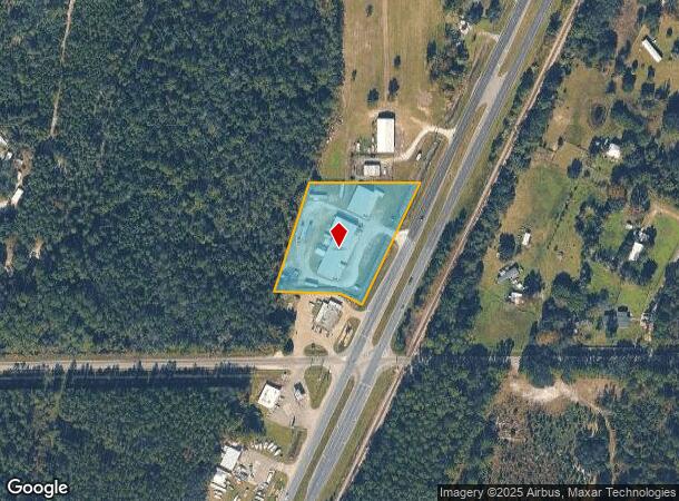
649 N Highway 17, Palatka, FL 32177


NEARBY LISTINGS FOR SALE OR LEASE
Property Detail
649 N Highway 17
13-09-26-0000-0031-0011
PT OF SW1/4 OF NW1/4 OR996, P1482 (EX OR1045 P152), (SUBJECT TO ESMT OR1197 P432)
Lightindustrial
Putnam
X
Florida
12107C0185C
2.15 AC
2025
Florida Central North Area
2025
Other Market Areas
950100
Palatka, FL
4,000 SF
DEMOGRAPHICS near 649 N Highway 17
1 Mile
3 Mile
5 Mile
2024 Total Population
144
1,080
10,460
2029 Population
153
1,127
10,839
Pop Growth 2024-2029
+ 6.25%
+ 4.35%
+ 3.62%
Average Age
44
45
41
2024 Total Households
58
434
4,073
HH Growth 2024-2029
+ 6.90%
+ 4.15%
+ 3.54%
Median Household Inc
$63,750
$54,193
$33,972
Avg Household Size
2.40
2.50
2.50
2024 Avg HH Vehicles
2.00
2.00
2.00
Median Home Value
$163,636
$201,000
$138,654
Median Year Built
1988
1986
1976
Nearby Places
Map Layers
Map Styles
 Street
 Aerial
- Restaurants
- Banks
- Shops
- Fitness
- Groceries
PUBLIC TRANSPORTATION
COMMUTER RAIL
Palatka Amtrak (Silver Meteor - Amtrak, Silver Star - Amtrak)
DRIVE
WALK
Distance
Palatka Amtrak (Silver Meteor - Amtrak, Silver Star - Amtrak)
9 min
5.6 mi
Freight Ports
Jacksonville Port
DRIVE
WALK
Distance
Jacksonville Port
78 min
51.6 mi
Nearby Properties
Address
Land Use
TOTAL SIZE
Lot Size
Zoning
Address
Land Use
TOTAL SIZE
Lot Size
Zoning
22,360 SF
103.82 AC
Address
Land Use
TOTAL SIZE
Lot Size
Zoning
211,250 SF
586.70 AC
Address
Land Use
TOTAL SIZE
Lot Size
Zoning
21,608 SF
1,990.73 AC
Address
Land Use
TOTAL SIZE
Lot Size
Zoning
54,720 SF
29.19 AC
Address
Land Use
TOTAL SIZE
Lot Size
Zoning
1,107 SF
21.57 AC
Address
Land Use
TOTAL SIZE
Lot Size
Zoning
2,450 SF
26.46 AC
Address
Land Use
TOTAL SIZE
Lot Size
Zoning
684 SF
184.90 AC
Address
Land Use
TOTAL SIZE
Lot Size
Zoning
2,816 SF
15.84 AC
Address
Land Use
TOTAL SIZE
Lot Size
Zoning
176,814 SF
4.64 AC
Address
Land Use
TOTAL SIZE
Lot Size
Zoning
12,960 SF
4.52 AC
Address
Land Use
TOTAL SIZE
Lot Size
Zoning
2,980 SF
38.86 AC
Address
Land Use
TOTAL SIZE
Lot Size
Zoning
10,560 SF
4.65 AC
Address
Land Use
TOTAL SIZE
Lot Size
Zoning
19,610 SF
18.28 AC
Address
Land Use
TOTAL SIZE
Lot Size
Zoning
3,614 SF
61.87 AC
Address
Land Use
TOTAL SIZE
Lot Size
Zoning
2,108 SF
5.42 AC
Address
Land Use
TOTAL SIZE
Lot Size
Zoning
768 SF
7.16 AC
Address
Land Use
TOTAL SIZE
Lot Size
Zoning
118.46 AC
Address
Land Use
TOTAL SIZE
Lot Size
Zoning
3,924 SF
2.97 AC
Address
Land Use
TOTAL SIZE
Lot Size
Zoning
27,424 SF
4.57 AC
Address
Land Use
TOTAL SIZE
Lot Size
Zoning
2,412 SF
3.34 AC
Address
Land Use
TOTAL SIZE
Lot Size
Zoning
23,584 SF
6.21 AC
Address
Land Use
TOTAL SIZE
Lot Size
Zoning
315.11 AC
Address
Land Use
TOTAL SIZE
Lot Size
Zoning
2,751 SF
7.70 AC
Address
Land Use
TOTAL SIZE
Lot Size
Zoning
900 SF
5.79 AC
Address
Land Use
TOTAL SIZE
Lot Size
Zoning
6,651 SF
7.26 AC
Address
Land Use
TOTAL SIZE
Lot Size
Zoning
4,070 SF
1.72 AC
Address
Land Use
TOTAL SIZE
Lot Size
Zoning
9,050 SF
3.19 AC
Address
Land Use
TOTAL SIZE
Lot Size
Zoning
4,500 SF
5.43 AC
Address
Land Use
TOTAL SIZE
Lot Size
Zoning
1,120 SF
3.62 AC
Address
Land Use
TOTAL SIZE
Lot Size
Zoning
18.05 AC
The World's #1 Commercial Real Estate Marketplace
Connect with us
© 2026 CoStar Group
The information above has been obtained from sources believed reliable. While we do not doubt its accuracy we have not verified it and make no guarantee, warranty or representation about it. It is your responsibility to independently confirm its accuracy and completeness. Any projections, opinions, assumptions, or estimates used are for example only and do not represent the current or future performance of the property. The value of this transaction to you depends on tax and other factors which should be evaluated by your tax, financial, and legal advisors. You and your advisors should conduct a careful, independent investigation of the property to determine to your satisfaction the suitability of the property for your needs.