Property Record
6492 Portland Rd Ne, Salem, OR 97305


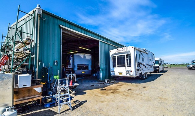

Property Detail
6492 Portland Rd Ne
552375
LABISH GARDENS LOT FR 45 ACRES 4.28
Officebuilding
Marion
I
Oregon
B and X Area of moderate flood hazard, usually the area between the limits of the 100-year and 500-year floods.
45
2024
4.28 AC
2025
Marion County
002502
Portland
8,242 SF
Salem, OR
NEARBY LISTINGS FOR SALE OR LEASE
DEMOGRAPHICS near 6492 Portland Rd Ne
1 mile
3 mile
5 mile
2025 Total Population
2,094
59,586
118,549
2030 Population
2,181
60,209
119,504
Pop Growth 2025-2030
+ 4.15%
+ 1.05%
+ 0.81%
Average Age
40
38
38
2025 Total Households
726
20,930
41,688
HH Growth 2025-2030
+ 4.41%
+ 1.17%
+ 0.93%
Median Household Inc
$65,493
$70,280
$67,144
Avg Household Size
2.80
2.80
2.70
2025 Avg HH Vehicles
2.00
2.00
2.00
Median Home Value
$342,592
$421,707
$392,080
Median Year Built
1987
1986
1979
Nearby Places
Map Layers
Map Styles
 Street
 Aerial
Transit
 Traffic
 Biking
Places
Listings with unknown addresses are not visible on the map
- Restaurants
- Banks
- Shops
- Fitness
- Groceries
PUBLIC TRANSPORTATION
COMMUTER RAIL
Drive
Walk
Distance
16 min
9.6 mi
Freight Ports
Port of Portland
Drive
Walk
Distance
Port of Portland
58 min
43.9 mi
SALE & LEASE HISTORY
LISTING DATE
SALE/LEASE

Sep 23, 2016
For Sale
Jan 11, 2017
For Lease
Nearby Properties
Address
Land Use
TOTAL SIZE
Lot Size
Zoning
Address
Land Use
TOTAL SIZE
Lot Size
Zoning
58,868 SF
38.09 AC
P; RM
Address
Land Use
TOTAL SIZE
Lot Size
Zoning
Address
Land Use
TOTAL SIZE
Lot Size
Zoning
236,632 SF
24.45 AC
CO
Address
Land Use
TOTAL SIZE
Lot Size
Zoning
318,068 SF
14.57 AC
RM2
Address
Land Use
TOTAL SIZE
Lot Size
Zoning
84,940 SF
16.75 AC
IBP
Address
Land Use
TOTAL SIZE
Lot Size
Zoning
68,512 SF
9.09 AC
P
Address
Land Use
TOTAL SIZE
Lot Size
Zoning
29.36 AC
IG; CR
Address
Land Use
TOTAL SIZE
Lot Size
Zoning
Address
Land Use
TOTAL SIZE
Lot Size
Zoning
161,418 SF
4.48 AC
MU
Address
Land Use
TOTAL SIZE
Lot Size
Zoning
134,440 SF
12.25 AC
IBP
Address
Land Use
TOTAL SIZE
Lot Size
Zoning
150,649 SF
3.67 AC
MU
Address
Land Use
TOTAL SIZE
Lot Size
Zoning
16.15 AC
EFU
Address
Land Use
TOTAL SIZE
Lot Size
Zoning
171,349 SF
6.88 AC
RM
Address
Land Use
TOTAL SIZE
Lot Size
Zoning
101,921 SF
3.76 AC
MU
Address
Land Use
TOTAL SIZE
Lot Size
Zoning
51,286 SF
3.43 AC
P
Address
Land Use
TOTAL SIZE
Lot Size
Zoning
112,380 SF
15.48 AC
P
Address
Land Use
TOTAL SIZE
Lot Size
Zoning
123,752 SF
10.14 AC
IBP
Address
Land Use
TOTAL SIZE
Lot Size
Zoning
143,992 SF
6.81 AC
RM2
Address
Land Use
TOTAL SIZE
Lot Size
Zoning
105,537 SF
5.86 AC
RS
Address
Land Use
TOTAL SIZE
Lot Size
Zoning
167,516 SF
7.42 AC
RM
Address
Land Use
TOTAL SIZE
Lot Size
Zoning
54,745 SF
5.32 AC
IBP
Address
Land Use
TOTAL SIZE
Lot Size
Zoning
136,937 SF
6.44 AC
RM2
Address
Land Use
TOTAL SIZE
Lot Size
Zoning
102,832 SF
4.93 AC
MU
Address
Land Use
TOTAL SIZE
Lot Size
Zoning
Address
Land Use
TOTAL SIZE
Lot Size
Zoning
93,718 SF
7.23 AC
CM
Address
Land Use
TOTAL SIZE
Lot Size
Zoning
120,177 SF
6.60 AC
MU
Address
Land Use
TOTAL SIZE
Lot Size
Zoning
128,448 SF
7.01 AC
RM
Address
Land Use
TOTAL SIZE
Lot Size
Zoning
160,626 SF
12.15 AC
RM2
Address
Land Use
TOTAL SIZE
Lot Size
Zoning
101,224 SF
3.93 AC
RM
Address
Land Use
TOTAL SIZE
Lot Size
Zoning
The World's #1 Commercial Real Estate Marketplace
Connect with us
© 2026 CoStar Group
The information above has been obtained from sources believed reliable. While we do not doubt its accuracy we have not verified it and make no guarantee, warranty or representation about it. It is your responsibility to independently confirm its accuracy and completeness. Any projections, opinions, assumptions, or estimates used are for example only and do not represent the current or future performance of the property. The value of this transaction to you depends on tax and other factors which should be evaluated by your tax, financial, and legal advisors. You and your advisors should conduct a careful, independent investigation of the property to determine to your satisfaction the suitability of the property for your needs.