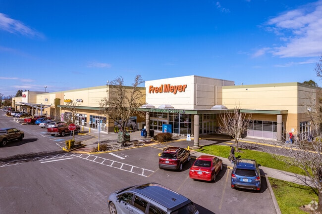
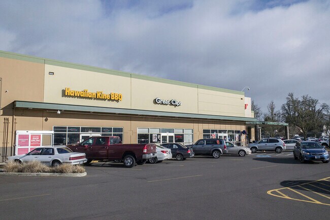
Property Record
6495 Se Tualatin Valley Hwy, Hillsboro, OR 97123

NEARBY LISTINGS FOR SALE OR LEASE
Property Detail
6495 Se Tualatin Valley Hwy
Portland-Vancouver-Hillsboro, OR-WA
Meyer Acres
R2057319
MEYER ACRES, LOT 1, ACRES 14.64
Commercialbuilding
Washington
X
Oregon
41067C0343E
1
2024
14.64 AC
2026
Sunset Corridor/Hillsboro
032412
Portland
165,400 SF
DEMOGRAPHICS near 6495 Se Tualatin Valley Hwy
1 Mile
3 Mile
5 Mile
2024 Total Population
17,357
127,456
253,983
2029 Population
17,932
128,549
255,503
Pop Growth 2024-2029
+ 3.31%
+ 0.86%
+ 0.60%
Average Age
38
38
38
2024 Total Households
6,045
46,947
94,973
HH Growth 2024-2029
+ 3.79%
+ 0.91%
+ 0.65%
Median Household Inc
$98,959
$91,807
$91,532
Avg Household Size
2.80
2.60
2.60
2024 Avg HH Vehicles
2.00
2.00
2.00
Median Home Value
$463,968
$439,611
$464,843
Median Year Built
1996
1995
1991
Nearby Places
Map Layers
Map Styles
 Street
 Aerial
- Restaurants
- Banks
- Shops
- Fitness
- Groceries
PUBLIC TRANSPORTATION
COMMUTER RAIL
Beaverton Transit Center (West Side Express) (Westside Express Service - Tri-County Metropolitan Transportation District of Oregon Rail (TriMet Rail))
DRIVE
WALK
Distance
Beaverton Transit Center (West Side Express) (Westside Express Service - Tri-County Metropolitan Transportation District of Oregon Rail (TriMet Rail))
12 min
5.8 mi
Hall/Nimbus (Westside Express Service - Tri-County Metropolitan Transportation District of Oregon Rail (TriMet Rail))
DRIVE
WALK
Distance
Hall/Nimbus (Westside Express Service - Tri-County Metropolitan Transportation District of Oregon Rail (TriMet Rail))
16 min
8.2 mi
AIRPORT
Portland International
DRIVE
WALK
Distance
Portland International
44 min
26.0 mi
Freight Ports
Port of Portland
DRIVE
WALK
Distance
Port of Portland
27 min
15.0 mi
SALE & LEASE HISTORY
LISTING DATE
SALE/LEASE

Mar 19, 2021
For Lease
Nearby Properties
Address
Land Use
TOTAL SIZE
Lot Size
Zoning
Address
Land Use
TOTAL SIZE
Lot Size
Zoning
373,884 SF
153.56 AC
UC-RP
Address
Land Use
TOTAL SIZE
Lot Size
Zoning
1,004,655 SF
24.55 AC
SCR-V
Address
Land Use
TOTAL SIZE
Lot Size
Zoning
60.97 AC
INST
Address
Land Use
TOTAL SIZE
Lot Size
Zoning
5.83 AC
INST
Address
Land Use
TOTAL SIZE
Lot Size
Zoning
37.66 AC
IND
Address
Land Use
TOTAL SIZE
Lot Size
Zoning
53.13 AC
SC-BP
Address
Land Use
TOTAL SIZE
Lot Size
Zoning
53.49 AC
SCFI
Address
Land Use
TOTAL SIZE
Lot Size
Zoning
256,652 SF
48.72 AC
SFR-7
Address
Land Use
TOTAL SIZE
Lot Size
Zoning
260,677 SF
16.86 AC
INST
Address
Land Use
TOTAL SIZE
Lot Size
Zoning
270,000 SF
37.85 AC
SFR-6
Address
Land Use
TOTAL SIZE
Lot Size
Zoning
0.68 AC
SCR-V
Address
Land Use
TOTAL SIZE
Lot Size
Zoning
495,454 SF
16.99 AC
SCR-V
Address
Land Use
TOTAL SIZE
Lot Size
Zoning
324,326 SF
4.23 AC
SCC-SC
Address
Land Use
TOTAL SIZE
Lot Size
Zoning
8.12 AC
SFR-4.5
Address
Land Use
TOTAL SIZE
Lot Size
Zoning
6.03 AC
SCR-MD
Address
Land Use
TOTAL SIZE
Lot Size
Zoning
24.26 AC
I-P
Address
Land Use
TOTAL SIZE
Lot Size
Zoning
43,041 SF
9.43 AC
SFR-7
Address
Land Use
TOTAL SIZE
Lot Size
Zoning
15.14 AC
MFR-3
Address
Land Use
TOTAL SIZE
Lot Size
Zoning
188,509 SF
17.27 AC
UC-OR
Address
Land Use
TOTAL SIZE
Lot Size
Zoning
90,670 SF
12.17 AC
UC-MU
Address
Land Use
TOTAL SIZE
Lot Size
Zoning
5.57 AC
MU-VTC
Address
Land Use
TOTAL SIZE
Lot Size
Zoning
219,963 SF
7.41 AC
TO:R18-24
Address
Land Use
TOTAL SIZE
Lot Size
Zoning
87,200 SF
6.66 AC
INST
Address
Land Use
TOTAL SIZE
Lot Size
Zoning
195,793 SF
1 AC
SCR-V
Address
Land Use
TOTAL SIZE
Lot Size
Zoning
354,705 SF
18.29 AC
C-G
Address
Land Use
TOTAL SIZE
Lot Size
Zoning
205,467 SF
19.44 AC
C-G
Address
Land Use
TOTAL SIZE
Lot Size
Zoning
115,140 SF
17.70 AC
SC-BP
Address
Land Use
TOTAL SIZE
Lot Size
Zoning
17.84 AC
SC-BP
Address
Land Use
TOTAL SIZE
Lot Size
Zoning
264,648 SF
6.70 AC
SCR-MD
The World's #1 Commercial Real Estate Marketplace
Connect with us
© 2025 CoStar Group
The information above has been obtained from sources believed reliable. While we do not doubt its accuracy we have not verified it and make no guarantee, warranty or representation about it. It is your responsibility to independently confirm its accuracy and completeness. Any projections, opinions, assumptions, or estimates used are for example only and do not represent the current or future performance of the property. The value of this transaction to you depends on tax and other factors which should be evaluated by your tax, financial, and legal advisors. You and your advisors should conduct a careful, independent investigation of the property to determine to your satisfaction the suitability of the property for your needs.