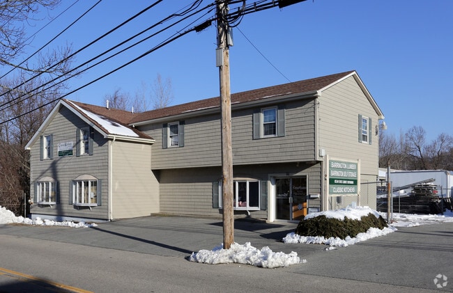
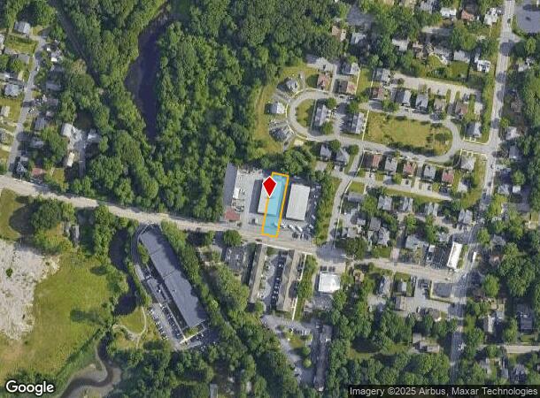
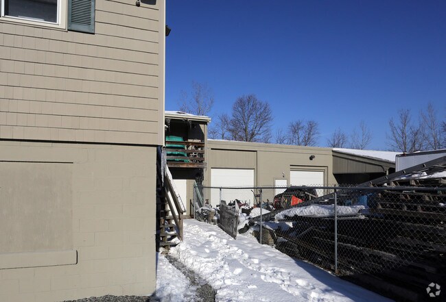
Property Record
65 Bay Spring Ave, Barrington, RI 02806
NEARBY LISTINGS FOR SALE OR LEASE
Property Detail
65 Bay Spring Ave
BARR-000002-000000-000108
Bristol
Vacantlandnec
Rhode Island
X
107
44001C0005H
0.24 AC
2025
Bristol County
2025
Providence
030200
Providence-Warwick, RI-MA
DEMOGRAPHICS near 65 Bay Spring Ave
1 Mile
3 Mile
5 Mile
2024 Total Population
8,177
45,386
147,788
2029 Population
8,238
45,549
147,742
Pop Growth 2024-2029
+ 0.75%
+ 0.36%
(0.03%)
Average Age
45
44
42
2024 Total Households
3,411
18,923
60,402
HH Growth 2024-2029
+ 0.70%
+ 0.33%
(0.02%)
Median Household Inc
$95,159
$96,676
$78,137
Avg Household Size
2.30
2.40
2.40
2024 Avg HH Vehicles
2.00
2.00
2.00
Median Home Value
$395,277
$364,959
$326,957
Median Year Built
1958
1957
1956
Nearby Places
Map Layers
Map Styles
 Street
 Aerial
- Restaurants
- Banks
- Shops
- Fitness
- Groceries
PUBLIC TRANSPORTATION
COMMUTER RAIL
Providence (Providence/Stoughton Line - Massachusetts Bay Transportation Authority Commuter Rail (Purple Line))
DRIVE
WALK
Distance
Providence (Providence/Stoughton Line - Massachusetts Bay Transportation Authority Commuter Rail (Purple Line))
15 min
8.6 mi
AIRPORT
Rhode Island Tf Green International
DRIVE
WALK
Distance
Rhode Island Tf Green International
28 min
15.4 mi
Freight Ports
Port of Davisville, RI
DRIVE
WALK
Distance
Port of Davisville, RI
44 min
27.8 mi
Nearby Properties
Address
Land Use
TOTAL SIZE
Lot Size
Zoning
Address
Land Use
TOTAL SIZE
Lot Size
Zoning
187,151 SF
29.41 AC
RE
Address
Land Use
TOTAL SIZE
Lot Size
Zoning
455.47 AC
I3
Address
Land Use
TOTAL SIZE
Lot Size
Zoning
183,710 SF
30.50 AC
RE
Address
Land Use
TOTAL SIZE
Lot Size
Zoning
110,031 SF
5.07 AC
EH
Address
Land Use
TOTAL SIZE
Lot Size
Zoning
9.35 AC
C1
Address
Land Use
TOTAL SIZE
Lot Size
Zoning
53.20 AC
C1
Address
Land Use
TOTAL SIZE
Lot Size
Zoning
225,458 SF
24.95 AC
I1
Address
Land Use
TOTAL SIZE
Lot Size
Zoning
25.24 AC
R10
Address
Land Use
TOTAL SIZE
Lot Size
Zoning
2.71 AC
B
Address
Land Use
TOTAL SIZE
Lot Size
Zoning
7.44 AC
R5
Address
Land Use
TOTAL SIZE
Lot Size
Zoning
6.58 AC
R5
Address
Land Use
TOTAL SIZE
Lot Size
Zoning
128,578 SF
38.89 AC
O1
Address
Land Use
TOTAL SIZE
Lot Size
Zoning
5.40 AC
WB
Address
Land Use
TOTAL SIZE
Lot Size
Zoning
98,596 SF
2.02 AC
R3
Address
Land Use
TOTAL SIZE
Lot Size
Zoning
84,316 SF
8.15 AC
C1
Address
Land Use
TOTAL SIZE
Lot Size
Zoning
5.76 AC
R5
Address
Land Use
TOTAL SIZE
Lot Size
Zoning
4.60 AC
C1
Address
Land Use
TOTAL SIZE
Lot Size
Zoning
143,838 SF
11.25 AC
I1
Address
Land Use
TOTAL SIZE
Lot Size
Zoning
4.39 AC
B
Address
Land Use
TOTAL SIZE
Lot Size
Zoning
5.97 AC
R5
Address
Land Use
TOTAL SIZE
Lot Size
Zoning
9.50 AC
O1
Address
Land Use
TOTAL SIZE
Lot Size
Zoning
79.02 AC
A7
Address
Land Use
TOTAL SIZE
Lot Size
Zoning
138.20 AC
RE
Address
Land Use
TOTAL SIZE
Lot Size
Zoning
218.86 AC
C
Address
Land Use
TOTAL SIZE
Lot Size
Zoning
6.77 AC
R5
Address
Land Use
TOTAL SIZE
Lot Size
Zoning
7.90 AC
RE
Address
Land Use
TOTAL SIZE
Lot Size
Zoning
31,338 SF
0.95 AC
GI
Address
Land Use
TOTAL SIZE
Lot Size
Zoning
19,144 SF
7.29 AC
R40
Address
Land Use
TOTAL SIZE
Lot Size
Zoning
79,010 SF
2.71 AC
EH
Address
Land Use
TOTAL SIZE
Lot Size
Zoning
39,150 SF
10.10 AC
C
The World's #1 Commercial Real Estate Marketplace
Connect with us
© 2025 CoStar Group
The information above has been obtained from sources believed reliable. While we do not doubt its accuracy we have not verified it and make no guarantee, warranty or representation about it. It is your responsibility to independently confirm its accuracy and completeness. Any projections, opinions, assumptions, or estimates used are for example only and do not represent the current or future performance of the property. The value of this transaction to you depends on tax and other factors which should be evaluated by your tax, financial, and legal advisors. You and your advisors should conduct a careful, independent investigation of the property to determine to your satisfaction the suitability of the property for your needs.