Property Record
65 E 78Th St, Kearney, NE 68847

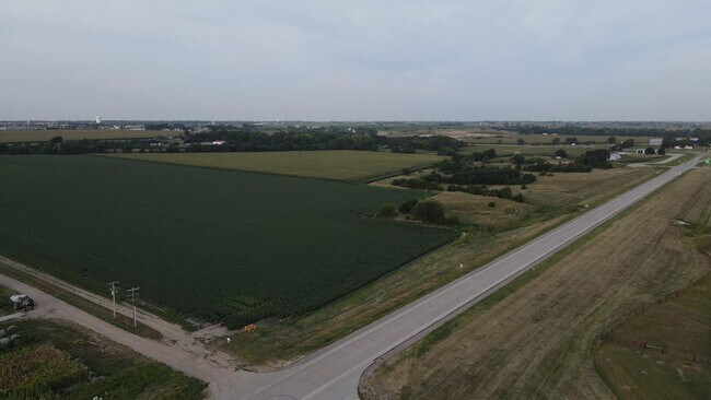

Property Detail
65 E 78Th St
560093000
13-9-16 TR IN N1/2 SW1/4 (0.32 AC)
Agriculturalland
BUFFALO
AGRICULTUR
Nebraska
AE The base floodplain where base flood elevations are provided. AE Zones are now used on new format FIRMs instead of A1-A30 Zones.
288.68 AC
2025
I-80 Corridor
2025
Other Market Areas
969400
Kearney, NE
NEARBY LISTINGS FOR SALE OR LEASE
DEMOGRAPHICS near 65 E 78Th St
1 mile
3 mile
5 mile
2025 Total Population
903
17,709
38,331
2030 Population
928
17,899
38,886
Pop Growth 2025-2030
+ 2.77%
+ 1.07%
+ 1.45%
Average Age
38
40
37
2025 Total Households
353
7,277
15,148
HH Growth 2025-2030
+ 2.83%
+ 1.06%
+ 1.50%
Median Household Inc
$86,250
$83,252
$74,624
Avg Household Size
2.40
2.40
2.30
2025 Avg HH Vehicles
2.00
2.00
2.00
Median Home Value
$333,333
$293,142
$266,793
Median Year Built
2001
1988
1981
Nearby Places
Map Layers
Map Styles
 Street
 Aerial
Transit
 Traffic
 Biking
Places
Listings with unknown addresses are not visible on the map
- Restaurants
- Banks
- Shops
- Fitness
- Groceries
SALE & LEASE HISTORY
LISTING DATE
SALE/LEASE

Sep 28, 2023
For Sale
Oct 24, 2018
For Sale
Nearby Properties
Address
Land Use
TOTAL SIZE
Lot Size
Zoning
Address
Land Use
TOTAL SIZE
Lot Size
Zoning
105,277 SF
20.70 AC
COMMERCIAL
Address
Land Use
TOTAL SIZE
Lot Size
Zoning
95,530 SF
3.27 AC
COMMERCIAL
Address
Land Use
TOTAL SIZE
Lot Size
Zoning
78,912 SF
6.01 AC
COMMERCIAL
Address
Land Use
TOTAL SIZE
Lot Size
Zoning
29,230 SF
9.18 AC
MULTI-FAMI
Address
Land Use
TOTAL SIZE
Lot Size
Zoning
37,515 SF
COMMERCIAL
Address
Land Use
TOTAL SIZE
Lot Size
Zoning
40,860 SF
6 AC
COMMERCIAL
Address
Land Use
TOTAL SIZE
Lot Size
Zoning
855 SF
19.51 AC
COMMERCIAL
Address
Land Use
TOTAL SIZE
Lot Size
Zoning
21,600 SF
15.58 AC
COMMERCIAL
Address
Land Use
TOTAL SIZE
Lot Size
Zoning
13,476 SF
7.44 AC
COMMERCIAL
Address
Land Use
TOTAL SIZE
Lot Size
Zoning
22,204 SF
12.40 AC
COMMERCIAL
Address
Land Use
TOTAL SIZE
Lot Size
Zoning
28,722 SF
7.36 AC
MULTI-FAMI
Address
Land Use
TOTAL SIZE
Lot Size
Zoning
13,736 SF
6.88 AC
MULTI-FAMI
Address
Land Use
TOTAL SIZE
Lot Size
Zoning
1,752 SF
6.90 AC
MULTI-FAMI
Address
Land Use
TOTAL SIZE
Lot Size
Zoning
24,916 SF
3.91 AC
COMMERCIAL
Address
Land Use
TOTAL SIZE
Lot Size
Zoning
1,184 SF
12.46 AC
COMMERCIAL
Address
Land Use
TOTAL SIZE
Lot Size
Zoning
2,592 SF
8.36 AC
COMMERCIAL
Address
Land Use
TOTAL SIZE
Lot Size
Zoning
33,708 SF
3.91 AC
COMMERCIAL
Address
Land Use
TOTAL SIZE
Lot Size
Zoning
110,442 SF
7.88 AC
COMMERCIAL
Address
Land Use
TOTAL SIZE
Lot Size
Zoning
6,517 SF
1.88 AC
COMMERCIAL
Address
Land Use
TOTAL SIZE
Lot Size
Zoning
15,190 SF
3.41 AC
MULTI-FAMI
Address
Land Use
TOTAL SIZE
Lot Size
Zoning
58,069 SF
5.44 AC
COMMERCIAL
Address
Land Use
TOTAL SIZE
Lot Size
Zoning
1,738 SF
3.09 AC
MULTI-FAMI
Address
Land Use
TOTAL SIZE
Lot Size
Zoning
33,784 SF
5.74 AC
OTHER
Address
Land Use
TOTAL SIZE
Lot Size
Zoning
13,521 SF
1.70 AC
COMMERCIAL
Address
Land Use
TOTAL SIZE
Lot Size
Zoning
25,837 SF
2.43 AC
COMMERCIAL
Address
Land Use
TOTAL SIZE
Lot Size
Zoning
12,848 SF
9.01 AC
MULTI-FAMI
Address
Land Use
TOTAL SIZE
Lot Size
Zoning
12,220 SF
51.29 AC
COMMERCIAL
Address
Land Use
TOTAL SIZE
Lot Size
Zoning
18,520 SF
2.20 AC
COMMERCIAL
Address
Land Use
TOTAL SIZE
Lot Size
Zoning
9,324 SF
3.06 AC
COMMERCIAL
Address
Land Use
TOTAL SIZE
Lot Size
Zoning
120 SF
7.67 AC
COMMERCIAL
The World's #1 Commercial Real Estate Marketplace
Connect with us
© 2026 CoStar Group
The information above has been obtained from sources believed reliable. While we do not doubt its accuracy we have not verified it and make no guarantee, warranty or representation about it. It is your responsibility to independently confirm its accuracy and completeness. Any projections, opinions, assumptions, or estimates used are for example only and do not represent the current or future performance of the property. The value of this transaction to you depends on tax and other factors which should be evaluated by your tax, financial, and legal advisors. You and your advisors should conduct a careful, independent investigation of the property to determine to your satisfaction the suitability of the property for your needs.