Property Record
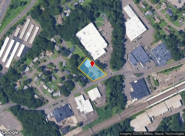
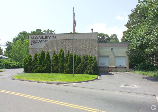
65 Railroad Ave, West Haven, CT 06516

NEARBY LISTINGS FOR SALE OR LEASE
Property Detail
65 Railroad Ave
Commercialbuilding
New Haven
X
Connecticut
09009C0439J
0.69 AC
2024
West Haven
2025
Westchester/So Connecticut
154600
New Haven-Milford, CT
11,212 SF
WHAV-000033-000052
DEMOGRAPHICS near 65 Railroad Ave
1 Mile
3 Mile
5 Mile
2024 Total Population
15,412
79,124
211,082
2029 Population
15,147
78,169
208,980
Pop Growth 2024-2029
(1.72%)
(1.21%)
(1.00%)
Average Age
40
39
38
2024 Total Households
6,182
30,045
81,714
HH Growth 2024-2029
(1.81%)
(1.22%)
(0.99%)
Median Household Inc
$62,274
$64,379
$64,058
Avg Household Size
2.30
2.40
2.30
2024 Avg HH Vehicles
2.00
2.00
1.00
Median Home Value
$213,309
$239,470
$272,031
Median Year Built
1966
1959
1956
Nearby Places
Map Layers
Map Styles
 Street
 Aerial
- Restaurants
- Banks
- Shops
- Fitness
- Groceries
PUBLIC TRANSPORTATION
COMMUTER RAIL
West Haven (New Haven - Metro-North Railroad)
DRIVE
WALK
Distance
West Haven (New Haven - Metro-North Railroad)
1 min
5 min
0.2 mi
New Haven (New Haven - Metro-North Railroad)
DRIVE
WALK
Distance
New Haven (New Haven - Metro-North Railroad)
7 min
3.2 mi
AIRPORT
Tweed/New Haven
DRIVE
WALK
Distance
Tweed/New Haven
17 min
8.3 mi
Freight Ports
Port of New Haven
DRIVE
WALK
Distance
Port of New Haven
12 min
5.4 mi
Nearby Properties
Address
Land Use
TOTAL SIZE
Lot Size
Zoning
Address
Land Use
TOTAL SIZE
Lot Size
Zoning
289,886 SF
2.21 AC
BD2
Address
Land Use
TOTAL SIZE
Lot Size
Zoning
56,359 SF
17.09 AC
RCPD
Address
Land Use
TOTAL SIZE
Lot Size
Zoning
50.14 AC
PRD
Address
Land Use
TOTAL SIZE
Lot Size
Zoning
81,870 SF
3.86 AC
RM2
Address
Land Use
TOTAL SIZE
Lot Size
Zoning
302,262 SF
10.40 AC
RM1
Address
Land Use
TOTAL SIZE
Lot Size
Zoning
133,767 SF
1.25 AC
BD2
Address
Land Use
TOTAL SIZE
Lot Size
Zoning
486,703 SF
2.12 AC
BD
Address
Land Use
TOTAL SIZE
Lot Size
Zoning
72,708 SF
1.91 AC
PDU 87
Address
Land Use
TOTAL SIZE
Lot Size
Zoning
42.52 AC
PF
Address
Land Use
TOTAL SIZE
Lot Size
Zoning
287,844 SF
2.11 AC
IL
Address
Land Use
TOTAL SIZE
Lot Size
Zoning
158,622 SF
2.09 AC
BA/RM2
Address
Land Use
TOTAL SIZE
Lot Size
Zoning
29.78 AC
PRD
Address
Land Use
TOTAL SIZE
Lot Size
Zoning
76,945 SF
8.52 AC
RM2
Address
Land Use
TOTAL SIZE
Lot Size
Zoning
35.05 AC
LI-2
Address
Land Use
TOTAL SIZE
Lot Size
Zoning
205,756 SF
1.27 AC
PDD 15
Address
Land Use
TOTAL SIZE
Lot Size
Zoning
840,277 SF
4.28 AC
BD2
Address
Land Use
TOTAL SIZE
Lot Size
Zoning
214,516 SF
35.88 AC
RA
Address
Land Use
TOTAL SIZE
Lot Size
Zoning
54,372 SF
2.42 AC
BD2
Address
Land Use
TOTAL SIZE
Lot Size
Zoning
287.63 AC
OS
Address
Land Use
TOTAL SIZE
Lot Size
Zoning
125,676 SF
22.12 AC
BOP
Address
Land Use
TOTAL SIZE
Lot Size
Zoning
228,347 SF
0.66 AC
BA
Address
Land Use
TOTAL SIZE
Lot Size
Zoning
297,601 SF
16.70 AC
PDD 10
Address
Land Use
TOTAL SIZE
Lot Size
Zoning
56,509 SF
1.07 AC
BA
Address
Land Use
TOTAL SIZE
Lot Size
Zoning
141,861 SF
1.62 AC
BD2
Address
Land Use
TOTAL SIZE
Lot Size
Zoning
63,304 SF
4.62 AC
RCPD
Address
Land Use
TOTAL SIZE
Lot Size
Zoning
25,590 SF
4.50 AC
BE
Address
Land Use
TOTAL SIZE
Lot Size
Zoning
64,240 SF
7.33 AC
BE
Address
Land Use
TOTAL SIZE
Lot Size
Zoning
161,426 SF
4.79 AC
EFD
Address
Land Use
TOTAL SIZE
Lot Size
Zoning
93,849 SF
3.16 AC
RM1
Address
Land Use
TOTAL SIZE
Lot Size
Zoning
13,204 SF
PDD 86
The World's #1 Commercial Real Estate Marketplace
Connect with us
© 2025 CoStar Group
The information above has been obtained from sources believed reliable. While we do not doubt its accuracy we have not verified it and make no guarantee, warranty or representation about it. It is your responsibility to independently confirm its accuracy and completeness. Any projections, opinions, assumptions, or estimates used are for example only and do not represent the current or future performance of the property. The value of this transaction to you depends on tax and other factors which should be evaluated by your tax, financial, and legal advisors. You and your advisors should conduct a careful, independent investigation of the property to determine to your satisfaction the suitability of the property for your needs.