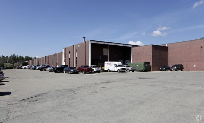
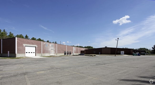
Property Record
65 Spring St, Plympton, MA 02367
Property Detail
65 Spring St
PLYP-000019-000001-000012
Plymouth
Industrialgeneral
Massachusetts
I
34
A Areas with a 1% annual chance of flooding and a 26% chance of flooding over the life of a 30-year mortgage.
45.45 AC
2025
Route 3 South
2025
Boston
524102
Boston-Cambridge-Newton, MA-NH
NEARBY LISTINGS FOR SALE OR LEASE
DEMOGRAPHICS near 65 Spring St
1 mile
3 mile
5 mile
2025 Total Population
818
13,290
47,297
2030 Population
833
13,586
48,289
Pop Growth 2025-2030
+ 1.83%
+ 2.23%
+ 2.10%
Average Age
42
43
43
2025 Total Households
278
4,844
18,178
HH Growth 2025-2030
+ 1.80%
+ 2.25%
+ 2.08%
Median Household Inc
$122,221
$100,725
$100,670
Avg Household Size
2.80
2.70
2.50
2025 Avg HH Vehicles
3.00
2.00
2.00
Median Home Value
$606,688
$580,317
$546,435
Median Year Built
1978
1982
1978
Nearby Places
Map Layers
Map Styles
 Street
 Aerial
Layers
 Traffic
 Biking
Places
Listings with unknown addresses are not visible on the map
- Restaurants
- Banks
- Shops
- Fitness
- Groceries
PUBLIC TRANSPORTATION
COMMUTER RAIL
Kingston/Route 3 (Kingston/Plymouth Line - Massachusetts Bay Transportation Authority Commuter Rail (Purple Line))
Drive
Walk
Distance
Kingston/Route 3 (Kingston/Plymouth Line - Massachusetts Bay Transportation Authority Commuter Rail (Purple Line))
14 min
6.6 mi
Halifax (Kingston/Plymouth Line - Massachusetts Bay Transportation Authority Commuter Rail (Purple Line))
Drive
Walk
Distance
Halifax (Kingston/Plymouth Line - Massachusetts Bay Transportation Authority Commuter Rail (Purple Line))
20 min
8.5 mi
AIRPORT
Rhode Island Tf Green International
Drive
Walk
Distance
Rhode Island Tf Green International
70 min
43.4 mi
General Edward Lawrence Logan International
Drive
Walk
Distance
General Edward Lawrence Logan International
64 min
45.0 mi
Freight Ports
Port of New Bedford Harbor
Drive
Walk
Distance
Port of New Bedford Harbor
48 min
32.3 mi
Nearby Properties
Address
Land Use
TOTAL SIZE
Lot Size
Zoning
Address
Land Use
TOTAL SIZE
Lot Size
Zoning
14.60 AC
MC
Address
Land Use
TOTAL SIZE
Lot Size
Zoning
82.62 AC
I
Address
Land Use
TOTAL SIZE
Lot Size
Zoning
27.31 AC
MC
Address
Land Use
TOTAL SIZE
Lot Size
Zoning
69.81 AC
Address
Land Use
TOTAL SIZE
Lot Size
Zoning
214,442 SF
21.50 AC
MC
Address
Land Use
TOTAL SIZE
Lot Size
Zoning
15.13 AC
HC
Address
Land Use
TOTAL SIZE
Lot Size
Zoning
9.41 AC
MC
Address
Land Use
TOTAL SIZE
Lot Size
Zoning
68,240 SF
10 AC
R1
Address
Land Use
TOTAL SIZE
Lot Size
Zoning
0.24 AC
R25
Address
Land Use
TOTAL SIZE
Lot Size
Zoning
30,105 SF
6.45 AC
MC
Address
Land Use
TOTAL SIZE
Lot Size
Zoning
59,377 SF
2.95 AC
MC
Address
Land Use
TOTAL SIZE
Lot Size
Zoning
58,356 SF
32.04 AC
R25
Address
Land Use
TOTAL SIZE
Lot Size
Zoning
52,447 SF
19.89 AC
Address
Land Use
TOTAL SIZE
Lot Size
Zoning
21,791 SF
5.05 AC
MC
Address
Land Use
TOTAL SIZE
Lot Size
Zoning
72,404 SF
3.10 AC
MC
Address
Land Use
TOTAL SIZE
Lot Size
Zoning
16,744 SF
24.62 AC
Address
Land Use
TOTAL SIZE
Lot Size
Zoning
227 AC
HC
Address
Land Use
TOTAL SIZE
Lot Size
Zoning
5.19 AC
MC
Address
Land Use
TOTAL SIZE
Lot Size
Zoning
147.50 AC
Address
Land Use
TOTAL SIZE
Lot Size
Zoning
76,134 SF
HC
Address
Land Use
TOTAL SIZE
Lot Size
Zoning
5.90 AC
C
Address
Land Use
TOTAL SIZE
Lot Size
Zoning
7,943 SF
1.56 AC
MC
Address
Land Use
TOTAL SIZE
Lot Size
Zoning
Address
Land Use
TOTAL SIZE
Lot Size
Zoning
4,782 SF
235.95 AC
Address
Land Use
TOTAL SIZE
Lot Size
Zoning
29.50 AC
HC
Address
Land Use
TOTAL SIZE
Lot Size
Zoning
2,911 SF
123.74 AC
RA
Address
Land Use
TOTAL SIZE
Lot Size
Zoning
6.82 AC
IC
Address
Land Use
TOTAL SIZE
Lot Size
Zoning
1.20 AC
R1
Address
Land Use
TOTAL SIZE
Lot Size
Zoning
30,099 SF
26.99 AC
R1
The World's #1 Commercial Real Estate Marketplace
Connect with us
© 2026 CoStar Group
The information above has been obtained from sources believed reliable. While we do not doubt its accuracy we have not verified it and make no guarantee, warranty or representation about it. It is your responsibility to independently confirm its accuracy and completeness. Any projections, opinions, assumptions, or estimates used are for example only and do not represent the current or future performance of the property. The value of this transaction to you depends on tax and other factors which should be evaluated by your tax, financial, and legal advisors. You and your advisors should conduct a careful, independent investigation of the property to determine to your satisfaction the suitability of the property for your needs.