Property Record
65 Wright Cir, Auburn, NY 13021
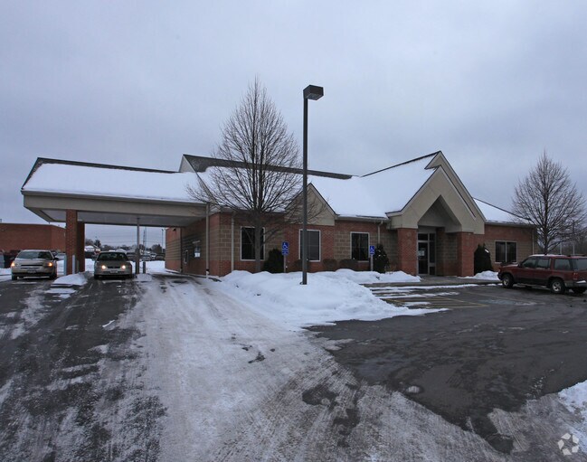

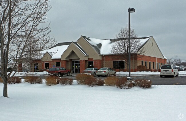
Property Detail
65 Wright Cir
050100-115-064-0001-001-003-0000
SPLIT OFF 115.64-1-1 2/98 69-71 WRIGHT CIR
Financialbuilding
Cayuga
I
New York
B and X Area of moderate flood hazard, usually the area between the limits of the 100-year and 500-year floods.
1.003
2025
2.31 AC
2025
Other Market Areas
042100
Auburn, NY
5,940 SF
NEARBY LISTINGS FOR SALE OR LEASE
DEMOGRAPHICS near 65 Wright Cir
1 mile
3 mile
5 mile
2025 Total Population
6,095
28,465
33,748
2030 Population
5,915
27,681
32,884
Pop Growth 2025-2030
(2.95%)
(2.75%)
(2.56%)
Average Age
41
43
44
2025 Total Households
2,523
12,243
14,425
HH Growth 2025-2030
(3.17%)
(2.98%)
(2.78%)
Median Household Inc
$40,058
$53,147
$57,713
Avg Household Size
2.20
2.10
2.10
2025 Avg HH Vehicles
1.00
1.00
2.00
Median Home Value
$123,461
$150,554
$163,903
Median Year Built
1949
1948
1949
Nearby Places
Map Layers
Map Styles
 Street
 Aerial
Layers
 Traffic
 Biking
Places
Listings with unknown addresses are not visible on the map
- Restaurants
- Banks
- Shops
- Fitness
- Groceries
PUBLIC TRANSPORTATION
AIRPORT
Syracuse Hancock International
Drive
Walk
Distance
Syracuse Hancock International
50 min
34.7 mi
Ithaca Tompkins International
Drive
Walk
Distance
Ithaca Tompkins International
58 min
36.1 mi
Nearby Properties
Address
Land Use
TOTAL SIZE
Lot Size
Zoning
Address
Land Use
TOTAL SIZE
Lot Size
Zoning
7.46 AC
A
Address
Land Use
TOTAL SIZE
Lot Size
Zoning
6,085 SF
23 AC
CC
Address
Land Use
TOTAL SIZE
Lot Size
Zoning
200,000 SF
43.73 AC
AR
Address
Land Use
TOTAL SIZE
Lot Size
Zoning
2,496 SF
15.27 AC
R1
Address
Land Use
TOTAL SIZE
Lot Size
Zoning
17.41 AC
A
Address
Land Use
TOTAL SIZE
Lot Size
Zoning
225,619 SF
6.90 AC
C
Address
Land Use
TOTAL SIZE
Lot Size
Zoning
3,360 SF
29.33 AC
I1
Address
Land Use
TOTAL SIZE
Lot Size
Zoning
300,342 SF
52 AC
R1
Address
Land Use
TOTAL SIZE
Lot Size
Zoning
165,775 SF
39.40 AC
R1
Address
Land Use
TOTAL SIZE
Lot Size
Zoning
190,229 SF
29.04 AC
HC
Address
Land Use
TOTAL SIZE
Lot Size
Zoning
Address
Land Use
TOTAL SIZE
Lot Size
Zoning
113,316 SF
4.60 AC
R2
Address
Land Use
TOTAL SIZE
Lot Size
Zoning
330,772 SF
27.80 AC
I
Address
Land Use
TOTAL SIZE
Lot Size
Zoning
100,000 SF
24.11 AC
C
Address
Land Use
TOTAL SIZE
Lot Size
Zoning
444,450 SF
30.70 AC
I1
Address
Land Use
TOTAL SIZE
Lot Size
Zoning
1,966 SF
20 AC
R2
Address
Land Use
TOTAL SIZE
Lot Size
Zoning
49,057 SF
9.89 AC
C
Address
Land Use
TOTAL SIZE
Lot Size
Zoning
113,388 SF
12.15 AC
R1
Address
Land Use
TOTAL SIZE
Lot Size
Zoning
88,967 SF
1.62 AC
D
Address
Land Use
TOTAL SIZE
Lot Size
Zoning
1,520 SF
14.50 AC
R2
Address
Land Use
TOTAL SIZE
Lot Size
Zoning
72,267 SF
2.75 AC
D
Address
Land Use
TOTAL SIZE
Lot Size
Zoning
3,920 SF
7.30 AC
R2
Address
Land Use
TOTAL SIZE
Lot Size
Zoning
117,877 SF
5.08 AC
D
Address
Land Use
TOTAL SIZE
Lot Size
Zoning
120,933 SF
1.47 AC
D
Address
Land Use
TOTAL SIZE
Lot Size
Zoning
109,990 SF
37.46 AC
R1
Address
Land Use
TOTAL SIZE
Lot Size
Zoning
33,964 SF
1.48 AC
C
Address
Land Use
TOTAL SIZE
Lot Size
Zoning
1,015 SF
1.20 AC
C
Address
Land Use
TOTAL SIZE
Lot Size
Zoning
101,680 SF
4.40 AC
D
Address
Land Use
TOTAL SIZE
Lot Size
Zoning
132,874 SF
37.95 AC
C
Address
Land Use
TOTAL SIZE
Lot Size
Zoning
74,514 SF
57.60 AC
R1
The World's #1 Commercial Real Estate Marketplace
Connect with us
© 2026 CoStar Group
The information above has been obtained from sources believed reliable. While we do not doubt its accuracy we have not verified it and make no guarantee, warranty or representation about it. It is your responsibility to independently confirm its accuracy and completeness. Any projections, opinions, assumptions, or estimates used are for example only and do not represent the current or future performance of the property. The value of this transaction to you depends on tax and other factors which should be evaluated by your tax, financial, and legal advisors. You and your advisors should conduct a careful, independent investigation of the property to determine to your satisfaction the suitability of the property for your needs.