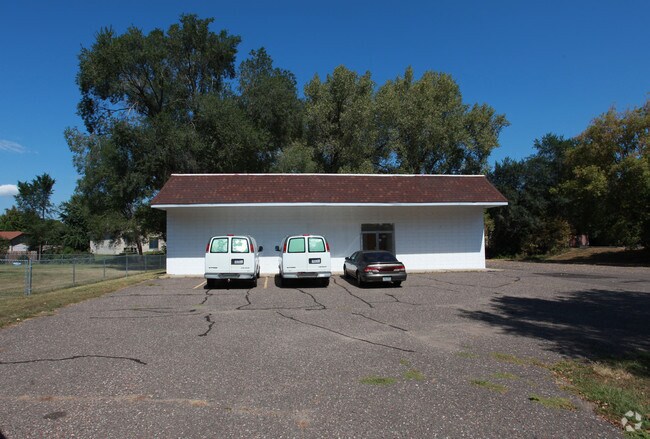
Property Record
650 79Th Ave N, Minneapolis, MN 55444


NEARBY LISTINGS FOR SALE OR LEASE
Property Detail
650 79Th Ave N
Minneapolis-St. Paul-Bloomington, MN-WI
Sunkist Acres
24-119-21-42-0012
LOT 019 T SUNKIST ACRES E 120 FT OF W 845 6/10 FT OF LOT 19 120 X 175
Commercialnec
Hennepin
X
Minnesota
27053C0206F
19
2024
0.48 AC
2024
Brookdale
026815
Minneapolis/St Paul
DEMOGRAPHICS near 650 79Th Ave N
1 Mile
3 Mile
5 Mile
2024 Total Population
10,864
87,089
263,309
2029 Population
10,740
87,377
263,319
Pop Growth 2024-2029
(1.14%)
+ 0.33%
0.00%
Average Age
38
38
38
2024 Total Households
3,557
30,891
96,486
HH Growth 2024-2029
(1.01%)
+ 0.56%
+ 0.06%
Median Household Inc
$83,186
$73,393
$72,712
Avg Household Size
2.90
2.70
2.60
2024 Avg HH Vehicles
2.00
2.00
2.00
Median Home Value
$271,037
$256,925
$254,319
Median Year Built
1972
1971
1972
Nearby Places
Map Layers
Map Styles
 Street
 Aerial
- Restaurants
- Banks
- Shops
- Fitness
- Groceries
PUBLIC TRANSPORTATION
COMMUTER RAIL
Fridley Station (Northstar Corridor - Northstar Commuter Rail)
DRIVE
WALK
Distance
Fridley Station (Northstar Corridor - Northstar Commuter Rail)
7 min
4.0 mi
AIRPORT
Minneapolis-St Paul International/Wold-Chamberlain
DRIVE
WALK
Distance
Minneapolis-St Paul International/Wold-Chamberlain
33 min
20.5 mi
Freight Ports
Port Milwaukee
DRIVE
WALK
Distance
Port Milwaukee
383 min
347.3 mi
Nearby Properties
Address
Land Use
TOTAL SIZE
Lot Size
Zoning
Address
Land Use
TOTAL SIZE
Lot Size
Zoning
47,727 SF
17.03 AC
Address
Land Use
TOTAL SIZE
Lot Size
Zoning
35,488 SF
39.07 AC
Address
Land Use
TOTAL SIZE
Lot Size
Zoning
Address
Land Use
TOTAL SIZE
Lot Size
Zoning
663,908 SF
109.91 AC
Address
Land Use
TOTAL SIZE
Lot Size
Zoning
417,810 SF
20.60 AC
Address
Land Use
TOTAL SIZE
Lot Size
Zoning
66,342 SF
8.85 AC
Address
Land Use
TOTAL SIZE
Lot Size
Zoning
264,574 SF
12.71 AC
Address
Land Use
TOTAL SIZE
Lot Size
Zoning
10.39 AC
Address
Land Use
TOTAL SIZE
Lot Size
Zoning
229,420 SF
4.14 AC
Address
Land Use
TOTAL SIZE
Lot Size
Zoning
539,671 SF
26.93 AC
Address
Land Use
TOTAL SIZE
Lot Size
Zoning
249,884 SF
Address
Land Use
TOTAL SIZE
Lot Size
Zoning
13,588 SF
129.03 AC
Address
Land Use
TOTAL SIZE
Lot Size
Zoning
Address
Land Use
TOTAL SIZE
Lot Size
Zoning
255,324 SF
15.22 AC
Address
Land Use
TOTAL SIZE
Lot Size
Zoning
106,897 SF
4.37 AC
Address
Land Use
TOTAL SIZE
Lot Size
Zoning
12.37 AC
Address
Land Use
TOTAL SIZE
Lot Size
Zoning
Address
Land Use
TOTAL SIZE
Lot Size
Zoning
213,984 SF
12.21 AC
Address
Land Use
TOTAL SIZE
Lot Size
Zoning
194,221 SF
27.83 AC
Address
Land Use
TOTAL SIZE
Lot Size
Zoning
173,183 SF
18.87 AC
Address
Land Use
TOTAL SIZE
Lot Size
Zoning
35,762 SF
4.48 AC
Address
Land Use
TOTAL SIZE
Lot Size
Zoning
196 SF
9.81 AC
Address
Land Use
TOTAL SIZE
Lot Size
Zoning
169,628 SF
2.67 AC
Address
Land Use
TOTAL SIZE
Lot Size
Zoning
10.28 AC
Address
Land Use
TOTAL SIZE
Lot Size
Zoning
368,545 SF
18.09 AC
Address
Land Use
TOTAL SIZE
Lot Size
Zoning
190,663 SF
11.39 AC
Address
Land Use
TOTAL SIZE
Lot Size
Zoning
142,237 SF
3.26 AC
Address
Land Use
TOTAL SIZE
Lot Size
Zoning
199,980 SF
11.81 AC
Address
Land Use
TOTAL SIZE
Lot Size
Zoning
128,841 SF
13 AC
Address
Land Use
TOTAL SIZE
Lot Size
Zoning
175,280 SF
17.53 AC
The World's #1 Commercial Real Estate Marketplace
Connect with us
© 2026 CoStar Group
The information above has been obtained from sources believed reliable. While we do not doubt its accuracy we have not verified it and make no guarantee, warranty or representation about it. It is your responsibility to independently confirm its accuracy and completeness. Any projections, opinions, assumptions, or estimates used are for example only and do not represent the current or future performance of the property. The value of this transaction to you depends on tax and other factors which should be evaluated by your tax, financial, and legal advisors. You and your advisors should conduct a careful, independent investigation of the property to determine to your satisfaction the suitability of the property for your needs.