Property Record
650 E 92Nd St, Minneapolis, MN 55420
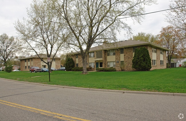

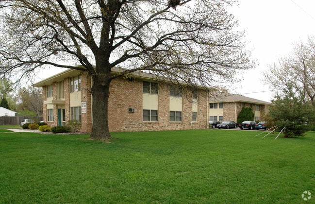

Property Detail
650 E 92Nd St
Minneapolis-St. Paul-Bloomington, MN-WI
LOT 010 BLOCK 004 A FARR 3RD ADDN S 266X145X269X119
11-027-24-32-0072
HENNEPIN
Apartment
Minnesota
B and X Area of moderate flood hazard, usually the area between the limits of the 100-year and 500-year floods.
10
2024
0.88 AC
2024
East Bloomington
025205
Minneapolis/St Paul
5,538 SF
NEARBY LISTINGS FOR SALE OR LEASE
DEMOGRAPHICS near 650 E 92Nd St
1 mile
3 mile
5 mile
2025 Total Population
12,908
71,765
211,448
2030 Population
12,840
72,013
213,175
Pop Growth 2025-2030
(0.53%)
+ 0.35%
+ 0.82%
Average Age
42
41
41
2025 Total Households
5,132
29,730
90,241
HH Growth 2025-2030
(0.72%)
+ 0.45%
+ 0.92%
Median Household Inc
$78,095
$81,847
$88,977
Avg Household Size
2.30
2.30
2.30
2025 Avg HH Vehicles
2.00
2.00
2.00
Median Home Value
$320,428
$338,112
$355,566
Median Year Built
1959
1964
1970
Nearby Places
Map Layers
Map Styles
 Street
 Aerial
Layers
 Traffic
 Biking
Places
Listings with unknown addresses are not visible on the map
- Restaurants
- Banks
- Shops
- Fitness
- Groceries
PUBLIC TRANSPORTATION
AIRPORT
Minneapolis-St Paul International/Wold-Chamberlain
Drive
Walk
Distance
Minneapolis-St Paul International/Wold-Chamberlain
12 min
5.5 mi
Freight Ports
Port Milwaukee
Drive
Walk
Distance
Port Milwaukee
380 min
342.6 mi
Nearby Properties
Address
Land Use
TOTAL SIZE
Lot Size
Zoning
Address
Land Use
TOTAL SIZE
Lot Size
Zoning
1,233,880 SF
63.49 AC
Address
Land Use
TOTAL SIZE
Lot Size
Zoning
1,341.19 AC
Address
Land Use
TOTAL SIZE
Lot Size
Zoning
4.26 AC
Address
Land Use
TOTAL SIZE
Lot Size
Zoning
21.50 AC
Address
Land Use
TOTAL SIZE
Lot Size
Zoning
3.86 AC
Address
Land Use
TOTAL SIZE
Lot Size
Zoning
752,064 SF
24.03 AC
Address
Land Use
TOTAL SIZE
Lot Size
Zoning
4.29 AC
Address
Land Use
TOTAL SIZE
Lot Size
Zoning
35.28 AC
Address
Land Use
TOTAL SIZE
Lot Size
Zoning
78,800 SF
2.12 AC
Address
Land Use
TOTAL SIZE
Lot Size
Zoning
435,796 SF
36.44 AC
Address
Land Use
TOTAL SIZE
Lot Size
Zoning
4.20 AC
Address
Land Use
TOTAL SIZE
Lot Size
Zoning
129,658 SF
13.52 AC
Address
Land Use
TOTAL SIZE
Lot Size
Zoning
98,676 SF
8.77 AC
Address
Land Use
TOTAL SIZE
Lot Size
Zoning
Address
Land Use
TOTAL SIZE
Lot Size
Zoning
114,617 SF
17.68 AC
Address
Land Use
TOTAL SIZE
Lot Size
Zoning
122,021 SF
21.74 AC
Address
Land Use
TOTAL SIZE
Lot Size
Zoning
2.49 AC
Address
Land Use
TOTAL SIZE
Lot Size
Zoning
6.87 AC
Address
Land Use
TOTAL SIZE
Lot Size
Zoning
142,229 SF
26.61 AC
Address
Land Use
TOTAL SIZE
Lot Size
Zoning
32,748 SF
2.24 AC
Address
Land Use
TOTAL SIZE
Lot Size
Zoning
4.20 AC
Address
Land Use
TOTAL SIZE
Lot Size
Zoning
33,246 SF
5.16 AC
Address
Land Use
TOTAL SIZE
Lot Size
Zoning
47,397 SF
6.78 AC
Address
Land Use
TOTAL SIZE
Lot Size
Zoning
Address
Land Use
TOTAL SIZE
Lot Size
Zoning
4.20 AC
Address
Land Use
TOTAL SIZE
Lot Size
Zoning
138,826 SF
23.39 AC
Address
Land Use
TOTAL SIZE
Lot Size
Zoning
14,568 SF
14.97 AC
Address
Land Use
TOTAL SIZE
Lot Size
Zoning
16,825 SF
2.75 AC
Address
Land Use
TOTAL SIZE
Lot Size
Zoning
Address
Land Use
TOTAL SIZE
Lot Size
Zoning
10.96 AC
The World's #1 Commercial Real Estate Marketplace
Connect with us
© 2026 CoStar Group
The information above has been obtained from sources believed reliable. While we do not doubt its accuracy we have not verified it and make no guarantee, warranty or representation about it. It is your responsibility to independently confirm its accuracy and completeness. Any projections, opinions, assumptions, or estimates used are for example only and do not represent the current or future performance of the property. The value of this transaction to you depends on tax and other factors which should be evaluated by your tax, financial, and legal advisors. You and your advisors should conduct a careful, independent investigation of the property to determine to your satisfaction the suitability of the property for your needs.