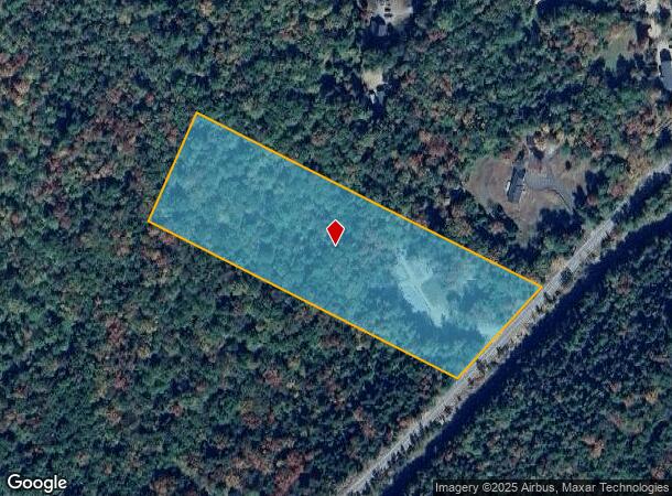
Property Record
650 Lost River Rd, North Woodstock, NH 03262
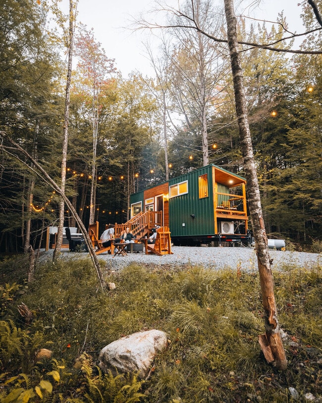
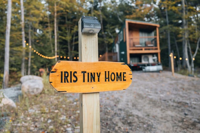
This Property Is For Sale
NEARBY LISTINGS FOR SALE OR LEASE
-
-
View all North Woodstock listings for sale on LoopNet.com
Property Detail
650 Lost River Rd
WDST M:206 B:012 L:000-00000
Grafton
Vacantlandnec
New Hampshire
X
00000
33009C0582F
6.60 AC
2024
Concord/New Hampshire North Area
2024
Other Market Areas
960500
Claremont-Lebanon, NH-VT
240 SF
DEMOGRAPHICS near 650 Lost River Rd
1 Mile
3 Mile
5 Mile
2024 Total Population
69
1,126
1,900
2029 Population
64
1,064
1,814
Pop Growth 2024-2029
(7.25%)
(5.51%)
(4.53%)
Average Age
50
49
49
2024 Total Households
29
522
887
HH Growth 2024-2029
(6.90%)
(5.56%)
(4.74%)
Median Household Inc
$67,500
$62,750
$67,105
Avg Household Size
2.10
2.10
2.10
2024 Avg HH Vehicles
2.00
2.00
2.00
Median Home Value
$272,222
$286,440
$293,385
Median Year Built
1984
1983
1982
Nearby Places
Map Layers
Map Styles
 Street
 Aerial
- Restaurants
- Banks
- Shops
- Fitness
- Groceries
Nearby Properties
Address
Land Use
TOTAL SIZE
Lot Size
Zoning
Address
Land Use
TOTAL SIZE
Lot Size
Zoning
54,360 SF
39 AC
Address
Land Use
TOTAL SIZE
Lot Size
Zoning
649 SF
20 AC
GU
Address
Land Use
TOTAL SIZE
Lot Size
Zoning
51,552 SF
1 AC
VC
Address
Land Use
TOTAL SIZE
Lot Size
Zoning
50,666 SF
2.52 AC
GU
Address
Land Use
TOTAL SIZE
Lot Size
Zoning
Address
Land Use
TOTAL SIZE
Lot Size
Zoning
94,961 SF
9.78 AC
GU
Address
Land Use
TOTAL SIZE
Lot Size
Zoning
15,446 SF
0.77 AC
R01
Address
Land Use
TOTAL SIZE
Lot Size
Zoning
0.96 AC
C01
Address
Land Use
TOTAL SIZE
Lot Size
Zoning
29,724 SF
5 AC
Address
Land Use
TOTAL SIZE
Lot Size
Zoning
3,568 SF
10.50 AC
GU
Address
Land Use
TOTAL SIZE
Lot Size
Zoning
38 AC
C01
Address
Land Use
TOTAL SIZE
Lot Size
Zoning
10,996 SF
1.39 AC
Address
Land Use
TOTAL SIZE
Lot Size
Zoning
14,650 SF
1.06 AC
C01
Address
Land Use
TOTAL SIZE
Lot Size
Zoning
14,288 SF
0.39 AC
GU
Address
Land Use
TOTAL SIZE
Lot Size
Zoning
4,166 SF
7.38 AC
GU
Address
Land Use
TOTAL SIZE
Lot Size
Zoning
4,550 SF
1.20 AC
Address
Land Use
TOTAL SIZE
Lot Size
Zoning
4,598 SF
1.56 AC
GU
Address
Land Use
TOTAL SIZE
Lot Size
Zoning
3,680 SF
0.77 AC
GU
Address
Land Use
TOTAL SIZE
Lot Size
Zoning
781 SF
3.28 AC
GU
Address
Land Use
TOTAL SIZE
Lot Size
Zoning
Address
Land Use
TOTAL SIZE
Lot Size
Zoning
2,806 SF
66 AC
C01
Address
Land Use
TOTAL SIZE
Lot Size
Zoning
19,480 SF
13 AC
C01
Address
Land Use
TOTAL SIZE
Lot Size
Zoning
9,850 SF
6.64 AC
RR
Address
Land Use
TOTAL SIZE
Lot Size
Zoning
3,581 SF
0.63 AC
Address
Land Use
TOTAL SIZE
Lot Size
Zoning
8,592 SF
0.16 AC
C01
Address
Land Use
TOTAL SIZE
Lot Size
Zoning
3,488 SF
7.57 AC
R01
Address
Land Use
TOTAL SIZE
Lot Size
Zoning
2,170 SF
1.15 AC
Address
Land Use
TOTAL SIZE
Lot Size
Zoning
2,820 SF
28.65 AC
R04
Address
Land Use
TOTAL SIZE
Lot Size
Zoning
4,268 SF
1.57 AC
GU
Address
Land Use
TOTAL SIZE
Lot Size
Zoning
10,535 SF
0.41 AC
C01
The World's #1 Commercial Real Estate Marketplace
Connect with us
© 2025 CoStar Group
The information above has been obtained from sources believed reliable. While we do not doubt its accuracy we have not verified it and make no guarantee, warranty or representation about it. It is your responsibility to independently confirm its accuracy and completeness. Any projections, opinions, assumptions, or estimates used are for example only and do not represent the current or future performance of the property. The value of this transaction to you depends on tax and other factors which should be evaluated by your tax, financial, and legal advisors. You and your advisors should conduct a careful, independent investigation of the property to determine to your satisfaction the suitability of the property for your needs.