Property Record
650 Neelytown Rd, Montgomery, NY 12549


NEARBY LISTINGS FOR SALE OR LEASE
-
-
View all Montgomery listings for sale on LoopNet.com
Property Detail
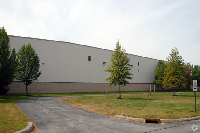
650 Neelytown Rd
New York-Jersey City-White Plains, NY-NJ
Brescia
334289-036-000-0001-034.000-0000
LT 2 & 3 BRESCIA SUB MAP 9540 & PARCEL
Warehouse
Orange
AE
New York
36071C0282E
34.00
2024
32.10 AC
2024
Orange County
010801
Northern New Jersey
366,680 SF
DEMOGRAPHICS near 650 Neelytown Rd
1 Mile
3 Mile
5 Mile
2024 Total Population
109
9,783
19,009
2029 Population
111
9,930
19,270
Pop Growth 2024-2029
+ 1.83%
+ 1.50%
+ 1.37%
Average Age
41
41
41
2024 Total Households
37
3,681
6,648
HH Growth 2024-2029
0.00%
+ 1.52%
+ 1.43%
Median Household Inc
$156,667
$96,352
$104,131
Avg Household Size
2.90
2.60
2.70
2024 Avg HH Vehicles
3.00
2.00
2.00
Median Home Value
$409,375
$304,622
$352,614
Median Year Built
1977
1977
1978
Nearby Places
Map Layers
Map Styles
 Street
 Aerial
- Restaurants
- Banks
- Shops
- Fitness
- Groceries
PUBLIC TRANSPORTATION
COMMUTER RAIL
Campbell Hall (Bergen County/Port Jervis Line - NJ Transit Commuter Rail (NJ Transit), Main/Port Jervis Line - NJ Transit Commuter Rail (NJ Transit))
DRIVE
WALK
Distance
Campbell Hall (Bergen County/Port Jervis Line - NJ Transit Commuter Rail (NJ Transit), Main/Port Jervis Line - NJ Transit Commuter Rail (NJ Transit))
9 min
4.9 mi
Middletown New York (Bergen County/Port Jervis Line - NJ Transit Commuter Rail (NJ Transit), Main/Port Jervis Line - NJ Transit Commuter Rail (NJ Transit))
DRIVE
WALK
Distance
Middletown New York (Bergen County/Port Jervis Line - NJ Transit Commuter Rail (NJ Transit), Main/Port Jervis Line - NJ Transit Commuter Rail (NJ Transit))
17 min
8.7 mi
AIRPORT
New York Stewart International
DRIVE
WALK
Distance
New York Stewart International
18 min
10.5 mi
Freight Ports
Port Newark Container Terminal
DRIVE
WALK
Distance
Port Newark Container Terminal
99 min
73.9 mi
Nearby Properties
Address
Land Use
TOTAL SIZE
Lot Size
Zoning
Address
Land Use
TOTAL SIZE
Lot Size
Zoning
1,332,075 SF
118 AC
I1
Address
Land Use
TOTAL SIZE
Lot Size
Zoning
1,040,580 SF
70.80 AC
ID
Address
Land Use
TOTAL SIZE
Lot Size
Zoning
513,951 SF
112.80 AC
ID
Address
Land Use
TOTAL SIZE
Lot Size
Zoning
249,128 SF
43.72 AC
ID
Address
Land Use
TOTAL SIZE
Lot Size
Zoning
340,782 SF
37 AC
LUI
Address
Land Use
TOTAL SIZE
Lot Size
Zoning
762,500 SF
80 AC
I1
Address
Land Use
TOTAL SIZE
Lot Size
Zoning
374,356 SF
35.90 AC
LUI
Address
Land Use
TOTAL SIZE
Lot Size
Zoning
760,927 SF
51.60 AC
ID
Address
Land Use
TOTAL SIZE
Lot Size
Zoning
25,800 SF
80.20 AC
LUI
Address
Land Use
TOTAL SIZE
Lot Size
Zoning
312,980 SF
42.30 AC
ID
Address
Land Use
TOTAL SIZE
Lot Size
Zoning
108.50 AC
Address
Land Use
TOTAL SIZE
Lot Size
Zoning
121,460 SF
42.70 AC
ID
Address
Land Use
TOTAL SIZE
Lot Size
Zoning
Address
Land Use
TOTAL SIZE
Lot Size
Zoning
103,857 SF
14.30 AC
B4
Address
Land Use
TOTAL SIZE
Lot Size
Zoning
26,500 SF
27.50 AC
B4
Address
Land Use
TOTAL SIZE
Lot Size
Zoning
109,481 SF
24.90 AC
ID
Address
Land Use
TOTAL SIZE
Lot Size
Zoning
330.10 AC
R4A*
Address
Land Use
TOTAL SIZE
Lot Size
Zoning
172,720 SF
41.60 AC
Address
Land Use
TOTAL SIZE
Lot Size
Zoning
90,200 SF
7.50 AC
B4
Address
Land Use
TOTAL SIZE
Lot Size
Zoning
103,079 SF
30.60 AC
ID
Address
Land Use
TOTAL SIZE
Lot Size
Zoning
49,056 SF
20 AC
RM1
Address
Land Use
TOTAL SIZE
Lot Size
Zoning
4,022 SF
360.50 AC
R4A*
Address
Land Use
TOTAL SIZE
Lot Size
Zoning
48,131 SF
2.80 AC
B4
Address
Land Use
TOTAL SIZE
Lot Size
Zoning
41.40 AC
R4A
Address
Land Use
TOTAL SIZE
Lot Size
Zoning
Address
Land Use
TOTAL SIZE
Lot Size
Zoning
10,433 SF
334.40 AC
I1
Address
Land Use
TOTAL SIZE
Lot Size
Zoning
10 AC
HRC4*
Address
Land Use
TOTAL SIZE
Lot Size
Zoning
63,139 SF
5.40 AC
Address
Land Use
TOTAL SIZE
Lot Size
Zoning
62,557 SF
37.20 AC
ID
The World's #1 Commercial Real Estate Marketplace
Connect with us
© 2025 CoStar Group
The information above has been obtained from sources believed reliable. While we do not doubt its accuracy we have not verified it and make no guarantee, warranty or representation about it. It is your responsibility to independently confirm its accuracy and completeness. Any projections, opinions, assumptions, or estimates used are for example only and do not represent the current or future performance of the property. The value of this transaction to you depends on tax and other factors which should be evaluated by your tax, financial, and legal advisors. You and your advisors should conduct a careful, independent investigation of the property to determine to your satisfaction the suitability of the property for your needs.