Property Record
650 Ridge Rd, Pittsburgh, PA 15205
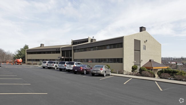

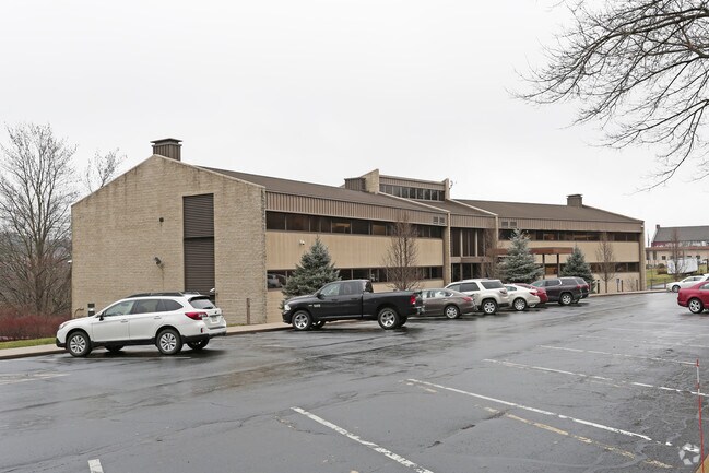
Property Detail
650 Ridge Rd
Pittsburgh, PA
HMC PLAN LOTS NO 1 - REVISION OF LOT 1 LOT 1-R = 646.25 FRONTING WITH 16 TOTAL BEARINGS
0264-H-00006-0000-00
Allegheny
Officebuilding
Pennsylvania
B and X Area of moderate flood hazard, usually the area between the limits of the 100-year and 500-year floods.
6
2024
19.18 AC
2025
Parkway West Corridor
458002
Pittsburgh
NEARBY LISTINGS FOR SALE OR LEASE
DEMOGRAPHICS near 650 Ridge Rd
1 mile
3 mile
5 mile
2025 Total Population
3,652
25,483
127,426
2030 Population
3,636
25,266
125,897
Pop Growth 2025-2030
(0.44%)
(0.85%)
(1.20%)
Average Age
42
43
43
2025 Total Households
1,597
11,504
55,334
HH Growth 2025-2030
(0.44%)
(0.94%)
(1.30%)
Median Household Inc
$103,228
$96,065
$82,685
Avg Household Size
2.20
2.10
2.20
2025 Avg HH Vehicles
2.00
2.00
2.00
Median Home Value
$328,185
$297,200
$240,772
Median Year Built
1994
1985
1964
Nearby Places
Map Layers
Map Styles
 Street
 Aerial
Layers
 Traffic
 Biking
Places
Listings with unknown addresses are not visible on the map
- Restaurants
- Banks
- Shops
- Fitness
- Groceries
PUBLIC TRANSPORTATION
AIRPORT
Pittsburgh International
Drive
Walk
Distance
Pittsburgh International
19 min
9.8 mi
Freight Ports
Port of Toledo
Drive
Walk
Distance
Port of Toledo
263 min
229.5 mi
Nearby Properties
Address
Land Use
TOTAL SIZE
Lot Size
Zoning
Address
Land Use
TOTAL SIZE
Lot Size
Zoning
105.09 AC
Address
Land Use
TOTAL SIZE
Lot Size
Zoning
61.94 AC
Address
Land Use
TOTAL SIZE
Lot Size
Zoning
33.43 AC
Address
Land Use
TOTAL SIZE
Lot Size
Zoning
Address
Land Use
TOTAL SIZE
Lot Size
Zoning
20.19 AC
Address
Land Use
TOTAL SIZE
Lot Size
Zoning
Address
Land Use
TOTAL SIZE
Lot Size
Zoning
Address
Land Use
TOTAL SIZE
Lot Size
Zoning
14.19 AC
Address
Land Use
TOTAL SIZE
Lot Size
Zoning
10.07 AC
Address
Land Use
TOTAL SIZE
Lot Size
Zoning
31.30 AC
Address
Land Use
TOTAL SIZE
Lot Size
Zoning
10.60 AC
Address
Land Use
TOTAL SIZE
Lot Size
Zoning
24.04 AC
Address
Land Use
TOTAL SIZE
Lot Size
Zoning
Address
Land Use
TOTAL SIZE
Lot Size
Zoning
11.83 AC
Address
Land Use
TOTAL SIZE
Lot Size
Zoning
Address
Land Use
TOTAL SIZE
Lot Size
Zoning
1,610 AC
Address
Land Use
TOTAL SIZE
Lot Size
Zoning
11.93 AC
Address
Land Use
TOTAL SIZE
Lot Size
Zoning
36.95 AC
Address
Land Use
TOTAL SIZE
Lot Size
Zoning
26.97 AC
Address
Land Use
TOTAL SIZE
Lot Size
Zoning
71.10 AC
Address
Land Use
TOTAL SIZE
Lot Size
Zoning
6.97 AC
Address
Land Use
TOTAL SIZE
Lot Size
Zoning
1,388 SF
24.61 AC
Address
Land Use
TOTAL SIZE
Lot Size
Zoning
162.40 AC
Address
Land Use
TOTAL SIZE
Lot Size
Zoning
Address
Land Use
TOTAL SIZE
Lot Size
Zoning
23.73 AC
Address
Land Use
TOTAL SIZE
Lot Size
Zoning
29.27 AC
Address
Land Use
TOTAL SIZE
Lot Size
Zoning
20.31 AC
Address
Land Use
TOTAL SIZE
Lot Size
Zoning
71.84 AC
Address
Land Use
TOTAL SIZE
Lot Size
Zoning
6.40 AC
The World's #1 Commercial Real Estate Marketplace
Connect with us
© 2026 CoStar Group
The information above has been obtained from sources believed reliable. While we do not doubt its accuracy we have not verified it and make no guarantee, warranty or representation about it. It is your responsibility to independently confirm its accuracy and completeness. Any projections, opinions, assumptions, or estimates used are for example only and do not represent the current or future performance of the property. The value of this transaction to you depends on tax and other factors which should be evaluated by your tax, financial, and legal advisors. You and your advisors should conduct a careful, independent investigation of the property to determine to your satisfaction the suitability of the property for your needs.