Property Record
650 S State Route 69, Dewey, AZ 86327


Property Detail
650 S State Route 69
Prescott, AZ
AN IRREG PCL LYNG W OF STATE ROUTE 69 THE NW COR LYNG APPROX 951 S FROM THE CENTER OF SEC 3 CONT 11.84AC SEC 3-13-1E LS21/71
402-02-028G
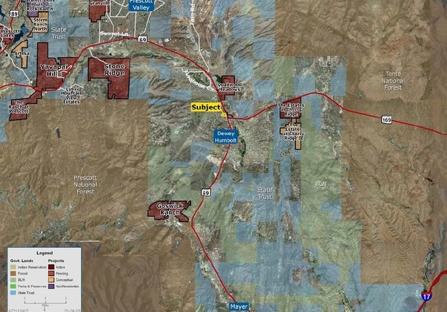
Yavapai
Commercialacreage
Arizona
AE The base floodplain where base flood elevations are provided. AE Zones are now used on new format FIRMs instead of A1-A30 Zones.
11.84 AC
2025
Prescott & Sedona
2027
Other Market Areas
000702
NEARBY LISTINGS FOR SALE OR LEASE
DEMOGRAPHICS near 650 S State Route 69
1 mile
3 mile
5 mile
2025 Total Population
994
11,134
12,873
2030 Population
1,036
11,633
13,482
Pop Growth 2025-2030
+ 4.23%
+ 4.48%
+ 4.73%
Average Age
52
53
53
2025 Total Households
438
5,082
5,872
HH Growth 2025-2030
+ 4.79%
+ 4.80%
+ 5.02%
Median Household Inc
$58,703
$71,407
$71,106
Avg Household Size
2.20
2.20
2.20
2025 Avg HH Vehicles
2.00
2.00
2.00
Median Home Value
$308,064
$384,148
$380,715
Median Year Built
1996
1998
1997
Nearby Places
Map Layers
Map Styles
 Street
 Aerial
Layers
 Traffic
 Biking
Places
Listings with unknown addresses are not visible on the map
- Restaurants
- Banks
- Shops
- Fitness
- Groceries
SALE & LEASE HISTORY
LISTING DATE
SALE/LEASE

Sep 24, 2016
For Sale
Nov 15, 2017
For Sale
May 24, 2021
For Sale
Jul 28, 2017
For Sale
Jul 25, 2017
For Sale
Nearby Properties
Address
Land Use
TOTAL SIZE
Lot Size
Zoning
Address
Land Use
TOTAL SIZE
Lot Size
Zoning
250,444 SF
40 AC
Address
Land Use
TOTAL SIZE
Lot Size
Zoning
5,516 SF
42.65 AC
Address
Land Use
TOTAL SIZE
Lot Size
Zoning
54,690 SF
4.83 AC
Address
Land Use
TOTAL SIZE
Lot Size
Zoning
251 SF
22.77 AC
Address
Land Use
TOTAL SIZE
Lot Size
Zoning
5,314 SF
19.05 AC
Address
Land Use
TOTAL SIZE
Lot Size
Zoning
6,616 SF
22.10 AC
Address
Land Use
TOTAL SIZE
Lot Size
Zoning
32,762 SF
11.26 AC
Address
Land Use
TOTAL SIZE
Lot Size
Zoning
149,296 SF
15.27 AC
Address
Land Use
TOTAL SIZE
Lot Size
Zoning
5,925 SF
1.01 AC
Address
Land Use
TOTAL SIZE
Lot Size
Zoning
13,468 SF
8.78 AC
Address
Land Use
TOTAL SIZE
Lot Size
Zoning
12,311 SF
10.30 AC
Address
Land Use
TOTAL SIZE
Lot Size
Zoning
34,352 SF
5.33 AC
Address
Land Use
TOTAL SIZE
Lot Size
Zoning
10,036 SF
7.33 AC
Address
Land Use
TOTAL SIZE
Lot Size
Zoning
5,690 SF
7.20 AC
Address
Land Use
TOTAL SIZE
Lot Size
Zoning
29,796 SF
2.05 AC
Address
Land Use
TOTAL SIZE
Lot Size
Zoning
6,000 SF
13.89 AC
Address
Land Use
TOTAL SIZE
Lot Size
Zoning
15,000 SF
7.44 AC
Address
Land Use
TOTAL SIZE
Lot Size
Zoning
59,116 SF
23.78 AC
Address
Land Use
TOTAL SIZE
Lot Size
Zoning
7,398 SF
2.06 AC
Address
Land Use
TOTAL SIZE
Lot Size
Zoning
38,300 SF
2.25 AC
Address
Land Use
TOTAL SIZE
Lot Size
Zoning
15,473 SF
4.49 AC
Address
Land Use
TOTAL SIZE
Lot Size
Zoning
12,849 SF
2.59 AC
Address
Land Use
TOTAL SIZE
Lot Size
Zoning
14,981 SF
2.85 AC
Address
Land Use
TOTAL SIZE
Lot Size
Zoning
11,828 SF
1.96 AC
Address
Land Use
TOTAL SIZE
Lot Size
Zoning
18,376 SF
3.81 AC
Address
Land Use
TOTAL SIZE
Lot Size
Zoning
23,600 SF
2.06 AC
Address
Land Use
TOTAL SIZE
Lot Size
Zoning
8,590 SF
36.56 AC
Address
Land Use
TOTAL SIZE
Lot Size
Zoning
5,027 SF
1.76 AC
The World's #1 Commercial Real Estate Marketplace
Connect with us
© 2026 CoStar Group
The information above has been obtained from sources believed reliable. While we do not doubt its accuracy we have not verified it and make no guarantee, warranty or representation about it. It is your responsibility to independently confirm its accuracy and completeness. Any projections, opinions, assumptions, or estimates used are for example only and do not represent the current or future performance of the property. The value of this transaction to you depends on tax and other factors which should be evaluated by your tax, financial, and legal advisors. You and your advisors should conduct a careful, independent investigation of the property to determine to your satisfaction the suitability of the property for your needs.