Property Record
650 S University Blvd, Mobile, AL 36609


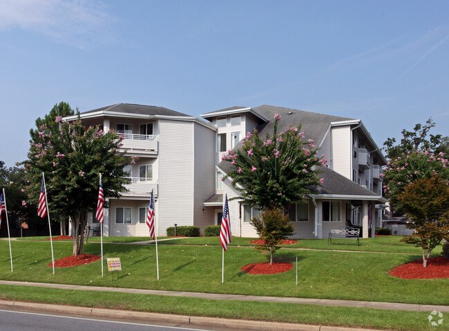
Property Detail
650 S University Blvd
Mobile, AL
LOT 1 UNIVERSITY OAKS UNIT 3 MBK 41 PG 113 #SEC 34 T4S R2W #MP28 08 34 4 002
28-08-34-4-002-067.004
MOBILE
Apartment
Alabama
B and X Area of moderate flood hazard, usually the area between the limits of the 100-year and 500-year floods.
1
2025
3.06 AC
2025
Malibar Heights
003707
Mobile
31,300 SF
NEARBY LISTINGS FOR SALE OR LEASE
-
-
View all Mobile listings for sale on LoopNet.com
DEMOGRAPHICS near 650 S University Blvd
1 mile
3 mile
5 mile
2025 Total Population
9,535
66,504
146,988
2030 Population
9,274
65,211
145,025
Pop Growth 2025-2030
(2.74%)
(1.94%)
(1.34%)
Average Age
40
39
39
2025 Total Households
4,101
28,679
60,562
HH Growth 2025-2030
(2.76%)
(2.07%)
(1.43%)
Median Household Inc
$48,356
$56,664
$55,550
Avg Household Size
2.30
2.20
2.30
2025 Avg HH Vehicles
2.00
2.00
2.00
Median Home Value
$225,760
$242,741
$211,367
Median Year Built
1977
1980
1977
Nearby Places
Map Layers
Map Styles
 Street
 Aerial
Layers
 Traffic
 Biking
Places
Listings with unknown addresses are not visible on the map
- Restaurants
- Banks
- Shops
- Fitness
- Groceries
PUBLIC TRANSPORTATION
AIRPORT
Mobile Regional
Drive
Walk
Distance
Mobile Regional
19 min
8.0 mi
Mobile International
Drive
Walk
Distance
Mobile International
18 min
9.3 mi
Freight Ports
Port of Mobile
Drive
Walk
Distance
Port of Mobile
20 min
12.2 mi
Nearby Properties
Address
Land Use
TOTAL SIZE
Lot Size
Zoning
Address
Land Use
TOTAL SIZE
Lot Size
Zoning
549,081 SF
15.70 AC
Address
Land Use
TOTAL SIZE
Lot Size
Zoning
142,425 SF
160 AC
Address
Land Use
TOTAL SIZE
Lot Size
Zoning
296,060 SF
40.49 AC
Address
Land Use
TOTAL SIZE
Lot Size
Zoning
359,478 SF
3.69 AC
Address
Land Use
TOTAL SIZE
Lot Size
Zoning
169,511 SF
44.42 AC
Address
Land Use
TOTAL SIZE
Lot Size
Zoning
34,801 SF
21.88 AC
Address
Land Use
TOTAL SIZE
Lot Size
Zoning
119,648 SF
38.21 AC
Address
Land Use
TOTAL SIZE
Lot Size
Zoning
194,016 SF
10.74 AC
Address
Land Use
TOTAL SIZE
Lot Size
Zoning
31,608 SF
20.30 AC
Address
Land Use
TOTAL SIZE
Lot Size
Zoning
102,380 SF
12.24 AC
Address
Land Use
TOTAL SIZE
Lot Size
Zoning
30,972 SF
4.75 AC
Address
Land Use
TOTAL SIZE
Lot Size
Zoning
228,018 SF
4.80 AC
Address
Land Use
TOTAL SIZE
Lot Size
Zoning
57,452 SF
14.58 AC
Address
Land Use
TOTAL SIZE
Lot Size
Zoning
18,368 SF
14.70 AC
Address
Land Use
TOTAL SIZE
Lot Size
Zoning
24,255 SF
9.15 AC
Address
Land Use
TOTAL SIZE
Lot Size
Zoning
31,452 SF
10.60 AC
Address
Land Use
TOTAL SIZE
Lot Size
Zoning
66,798 SF
10.31 AC
Address
Land Use
TOTAL SIZE
Lot Size
Zoning
65,356 SF
6.35 AC
Address
Land Use
TOTAL SIZE
Lot Size
Zoning
7,810 SF
15.35 AC
Address
Land Use
TOTAL SIZE
Lot Size
Zoning
34,200 SF
30.03 AC
Address
Land Use
TOTAL SIZE
Lot Size
Zoning
37,604 SF
9.10 AC
Address
Land Use
TOTAL SIZE
Lot Size
Zoning
19,536 SF
14.68 AC
Address
Land Use
TOTAL SIZE
Lot Size
Zoning
208,683 SF
11.68 AC
Address
Land Use
TOTAL SIZE
Lot Size
Zoning
17,240 SF
12 AC
Address
Land Use
TOTAL SIZE
Lot Size
Zoning
29,448 SF
7.64 AC
Address
Land Use
TOTAL SIZE
Lot Size
Zoning
9,184 SF
12 AC
Address
Land Use
TOTAL SIZE
Lot Size
Zoning
31,728 SF
8.10 AC
Address
Land Use
TOTAL SIZE
Lot Size
Zoning
62,859 SF
6.84 AC
Address
Land Use
TOTAL SIZE
Lot Size
Zoning
54,089 SF
14 AC
Address
Land Use
TOTAL SIZE
Lot Size
Zoning
150,800 SF
15.39 AC
The World's #1 Commercial Real Estate Marketplace
Connect with us
© 2026 CoStar Group
The information above has been obtained from sources believed reliable. While we do not doubt its accuracy we have not verified it and make no guarantee, warranty or representation about it. It is your responsibility to independently confirm its accuracy and completeness. Any projections, opinions, assumptions, or estimates used are for example only and do not represent the current or future performance of the property. The value of this transaction to you depends on tax and other factors which should be evaluated by your tax, financial, and legal advisors. You and your advisors should conduct a careful, independent investigation of the property to determine to your satisfaction the suitability of the property for your needs.