Property Record
650 S Us Highway 27/441 Hwy, Lady Lake, FL 32159

NEARBY LISTINGS FOR SALE OR LEASE
Property Detail
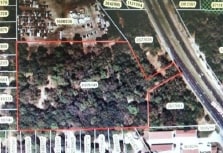
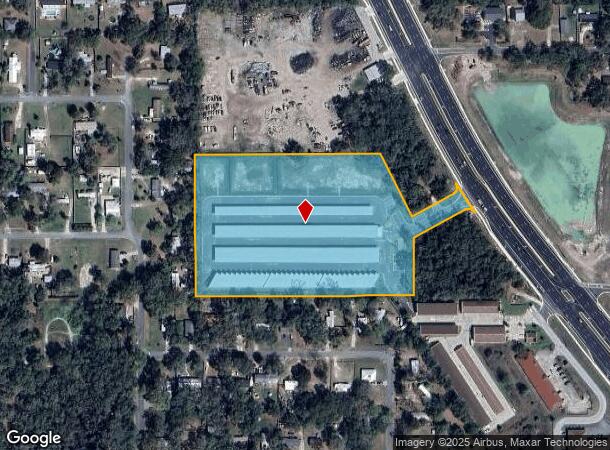
650 S Us Highway 27/441 Hwy
Orlando-Kissimmee-Sanford, FL
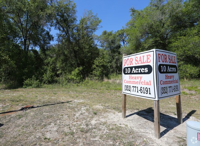
Acreage
21-18-24-0003-000-08000
FROM SW COR OF SEC RUN N 89-54-0 E 995.66 FT FOR POB RUN N 0-0-20 W 485.3 FT N 89-45-0 E 633 FT TO SWLY RR R/W S 27-0-47 E 240.90 FT N 62-09-32 E 159.81 FT TO A POINT OF CURVATURE THENCE NLY ALONG THE ARC OF A CURVE CONCAVE TO THE W HAVING A RADIUS O
Publicstorage
Lake
AE
Florida
12069C0170E
80
2024
8.38 AC
2026
Lake County
030408
Orlando
76,637 SF
DEMOGRAPHICS near 650 S Us Highway 27/441 Hwy
1 Mile
3 Mile
5 Mile
2024 Total Population
4,402
26,813
86,465
2029 Population
5,140
31,920
105,349
Pop Growth 2024-2029
+ 16.77%
+ 19.05%
+ 21.84%
Average Age
42
55
62
2024 Total Households
1,810
13,362
45,275
HH Growth 2024-2029
+ 16.57%
+ 19.49%
+ 22.56%
Median Household Inc
$42,091
$56,950
$62,289
Avg Household Size
2.40
2.00
1.90
2024 Avg HH Vehicles
2.00
1.00
1.00
Median Home Value
$125,308
$244,053
$283,729
Median Year Built
1991
1997
2002
Nearby Places
- Restaurants
- Banks
- Shops
- Fitness
- Groceries
SALE & LEASE HISTORY
LISTING DATE
SALE/LEASE

Jun 14, 2017
For Sale
Aug 07, 2017
For Sale
Nearby Properties
Address
Land Use
TOTAL SIZE
Lot Size
Zoning
Address
Land Use
TOTAL SIZE
Lot Size
Zoning
395,767 SF
33.07 AC
Address
Land Use
TOTAL SIZE
Lot Size
Zoning
404,584 SF
29.32 AC
MF12
Address
Land Use
TOTAL SIZE
Lot Size
Zoning
344,318 SF
25.73 AC
MF18
Address
Land Use
TOTAL SIZE
Lot Size
Zoning
171,544 SF
15.78 AC
CP
Address
Land Use
TOTAL SIZE
Lot Size
Zoning
182,128 SF
13.25 AC
MF12
Address
Land Use
TOTAL SIZE
Lot Size
Zoning
30,641 SF
103.82 AC
CT
Address
Land Use
TOTAL SIZE
Lot Size
Zoning
165,197 SF
16.74 AC
HC
Address
Land Use
TOTAL SIZE
Lot Size
Zoning
115,531 SF
6.21 AC
MH9
Address
Land Use
TOTAL SIZE
Lot Size
Zoning
94,208 SF
12.72 AC
CP
Address
Land Use
TOTAL SIZE
Lot Size
Zoning
90,064 SF
8.12 AC
A
Address
Land Use
TOTAL SIZE
Lot Size
Zoning
29,018 SF
2.43 AC
HC
Address
Land Use
TOTAL SIZE
Lot Size
Zoning
201,953 SF
19.52 AC
HC
Address
Land Use
TOTAL SIZE
Lot Size
Zoning
91,762 SF
3.24 AC
Address
Land Use
TOTAL SIZE
Lot Size
Zoning
101,154 SF
19.35 AC
PFD
Address
Land Use
TOTAL SIZE
Lot Size
Zoning
106,910 SF
10.40 AC
CP
Address
Land Use
TOTAL SIZE
Lot Size
Zoning
12,456 SF
88.51 AC
C1
Address
Land Use
TOTAL SIZE
Lot Size
Zoning
77,450 SF
8.97 AC
A
Address
Land Use
TOTAL SIZE
Lot Size
Zoning
72,245 SF
9.97 AC
Address
Land Use
TOTAL SIZE
Lot Size
Zoning
24,570 SF
6.46 AC
Address
Land Use
TOTAL SIZE
Lot Size
Zoning
151,588 SF
16.62 AC
A
Address
Land Use
TOTAL SIZE
Lot Size
Zoning
134,787 SF
22.77 AC
HC
Address
Land Use
TOTAL SIZE
Lot Size
Zoning
51,658 SF
7.39 AC
PUD
Address
Land Use
TOTAL SIZE
Lot Size
Zoning
155,857 SF
10.69 AC
A
Address
Land Use
TOTAL SIZE
Lot Size
Zoning
51,662 SF
13.88 AC
A
Address
Land Use
TOTAL SIZE
Lot Size
Zoning
27,420 SF
9.78 AC
I
Address
Land Use
TOTAL SIZE
Lot Size
Zoning
37,644 SF
2.19 AC
CP
Address
Land Use
TOTAL SIZE
Lot Size
Zoning
118,128 SF
15.31 AC
I
Address
Land Use
TOTAL SIZE
Lot Size
Zoning
41,415 SF
7.63 AC
PUD
Address
Land Use
TOTAL SIZE
Lot Size
Zoning
119,703 SF
10.07 AC
CP
Address
Land Use
TOTAL SIZE
Lot Size
Zoning
120,819 SF
17.65 AC
HC
The World's #1 Commercial Real Estate Marketplace
Connect with us
© 2025 CoStar Group
The information above has been obtained from sources believed reliable. While we do not doubt its accuracy we have not verified it and make no guarantee, warranty or representation about it. It is your responsibility to independently confirm its accuracy and completeness. Any projections, opinions, assumptions, or estimates used are for example only and do not represent the current or future performance of the property. The value of this transaction to you depends on tax and other factors which should be evaluated by your tax, financial, and legal advisors. You and your advisors should conduct a careful, independent investigation of the property to determine to your satisfaction the suitability of the property for your needs.