Property Record
650 Us Highway 20 E, Norwalk, OH 44857
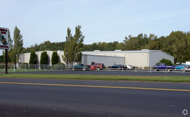

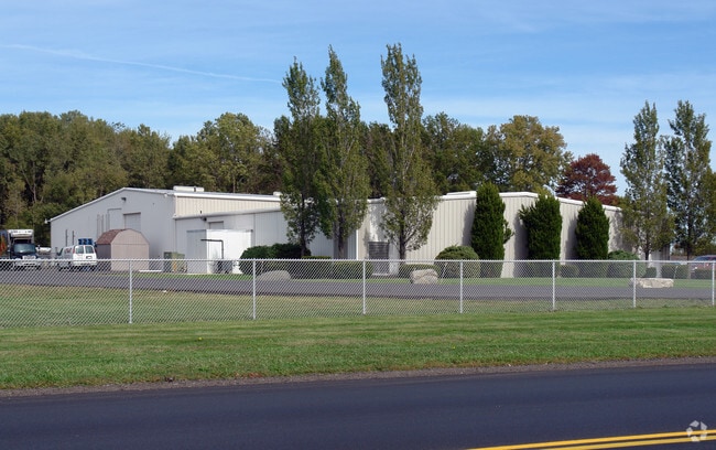
Property Detail
650 Us Highway 20 E
Norwalk, OH
SEC 2 LOT 3
30-0020-01-003-0100
HURON
Distributionwarehouseregional
Ohio
B and X Area of moderate flood hazard, usually the area between the limits of the 100-year and 500-year floods.
3
2025
5 AC
2025
Huron County
915500
Cleveland
13,200 SF
NEARBY LISTINGS FOR SALE OR LEASE
DEMOGRAPHICS near 650 Us Highway 20 E
1 mile
3 mile
5 mile
2025 Total Population
827
18,595
27,309
2030 Population
816
18,906
27,460
Pop Growth 2025-2030
(1.33%)
+ 1.67%
+ 0.55%
Average Age
41
41
41
2025 Total Households
351
7,679
11,142
HH Growth 2025-2030
(1.42%)
+ 1.61%
+ 0.52%
Median Household Inc
$84,523
$58,758
$62,055
Avg Household Size
2.40
2.40
2.40
2025 Avg HH Vehicles
2.00
2.00
2.00
Median Home Value
$170,641
$171,019
$185,649
Median Year Built
1986
1978
1975
Nearby Places
Map Layers
Map Styles
 Street
 Aerial
Layers
 Traffic
 Biking
Places
Listings with unknown addresses are not visible on the map
- Restaurants
- Banks
- Shops
- Fitness
- Groceries
Nearby Properties
Address
Land Use
TOTAL SIZE
Lot Size
Zoning
Address
Land Use
TOTAL SIZE
Lot Size
Zoning
29,304 SF
10.83 AC
Address
Land Use
TOTAL SIZE
Lot Size
Zoning
66,953 SF
30.03 AC
Address
Land Use
TOTAL SIZE
Lot Size
Zoning
2,964 SF
11.66 AC
Address
Land Use
TOTAL SIZE
Lot Size
Zoning
150,176 SF
Address
Land Use
TOTAL SIZE
Lot Size
Zoning
99,960 SF
Address
Land Use
TOTAL SIZE
Lot Size
Zoning
207,908 SF
16.74 AC
Address
Land Use
TOTAL SIZE
Lot Size
Zoning
12,419 SF
4.01 AC
Address
Land Use
TOTAL SIZE
Lot Size
Zoning
28,149 SF
6.77 AC
Address
Land Use
TOTAL SIZE
Lot Size
Zoning
5,170 SF
1.38 AC
Address
Land Use
TOTAL SIZE
Lot Size
Zoning
70,000 SF
11.72 AC
Address
Land Use
TOTAL SIZE
Lot Size
Zoning
9,152 SF
24.17 AC
Address
Land Use
TOTAL SIZE
Lot Size
Zoning
4,586 SF
122.14 AC
Address
Land Use
TOTAL SIZE
Lot Size
Zoning
7,042 SF
10.22 AC
Address
Land Use
TOTAL SIZE
Lot Size
Zoning
5,600 SF
11.48 AC
Address
Land Use
TOTAL SIZE
Lot Size
Zoning
16,618 SF
8.51 AC
Address
Land Use
TOTAL SIZE
Lot Size
Zoning
50,854 SF
18.62 AC
Address
Land Use
TOTAL SIZE
Lot Size
Zoning
2,040 SF
1.47 AC
Address
Land Use
TOTAL SIZE
Lot Size
Zoning
7,852 SF
0.21 AC
Address
Land Use
TOTAL SIZE
Lot Size
Zoning
1,860 SF
9.08 AC
Address
Land Use
TOTAL SIZE
Lot Size
Zoning
23,680 SF
7.60 AC
Address
Land Use
TOTAL SIZE
Lot Size
Zoning
20,824 SF
2 AC
Address
Land Use
TOTAL SIZE
Lot Size
Zoning
12,832 SF
3.61 AC
Address
Land Use
TOTAL SIZE
Lot Size
Zoning
4,860 SF
7.05 AC
Address
Land Use
TOTAL SIZE
Lot Size
Zoning
4,608 SF
15.01 AC
Address
Land Use
TOTAL SIZE
Lot Size
Zoning
42,754 SF
6.81 AC
Address
Land Use
TOTAL SIZE
Lot Size
Zoning
220,880 SF
21.19 AC
Address
Land Use
TOTAL SIZE
Lot Size
Zoning
5,280 SF
14.35 AC
Address
Land Use
TOTAL SIZE
Lot Size
Zoning
115,200 SF
10 AC
Address
Land Use
TOTAL SIZE
Lot Size
Zoning
9,717 SF
0.54 AC
Address
Land Use
TOTAL SIZE
Lot Size
Zoning
49,000 SF
The World's #1 Commercial Real Estate Marketplace
Connect with us
© 2026 CoStar Group
The information above has been obtained from sources believed reliable. While we do not doubt its accuracy we have not verified it and make no guarantee, warranty or representation about it. It is your responsibility to independently confirm its accuracy and completeness. Any projections, opinions, assumptions, or estimates used are for example only and do not represent the current or future performance of the property. The value of this transaction to you depends on tax and other factors which should be evaluated by your tax, financial, and legal advisors. You and your advisors should conduct a careful, independent investigation of the property to determine to your satisfaction the suitability of the property for your needs.