Property Record
650 Woodlake Dr, Chesapeake, VA 23320


NEARBY LISTINGS FOR SALE OR LEASE
Property Detail
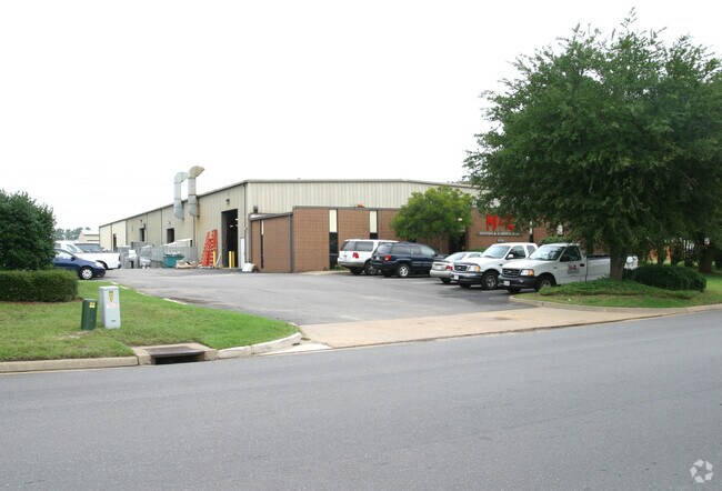
650 Woodlake Dr
0280000000110
Washington - Commercial
Warehouse
PARCEL 6 PORTION OF GREENBRIER ZONE 1 1.800 AC
X
Chesapeake
5100340017D
Virginia
2024
1.80 AC
2025
Bainbridge
020805
Hampton Roads
24,446 SF
Virginia Beach-Norfolk-Newport News, VA-NC
DEMOGRAPHICS near 650 Woodlake Dr
1 Mile
3 Mile
5 Mile
2024 Total Population
6,255
101,187
228,284
2029 Population
6,461
103,795
230,846
Pop Growth 2024-2029
+ 3.29%
+ 2.58%
+ 1.12%
Average Age
42
38
38
2024 Total Households
3,057
40,355
88,550
HH Growth 2024-2029
+ 3.50%
+ 2.62%
+ 1.09%
Median Household Inc
$58,232
$67,170
$69,675
Avg Household Size
2.00
2.40
2.50
2024 Avg HH Vehicles
2.00
2.00
2.00
Median Home Value
$226,470
$242,105
$264,615
Median Year Built
1986
1983
1982
Nearby Places
Map Layers
Map Styles
 Street
 Aerial
- Restaurants
- Banks
- Shops
- Fitness
- Groceries
PUBLIC TRANSPORTATION
COMMUTER RAIL
DRIVE
WALK
Distance
13 min
6.1 mi
AIRPORT
Norfolk International
DRIVE
WALK
Distance
Norfolk International
19 min
9.3 mi
Newport News/Williamsburg International
DRIVE
WALK
Distance
Newport News/Williamsburg International
54 min
37.1 mi
Freight Ports
Virginia Port Authority - Portsmouth
DRIVE
WALK
Distance
Virginia Port Authority - Portsmouth
23 min
10.4 mi
Nearby Properties
Address
Land Use
TOTAL SIZE
Lot Size
Zoning
Address
Land Use
TOTAL SIZE
Lot Size
Zoning
470,098 SF
14.10 AC
O-I: OFFIC
Address
Land Use
TOTAL SIZE
Lot Size
Zoning
405,992 SF
40.22 AC
PUD: PLANN
Address
Land Use
TOTAL SIZE
Lot Size
Zoning
439,870 SF
24.90 AC
PUD: PLANN
Address
Land Use
TOTAL SIZE
Lot Size
Zoning
743,121 SF
57.42 AC
RMF1: MULT
Address
Land Use
TOTAL SIZE
Lot Size
Zoning
358,908 SF
22.21 AC
MULTI: MUL
Address
Land Use
TOTAL SIZE
Lot Size
Zoning
258,000 SF
1.38 AC
M2: GENERA
Address
Land Use
TOTAL SIZE
Lot Size
Zoning
1 SF
20.80 AC
A18
Address
Land Use
TOTAL SIZE
Lot Size
Zoning
17.04 AC
A24
Address
Land Use
TOTAL SIZE
Lot Size
Zoning
209,403 SF
2.81 AC
PUD: PLANN
Address
Land Use
TOTAL SIZE
Lot Size
Zoning
95,354 SF
39.53 AC
B2: GENERA
Address
Land Use
TOTAL SIZE
Lot Size
Zoning
264,213 SF
17.59 AC
PUD: PLANN
Address
Land Use
TOTAL SIZE
Lot Size
Zoning
252,524 SF
20 AC
R8S: RESID
Address
Land Use
TOTAL SIZE
Lot Size
Zoning
145,522 SF
15.51 AC
PUD: PLANN
Address
Land Use
TOTAL SIZE
Lot Size
Zoning
168,391 SF
28.39 AC
B2: GENERA
Address
Land Use
TOTAL SIZE
Lot Size
Zoning
218,812 SF
45.15 AC
PUD: PLANN
Address
Land Use
TOTAL SIZE
Lot Size
Zoning
32,163 SF
17.59 AC
MULTI: MUL
Address
Land Use
TOTAL SIZE
Lot Size
Zoning
26.63 AC
Address
Land Use
TOTAL SIZE
Lot Size
Zoning
92,723 SF
28.83 AC
R6: RESIDE
Address
Land Use
TOTAL SIZE
Lot Size
Zoning
270,962 SF
6.17 AC
MXD-U: MIX
Address
Land Use
TOTAL SIZE
Lot Size
Zoning
262,920 SF
20.94 AC
PUD: PLANN
Address
Land Use
TOTAL SIZE
Lot Size
Zoning
366,720 SF
23 AC
RMF1: MULT
Address
Land Use
TOTAL SIZE
Lot Size
Zoning
303,401 SF
12.98 AC
A24
Address
Land Use
TOTAL SIZE
Lot Size
Zoning
401,302 SF
18.74 AC
M2: GENERA
Address
Land Use
TOTAL SIZE
Lot Size
Zoning
128,596 SF
16.91 AC
M2: GENERA
Address
Land Use
TOTAL SIZE
Lot Size
Zoning
142,656 SF
22.17 AC
RMF1: MULT
Address
Land Use
TOTAL SIZE
Lot Size
Zoning
287,268 SF
83.63 AC
MULTI: MUL
Address
Land Use
TOTAL SIZE
Lot Size
Zoning
240,547 SF
6.18 AC
PUD: PLANN
Address
Land Use
TOTAL SIZE
Lot Size
Zoning
2 SF
13.12 AC
A24
Address
Land Use
TOTAL SIZE
Lot Size
Zoning
16.03 AC
A24
Address
Land Use
TOTAL SIZE
Lot Size
Zoning
127,755 SF
14.68 AC
PUD: PLANN
The World's #1 Commercial Real Estate Marketplace
Connect with us
© 2025 CoStar Group
The information above has been obtained from sources believed reliable. While we do not doubt its accuracy we have not verified it and make no guarantee, warranty or representation about it. It is your responsibility to independently confirm its accuracy and completeness. Any projections, opinions, assumptions, or estimates used are for example only and do not represent the current or future performance of the property. The value of this transaction to you depends on tax and other factors which should be evaluated by your tax, financial, and legal advisors. You and your advisors should conduct a careful, independent investigation of the property to determine to your satisfaction the suitability of the property for your needs.