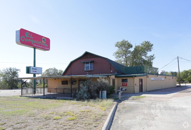
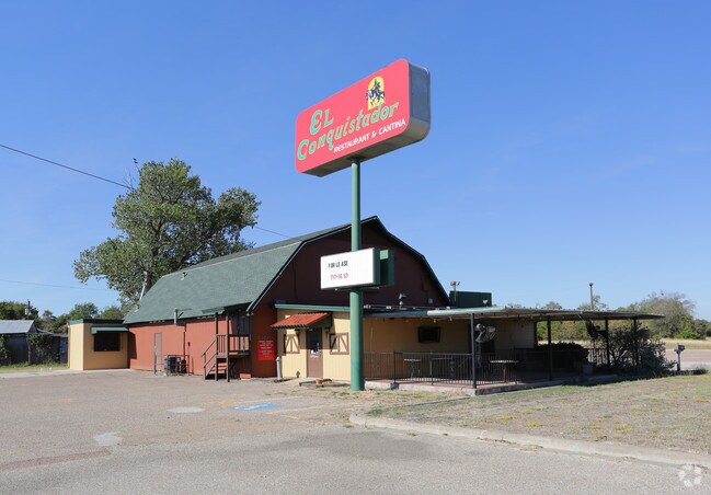
Property Record
6500 N 19Th St, Waco, TX 76708

Property Detail
6500 N 19Th St
14-040710-000200-0
VILLAGE BARN LOT 2 BLOCK 1 ACRES 18.6
Commercialnec
McLennan
C2 &
Texas
B and X Area of moderate flood hazard, usually the area between the limits of the 100-year and 500-year floods.
2
2024
18.60 AC
2025
Waco
004105
Other Market Areas
6,278 SF
Waco, TX
NEARBY LISTINGS FOR SALE OR LEASE
-
-
View all Waco listings for sale on LoopNet.com
DEMOGRAPHICS near 6500 N 19Th St
1 mile
3 mile
5 mile
2024 Total Population
1,118
15,999
68,842
2029 Population
1,184
16,968
73,098
Pop Growth 2024-2029
+ 5.90%
+ 6.06%
+ 6.18%
Average Age
39
39
37
2024 Total Households
410
6,426
25,868
HH Growth 2024-2029
+ 6.10%
+ 6.12%
+ 6.27%
Median Household Inc
$71,952
$56,429
$49,974
Avg Household Size
2.70
2.40
2.60
2024 Avg HH Vehicles
2.00
2.00
2.00
Median Home Value
$238,281
$190,239
$173,543
Median Year Built
1998
1975
1968
Nearby Places
Map Layers
Map Styles
 Street
 Aerial
Transit
 Traffic
 Biking
Places
Listings with unknown addresses are not visible on the map
- Restaurants
- Banks
- Shops
- Fitness
- Groceries
PUBLIC TRANSPORTATION
AIRPORT
Waco Regional
Drive
Walk
Distance
Waco Regional
9 min
2.9 mi
Nearby Properties
Address
Land Use
TOTAL SIZE
Lot Size
Zoning
Address
Land Use
TOTAL SIZE
Lot Size
Zoning
214,351 SF
19.37 AC
R3B
Address
Land Use
TOTAL SIZE
Lot Size
Zoning
346,987 SF
146.01 AC
C
Address
Land Use
TOTAL SIZE
Lot Size
Zoning
189,996 SF
13.98 AC
O2
Address
Land Use
TOTAL SIZE
Lot Size
Zoning
238,580 SF
12.25 AC
R-3E
Address
Land Use
TOTAL SIZE
Lot Size
Zoning
163,937 SF
11.09 AC
R1B
Address
Land Use
TOTAL SIZE
Lot Size
Zoning
32,870 SF
100 AC
TIF3
Address
Land Use
TOTAL SIZE
Lot Size
Zoning
111,840 SF
38.94 AC
R1B
Address
Land Use
TOTAL SIZE
Lot Size
Zoning
11,487 SF
85.25 AC
R
Address
Land Use
TOTAL SIZE
Lot Size
Zoning
95,336 SF
4.06 AC
R3E
Address
Land Use
TOTAL SIZE
Lot Size
Zoning
104,472 SF
5.95 AC
O3
Address
Land Use
TOTAL SIZE
Lot Size
Zoning
111,212 SF
3.02 AC
O3
Address
Land Use
TOTAL SIZE
Lot Size
Zoning
113,795 SF
7.38 AC
C-3
Address
Land Use
TOTAL SIZE
Lot Size
Zoning
83,212 SF
4.92 AC
Address
Land Use
TOTAL SIZE
Lot Size
Zoning
7,772 SF
2.18 AC
Address
Land Use
TOTAL SIZE
Lot Size
Zoning
129,138 SF
53.11 AC
R1B
Address
Land Use
TOTAL SIZE
Lot Size
Zoning
7,020 SF
71.49 AC
R1B
Address
Land Use
TOTAL SIZE
Lot Size
Zoning
7,020 SF
71.30 AC
R1B
Address
Land Use
TOTAL SIZE
Lot Size
Zoning
5,654 SF
2.33 AC
Address
Land Use
TOTAL SIZE
Lot Size
Zoning
55,862 SF
13.88 AC
R1B
Address
Land Use
TOTAL SIZE
Lot Size
Zoning
51,356 SF
6.27 AC
R1B
Address
Land Use
TOTAL SIZE
Lot Size
Zoning
14,769 SF
2.61 AC
C-2
Address
Land Use
TOTAL SIZE
Lot Size
Zoning
15,060 SF
3.88 AC
R1B
Address
Land Use
TOTAL SIZE
Lot Size
Zoning
46,543 SF
5.38 AC
O-3
Address
Land Use
TOTAL SIZE
Lot Size
Zoning
56,732 SF
10.70 AC
R
Address
Land Use
TOTAL SIZE
Lot Size
Zoning
65,309 SF
2.08 AC
O3
Address
Land Use
TOTAL SIZE
Lot Size
Zoning
46,620 SF
2.73 AC
R3D
Address
Land Use
TOTAL SIZE
Lot Size
Zoning
18,724 SF
1.91 AC
C-2
Address
Land Use
TOTAL SIZE
Lot Size
Zoning
28,278 SF
256.39 AC
R1B
Address
Land Use
TOTAL SIZE
Lot Size
Zoning
73,302 SF
22.24 AC
C
Address
Land Use
TOTAL SIZE
Lot Size
Zoning
27,222 SF
6.31 AC
R1B
The World's #1 Commercial Real Estate Marketplace
Connect with us
© 2026 CoStar Group
The information above has been obtained from sources believed reliable. While we do not doubt its accuracy we have not verified it and make no guarantee, warranty or representation about it. It is your responsibility to independently confirm its accuracy and completeness. Any projections, opinions, assumptions, or estimates used are for example only and do not represent the current or future performance of the property. The value of this transaction to you depends on tax and other factors which should be evaluated by your tax, financial, and legal advisors. You and your advisors should conduct a careful, independent investigation of the property to determine to your satisfaction the suitability of the property for your needs.