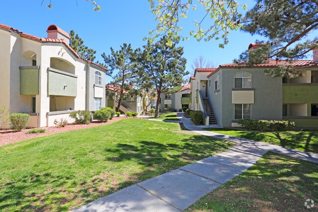
Property Record
6500 Vegas Dr, Las Vegas, NV 89108


NEARBY LISTINGS FOR SALE OR LEASE
Property Detail
6500 Vegas Dr
Las Vegas-Henderson-Paradise, NV
Parcel Map File 71 Page 91
138-23-402-001
PARCEL MAP FILE 71 PAGE 91 LOT 2
Apartment
Clark
X
Nevada
32003C2155F
2
2025
15.33 AC
2025
Michael Way
003422
Las Vegas
7,148 SF
DEMOGRAPHICS near 6500 Vegas Dr
1 Mile
3 Mile
5 Mile
2024 Total Population
36,285
191,565
448,131
2029 Population
39,002
205,193
480,568
Pop Growth 2024-2029
+ 7.49%
+ 7.11%
+ 7.24%
Average Age
36
39
40
2024 Total Households
13,389
71,422
170,012
HH Growth 2024-2029
+ 7.39%
+ 7.13%
+ 7.24%
Median Household Inc
$44,616
$50,481
$55,967
Avg Household Size
2.60
2.60
2.60
2024 Avg HH Vehicles
2.00
2.00
2.00
Median Home Value
$243,472
$285,907
$340,130
Median Year Built
1987
1987
1990
Nearby Places
Map Layers
Map Styles
 Street
 Aerial
- Restaurants
- Banks
- Shops
- Fitness
- Groceries
PUBLIC TRANSPORTATION
AIRPORT
Harry Reid International
DRIVE
WALK
Distance
Harry Reid International
23 min
12.0 mi
Boulder City Municipal
DRIVE
WALK
Distance
Boulder City Municipal
43 min
33.1 mi
Freight Ports
Port of Long Beach
DRIVE
WALK
Distance
Port of Long Beach
324 min
287.5 mi
Nearby Properties
Address
Land Use
TOTAL SIZE
Lot Size
Zoning
Address
Land Use
TOTAL SIZE
Lot Size
Zoning
161.14 AC
CV
Address
Land Use
TOTAL SIZE
Lot Size
Zoning
157.50 AC
Address
Land Use
TOTAL SIZE
Lot Size
Zoning
5,643 SF
10.29 AC
Address
Land Use
TOTAL SIZE
Lot Size
Zoning
37.31 AC
CV
Address
Land Use
TOTAL SIZE
Lot Size
Zoning
49,716 SF
59.37 AC
CV
Address
Land Use
TOTAL SIZE
Lot Size
Zoning
7,148 SF
7.26 AC
Address
Land Use
TOTAL SIZE
Lot Size
Zoning
14,793 SF
9.57 AC
CPB
Address
Land Use
TOTAL SIZE
Lot Size
Zoning
28,956 SF
75.82 AC
CV
Address
Land Use
TOTAL SIZE
Lot Size
Zoning
5,057 SF
9.46 AC
RE
Address
Land Use
TOTAL SIZE
Lot Size
Zoning
3,518 SF
11.95 AC
Address
Land Use
TOTAL SIZE
Lot Size
Zoning
8,261 SF
9.36 AC
Address
Land Use
TOTAL SIZE
Lot Size
Zoning
271,484 SF
7.04 AC
C2
Address
Land Use
TOTAL SIZE
Lot Size
Zoning
5,750 SF
19.67 AC
R3
Address
Land Use
TOTAL SIZE
Lot Size
Zoning
4,084 SF
1.84 AC
CPB
Address
Land Use
TOTAL SIZE
Lot Size
Zoning
52,058 SF
6.44 AC
C1
Address
Land Use
TOTAL SIZE
Lot Size
Zoning
66.57 AC
CV
Address
Land Use
TOTAL SIZE
Lot Size
Zoning
285,929 SF
5.06 AC
C1
Address
Land Use
TOTAL SIZE
Lot Size
Zoning
211,331 SF
6.70 AC
USC
Address
Land Use
TOTAL SIZE
Lot Size
Zoning
6,280 SF
8.72 AC
RPD18
Address
Land Use
TOTAL SIZE
Lot Size
Zoning
1,883 SF
18.13 AC
C2
Address
Land Use
TOTAL SIZE
Lot Size
Zoning
40,434 SF
25.46 AC
C3
Address
Land Use
TOTAL SIZE
Lot Size
Zoning
86,946 SF
162.05 AC
M2
Address
Land Use
TOTAL SIZE
Lot Size
Zoning
7,103 SF
14.27 AC
L:R-3
Address
Land Use
TOTAL SIZE
Lot Size
Zoning
Address
Land Use
TOTAL SIZE
Lot Size
Zoning
99,487 SF
22.61 AC
PC
The World's #1 Commercial Real Estate Marketplace
Connect with us
© 2025 CoStar Group
The information above has been obtained from sources believed reliable. While we do not doubt its accuracy we have not verified it and make no guarantee, warranty or representation about it. It is your responsibility to independently confirm its accuracy and completeness. Any projections, opinions, assumptions, or estimates used are for example only and do not represent the current or future performance of the property. The value of this transaction to you depends on tax and other factors which should be evaluated by your tax, financial, and legal advisors. You and your advisors should conduct a careful, independent investigation of the property to determine to your satisfaction the suitability of the property for your needs.