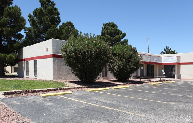
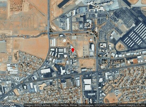
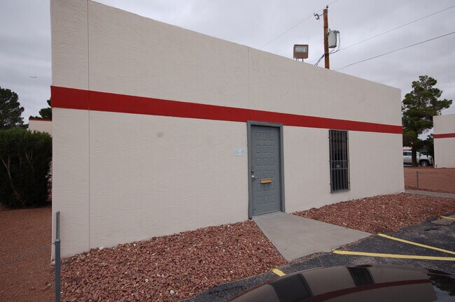
Property Record
6501 Boeing Dr, El Paso, TX 79925
NEARBY LISTINGS FOR SALE OR LEASE
Property Detail
6501 Boeing Dr
El Paso, TX
1-A El Paso Intl Airport Trs
E378-999-002A-1500
2-A EL PASO INTL AIRPORT TRS RPL IMPS ONLY ON 4 TO 6 & S 237.54 FT OF 3 (OUT OF E378-999-002A-0300)
Commercialnec
El Paso
2024
Texas
2025
East
003402
El Paso
59,749 SF
DEMOGRAPHICS near 6501 Boeing Dr
1 Mile
3 Mile
5 Mile
2024 Total Population
7,180
73,914
194,562
2029 Population
7,271
74,853
197,381
Pop Growth 2024-2029
+ 1.27%
+ 1.27%
+ 1.45%
Average Age
37
37
38
2024 Total Households
2,565
25,914
71,910
HH Growth 2024-2029
+ 1.21%
+ 1.08%
+ 1.44%
Median Household Inc
$41,536
$37,746
$38,241
Avg Household Size
2.30
2.60
2.60
2024 Avg HH Vehicles
1.00
2.00
2.00
Median Home Value
$129,680
$134,146
$133,703
Median Year Built
1964
1963
1967
Nearby Places
- Restaurants
- Banks
- Shops
- Fitness
- Groceries
PUBLIC TRANSPORTATION
AIRPORT
El Paso International
DRIVE
WALK
Distance
El Paso International
19 min
8.3 mi
SALE & LEASE HISTORY
LISTING DATE
SALE/LEASE

Sep 25, 2016
For Lease
May 15, 2019
For Lease
Nearby Properties
Address
Land Use
TOTAL SIZE
Lot Size
Zoning
Address
Land Use
TOTAL SIZE
Lot Size
Zoning
75,601 SF
495.64 AC
M3
Address
Land Use
TOTAL SIZE
Lot Size
Zoning
753,996 SF
23.50 AC
C4
Address
Land Use
TOTAL SIZE
Lot Size
Zoning
1,122,782 SF
55.24 AC
C4
Address
Land Use
TOTAL SIZE
Lot Size
Zoning
237,300 SF
4.99 AC
M1
Address
Land Use
TOTAL SIZE
Lot Size
Zoning
315,094 SF
2.22 AC
M1S
Address
Land Use
TOTAL SIZE
Lot Size
Zoning
561,866 SF
27.25 AC
C4
Address
Land Use
TOTAL SIZE
Lot Size
Zoning
230,968 SF
10.69 AC
C4
Address
Land Use
TOTAL SIZE
Lot Size
Zoning
1 SF
214 AC
M3
Address
Land Use
TOTAL SIZE
Lot Size
Zoning
380,811 SF
22.75 AC
M1
Address
Land Use
TOTAL SIZE
Lot Size
Zoning
343,190 SF
31.84 AC
C4
Address
Land Use
TOTAL SIZE
Lot Size
Zoning
259,926 SF
250.23 AC
M1
Address
Land Use
TOTAL SIZE
Lot Size
Zoning
107.76 AC
C4
Address
Land Use
TOTAL SIZE
Lot Size
Zoning
289.07 AC
Address
Land Use
TOTAL SIZE
Lot Size
Zoning
374,839 SF
33.29 AC
C3S
Address
Land Use
TOTAL SIZE
Lot Size
Zoning
683,161 SF
M1
Address
Land Use
TOTAL SIZE
Lot Size
Zoning
213,351 SF
12 AC
C3S
Address
Land Use
TOTAL SIZE
Lot Size
Zoning
195,101 SF
15.45 AC
C1
Address
Land Use
TOTAL SIZE
Lot Size
Zoning
271,746 SF
1.93 AC
C4
Address
Land Use
TOTAL SIZE
Lot Size
Zoning
190,770 SF
8.70 AC
C4S
Address
Land Use
TOTAL SIZE
Lot Size
Zoning
210,541 SF
2.45 AC
C3S
Address
Land Use
TOTAL SIZE
Lot Size
Zoning
74,907 SF
8.07 AC
C4
Address
Land Use
TOTAL SIZE
Lot Size
Zoning
142,532 SF
13.32 AC
C3S
Address
Land Use
TOTAL SIZE
Lot Size
Zoning
495,319 SF
36.42 AC
M1
Address
Land Use
TOTAL SIZE
Lot Size
Zoning
196,860 SF
10.15 AC
C4
Address
Land Use
TOTAL SIZE
Lot Size
Zoning
272,601 SF
14.97 AC
AO
Address
Land Use
TOTAL SIZE
Lot Size
Zoning
197,902 SF
30 AC
R4
Address
Land Use
TOTAL SIZE
Lot Size
Zoning
184,016 SF
14.17 AC
C4
Address
Land Use
TOTAL SIZE
Lot Size
Zoning
235,213 SF
11.98 AC
A3O
Address
Land Use
TOTAL SIZE
Lot Size
Zoning
174,369 SF
6.47 AC
C4
Address
Land Use
TOTAL SIZE
Lot Size
Zoning
105,970 SF
7.45 AC
C4
The World's #1 Commercial Real Estate Marketplace
Connect with us
© 2025 CoStar Group
The information above has been obtained from sources believed reliable. While we do not doubt its accuracy we have not verified it and make no guarantee, warranty or representation about it. It is your responsibility to independently confirm its accuracy and completeness. Any projections, opinions, assumptions, or estimates used are for example only and do not represent the current or future performance of the property. The value of this transaction to you depends on tax and other factors which should be evaluated by your tax, financial, and legal advisors. You and your advisors should conduct a careful, independent investigation of the property to determine to your satisfaction the suitability of the property for your needs.