Property Record
6501 Colony St, Bakersfield, CA 93307


Property Detail
6501 Colony St
515-060-02-00-7
PARCEL MAP 6698 , LOT 1
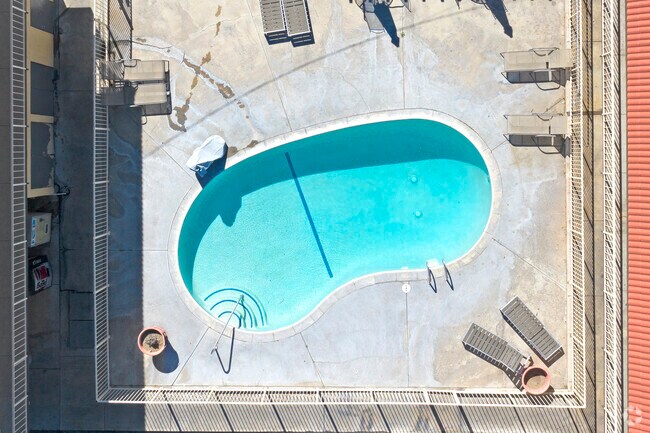
Motel
KERN
C-2
California
B and X Area of moderate flood hazard, usually the area between the limits of the 100-year and 500-year floods.
1
2024
3.90 AC
2025
Bakersfield
003207
Bakersfield
36,320 SF
Bakersfield-Delano, CA
NEARBY LISTINGS FOR SALE OR LEASE
-
-
View all Bakersfield listings for sale on LoopNet.com
DEMOGRAPHICS near 6501 Colony St
1 mile
3 mile
5 mile
2025 Total Population
19,345
130,199
237,638
2030 Population
19,490
131,484
240,122
Pop Growth 2025-2030
+ 0.75%
+ 0.99%
+ 1.05%
Average Age
33
34
35
2025 Total Households
5,065
36,354
72,478
HH Growth 2025-2030
+ 0.69%
+ 0.92%
+ 0.98%
Median Household Inc
$77,595
$71,452
$68,440
Avg Household Size
3.70
3.50
3.20
2025 Avg HH Vehicles
2.00
2.00
2.00
Median Home Value
$299,721
$324,855
$330,588
Median Year Built
1987
1986
1981
Nearby Places
Map Layers
Map Styles
 Street
 Aerial
Layers
 Traffic
 Biking
Places
Listings with unknown addresses are not visible on the map
- Restaurants
- Banks
- Shops
- Fitness
- Groceries
PUBLIC TRANSPORTATION
COMMUTER RAIL
Bakersfield (San Joaquins - Amtrak)
Drive
Walk
Distance
Bakersfield (San Joaquins - Amtrak)
13 min
7.7 mi
AIRPORT
Meadows Field
Drive
Walk
Distance
Meadows Field
20 min
11.2 mi
Freight Ports
The Port of Hueneme
Drive
Walk
Distance
The Port of Hueneme
146 min
116.9 mi
Nearby Properties
Address
Land Use
TOTAL SIZE
Lot Size
Zoning
Address
Land Use
TOTAL SIZE
Lot Size
Zoning
114,500 SF
12.02 AC
C-2
Address
Land Use
TOTAL SIZE
Lot Size
Zoning
354,000 SF
20 AC
M2
Address
Land Use
TOTAL SIZE
Lot Size
Zoning
269,429 SF
12.71 AC
R-2
Address
Land Use
TOTAL SIZE
Lot Size
Zoning
17.96 AC
C2
Address
Land Use
TOTAL SIZE
Lot Size
Zoning
218,345 SF
19.54 AC
PCD
Address
Land Use
TOTAL SIZE
Lot Size
Zoning
62,941 SF
8.79 AC
M-1
Address
Land Use
TOTAL SIZE
Lot Size
Zoning
79,325 SF
7.77 AC
C-2
Address
Land Use
TOTAL SIZE
Lot Size
Zoning
88,988 SF
9.82 AC
C-2
Address
Land Use
TOTAL SIZE
Lot Size
Zoning
11,780 SF
11.25 AC
C1
Address
Land Use
TOTAL SIZE
Lot Size
Zoning
147,451 SF
9.55 AC
C2
Address
Land Use
TOTAL SIZE
Lot Size
Zoning
69,414 SF
4.47 AC
M1
Address
Land Use
TOTAL SIZE
Lot Size
Zoning
149,499 SF
13.20 AC
GC
Address
Land Use
TOTAL SIZE
Lot Size
Zoning
92,469 SF
7.15 AC
R-3
Address
Land Use
TOTAL SIZE
Lot Size
Zoning
41,507 SF
10.37 AC
C2
Address
Land Use
TOTAL SIZE
Lot Size
Zoning
10,073 SF
15.48 AC
PCD
Address
Land Use
TOTAL SIZE
Lot Size
Zoning
1,100 SF
6.28 AC
R-3
Address
Land Use
TOTAL SIZE
Lot Size
Zoning
154,581 SF
2.11 AC
C-2
Address
Land Use
TOTAL SIZE
Lot Size
Zoning
81,682 SF
12.27 AC
M-2
Address
Land Use
TOTAL SIZE
Lot Size
Zoning
34,306 SF
12.39 AC
R-2
Address
Land Use
TOTAL SIZE
Lot Size
Zoning
94,240 SF
4.95 AC
C-2
Address
Land Use
TOTAL SIZE
Lot Size
Zoning
232,000 SF
15.74 AC
M-2
Address
Land Use
TOTAL SIZE
Lot Size
Zoning
149,777 SF
15.27 AC
C2
Address
Land Use
TOTAL SIZE
Lot Size
Zoning
7.62 AC
C2
Address
Land Use
TOTAL SIZE
Lot Size
Zoning
4.02 AC
C2
Address
Land Use
TOTAL SIZE
Lot Size
Zoning
5,000 SF
0.34 AC
Address
Land Use
TOTAL SIZE
Lot Size
Zoning
10.37 AC
C2
Address
Land Use
TOTAL SIZE
Lot Size
Zoning
10,134 SF
5.01 AC
R-3
Address
Land Use
TOTAL SIZE
Lot Size
Zoning
41.06 AC
Address
Land Use
TOTAL SIZE
Lot Size
Zoning
41,231 SF
6 AC
M-1
Address
Land Use
TOTAL SIZE
Lot Size
Zoning
226,850 SF
22.82 AC
P.U.D.
The World's #1 Commercial Real Estate Marketplace
Connect with us
© 2026 CoStar Group
The information above has been obtained from sources believed reliable. While we do not doubt its accuracy we have not verified it and make no guarantee, warranty or representation about it. It is your responsibility to independently confirm its accuracy and completeness. Any projections, opinions, assumptions, or estimates used are for example only and do not represent the current or future performance of the property. The value of this transaction to you depends on tax and other factors which should be evaluated by your tax, financial, and legal advisors. You and your advisors should conduct a careful, independent investigation of the property to determine to your satisfaction the suitability of the property for your needs.