Property Record
6501 Lynch Rd, Detroit, MI 48234


NEARBY LISTINGS FOR SALE OR LEASE
Property Detail
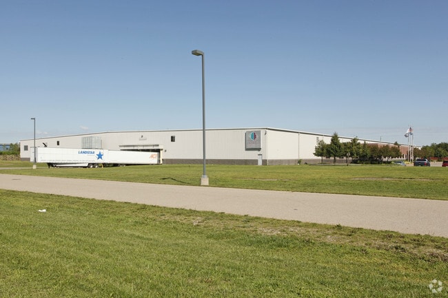
6501 Lynch Rd
15-002527-001
Harrahs Lynch Rd
Industrialgeneral
N LYNCH PT OF S 1/2 SEC 16 T1 S R 12 E S 6.44 FT ON E LINE BG S 6.11 FT ON W LINE OF 9 10 THRU 26 N 9.35 FT 27 AND VAC ALLEY
X
Wayne
26163C0125E
Michigan
2025
33.22 AC
2025
Detroit East
505800
Detroit
218,188 SF
Detroit-Warren-Dearborn, MI
DEMOGRAPHICS near 6501 Lynch Rd
1 Mile
3 Mile
5 Mile
2024 Total Population
9,918
124,517
385,918
2029 Population
9,726
124,844
387,512
Pop Growth 2024-2029
(1.94%)
+ 0.26%
+ 0.41%
Average Age
34
37
38
2024 Total Households
3,024
43,957
155,857
HH Growth 2024-2029
(1.36%)
+ 0.66%
+ 0.41%
Median Household Inc
$29,465
$34,683
$36,266
Avg Household Size
3.10
2.70
2.40
2024 Avg HH Vehicles
1.00
1.00
1.00
Median Home Value
$77,063
$68,626
$81,435
Median Year Built
1947
1948
1950
Nearby Places
Map Layers
Map Styles
 Street
 Aerial
- Restaurants
- Banks
- Shops
- Fitness
- Groceries
PUBLIC TRANSPORTATION
AIRPORT
Windsor International
DRIVE
WALK
Distance
Windsor International
37 min
16.7 mi
Detroit Metro Wayne County
DRIVE
WALK
Distance
Detroit Metro Wayne County
40 min
26.2 mi
Nearby Properties
Address
Land Use
TOTAL SIZE
Lot Size
Zoning
Address
Land Use
TOTAL SIZE
Lot Size
Zoning
3,793,609 SF
265.70 AC
M4
Address
Land Use
TOTAL SIZE
Lot Size
Zoning
996,200 SF
2.14 AC
Address
Land Use
TOTAL SIZE
Lot Size
Zoning
506,404 SF
198 AC
M4
Address
Land Use
TOTAL SIZE
Lot Size
Zoning
892,351 SF
92.45 AC
I
Address
Land Use
TOTAL SIZE
Lot Size
Zoning
331,559 SF
11.42 AC
M4
Address
Land Use
TOTAL SIZE
Lot Size
Zoning
564,958 SF
9.69 AC
M4
Address
Land Use
TOTAL SIZE
Lot Size
Zoning
197,670 SF
42.84 AC
M4
Address
Land Use
TOTAL SIZE
Lot Size
Zoning
144,578 SF
7.10 AC
PD
Address
Land Use
TOTAL SIZE
Lot Size
Zoning
300,000 SF
0.29 AC
M4
Address
Land Use
TOTAL SIZE
Lot Size
Zoning
405,004 SF
28.13 AC
M4
Address
Land Use
TOTAL SIZE
Lot Size
Zoning
358,327 SF
M4
Address
Land Use
TOTAL SIZE
Lot Size
Zoning
455,634 SF
0.58 AC
Address
Land Use
TOTAL SIZE
Lot Size
Zoning
116,060 SF
6.95 AC
R2
Address
Land Use
TOTAL SIZE
Lot Size
Zoning
353,800 SF
15.70 AC
Address
Land Use
TOTAL SIZE
Lot Size
Zoning
302,305 SF
M4
Address
Land Use
TOTAL SIZE
Lot Size
Zoning
410,359 SF
27.52 AC
M4
Address
Land Use
TOTAL SIZE
Lot Size
Zoning
301,000 SF
Address
Land Use
TOTAL SIZE
Lot Size
Zoning
286,023 SF
M4
Address
Land Use
TOTAL SIZE
Lot Size
Zoning
641,836 SF
20.69 AC
M4
Address
Land Use
TOTAL SIZE
Lot Size
Zoning
72,270 SF
0.20 AC
M3
Address
Land Use
TOTAL SIZE
Lot Size
Zoning
217,000 SF
11.91 AC
Address
Land Use
TOTAL SIZE
Lot Size
Zoning
224,148 SF
8.59 AC
M4
Address
Land Use
TOTAL SIZE
Lot Size
Zoning
307,262 SF
M4
Address
Land Use
TOTAL SIZE
Lot Size
Zoning
38,333 SF
0.32 AC
M3
Address
Land Use
TOTAL SIZE
Lot Size
Zoning
300,000 SF
17.73 AC
Address
Land Use
TOTAL SIZE
Lot Size
Zoning
351,731 SF
1.93 AC
M4
Address
Land Use
TOTAL SIZE
Lot Size
Zoning
192,452 SF
10.89 AC
M4
Address
Land Use
TOTAL SIZE
Lot Size
Zoning
487,700 SF
12.30 AC
M4
Address
Land Use
TOTAL SIZE
Lot Size
Zoning
76,856 SF
1.27 AC
R5
The World's #1 Commercial Real Estate Marketplace
Connect with us
© 2026 CoStar Group
The information above has been obtained from sources believed reliable. While we do not doubt its accuracy we have not verified it and make no guarantee, warranty or representation about it. It is your responsibility to independently confirm its accuracy and completeness. Any projections, opinions, assumptions, or estimates used are for example only and do not represent the current or future performance of the property. The value of this transaction to you depends on tax and other factors which should be evaluated by your tax, financial, and legal advisors. You and your advisors should conduct a careful, independent investigation of the property to determine to your satisfaction the suitability of the property for your needs.