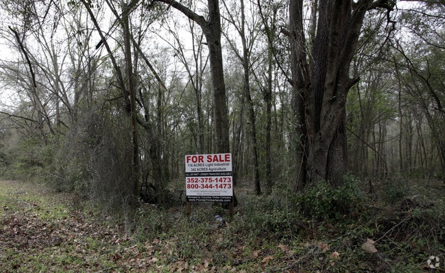
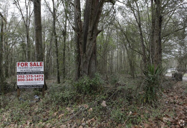
Property Record
6502 N County Road 225, Gainesville, FL 32609

NEARBY LISTINGS FOR SALE OR LEASE
-
-
View all Gainesville listings for sale on LoopNet.com
Property Detail
6502 N County Road 225
Gainesville, FL
Haile Lt 65 A Condo
07872-016-000
N1/2 W OF RD LESS COM AT INTERSECTION OF W SIDE OF MONTEOCHA RD & N LINE OF SEC RUN W 600 FT N 350 FT POB LESS OR 806/ 192 R/W OR 893/713) OR 4196/1494
Countyproperty
Alachua
A
Florida
12001C0308D
220 AC
0
Gainesville
2025
Other Market Areas
001908
DEMOGRAPHICS near 6502 N County Road 225
1 Mile
3 Mile
5 Mile
2024 Total Population
376
4,933
39,854
2029 Population
400
5,228
42,389
Pop Growth 2024-2029
+ 6.38%
+ 5.98%
+ 6.36%
Average Age
41
38
38
2024 Total Households
150
1,790
16,367
HH Growth 2024-2029
+ 6.67%
+ 6.03%
+ 6.32%
Median Household Inc
$68,099
$41,145
$43,532
Avg Household Size
2.40
2.50
2.20
2024 Avg HH Vehicles
1.00
1.00
1.00
Median Home Value
$167,441
$127,201
$157,048
Median Year Built
1985
1980
1976
Nearby Places
Map Layers
Map Styles
 Street
 Aerial
- Restaurants
- Banks
- Shops
- Fitness
- Groceries
PUBLIC TRANSPORTATION
AIRPORT
Gainesville Regional
DRIVE
WALK
Distance
Gainesville Regional
12 min
4.5 mi
Freight Ports
Jacksonville Port
DRIVE
WALK
Distance
Jacksonville Port
92 min
70.0 mi
Nearby Properties
Address
Land Use
TOTAL SIZE
Lot Size
Zoning
Address
Land Use
TOTAL SIZE
Lot Size
Zoning
25.64 AC
PS
Address
Land Use
TOTAL SIZE
Lot Size
Zoning
60,480 SF
117.68 AC
PS
Address
Land Use
TOTAL SIZE
Lot Size
Zoning
341,625 SF
1,093.63 AC
AF
Address
Land Use
TOTAL SIZE
Lot Size
Zoning
3 SF
14.81 AC
ED
Address
Land Use
TOTAL SIZE
Lot Size
Zoning
93,004 SF
37.39 AC
ED
Address
Land Use
TOTAL SIZE
Lot Size
Zoning
85,476 SF
17.92 AC
MP
Address
Land Use
TOTAL SIZE
Lot Size
Zoning
177,604 SF
41.41 AC
I2
Address
Land Use
TOTAL SIZE
Lot Size
Zoning
64,138 SF
8.43 AC
I2
Address
Land Use
TOTAL SIZE
Lot Size
Zoning
118,740 SF
11.16 AC
I1
Address
Land Use
TOTAL SIZE
Lot Size
Zoning
154,130 SF
24.65 AC
I2
Address
Land Use
TOTAL SIZE
Lot Size
Zoning
93,651 SF
6.50 AC
RMF6
Address
Land Use
TOTAL SIZE
Lot Size
Zoning
123,764 SF
10.13 AC
PD
Address
Land Use
TOTAL SIZE
Lot Size
Zoning
82,852 SF
8.08 AC
RMF6
Address
Land Use
TOTAL SIZE
Lot Size
Zoning
115,389 SF
9.73 AC
RMF7
Address
Land Use
TOTAL SIZE
Lot Size
Zoning
241,937 SF
16.93 AC
I2
Address
Land Use
TOTAL SIZE
Lot Size
Zoning
82,394 SF
13.93 AC
I2
Address
Land Use
TOTAL SIZE
Lot Size
Zoning
88,104 SF
60.24 AC
PS
Address
Land Use
TOTAL SIZE
Lot Size
Zoning
2,030 SF
34.88 AC
RM
Address
Land Use
TOTAL SIZE
Lot Size
Zoning
66,014 SF
44.26 AC
PD
Address
Land Use
TOTAL SIZE
Lot Size
Zoning
23 AC
PS
Address
Land Use
TOTAL SIZE
Lot Size
Zoning
41,875 SF
12.97 AC
BA
Address
Land Use
TOTAL SIZE
Lot Size
Zoning
43,584 SF
219.21 AC
PS
Address
Land Use
TOTAL SIZE
Lot Size
Zoning
2,540 SF
13.84 AC
I1
Address
Land Use
TOTAL SIZE
Lot Size
Zoning
63,475 SF
9.42 AC
I2
Address
Land Use
TOTAL SIZE
Lot Size
Zoning
85,034 SF
8.82 AC
BA
Address
Land Use
TOTAL SIZE
Lot Size
Zoning
77,500 SF
36.72 AC
MP
Address
Land Use
TOTAL SIZE
Lot Size
Zoning
66.89 AC
PS
Address
Land Use
TOTAL SIZE
Lot Size
Zoning
98.47 AC
CON
Address
Land Use
TOTAL SIZE
Lot Size
Zoning
237.10 AC
PS
Address
Land Use
TOTAL SIZE
Lot Size
Zoning
19,602 SF
7.17 AC
BA
The World's #1 Commercial Real Estate Marketplace
Connect with us
© 2025 CoStar Group
The information above has been obtained from sources believed reliable. While we do not doubt its accuracy we have not verified it and make no guarantee, warranty or representation about it. It is your responsibility to independently confirm its accuracy and completeness. Any projections, opinions, assumptions, or estimates used are for example only and do not represent the current or future performance of the property. The value of this transaction to you depends on tax and other factors which should be evaluated by your tax, financial, and legal advisors. You and your advisors should conduct a careful, independent investigation of the property to determine to your satisfaction the suitability of the property for your needs.