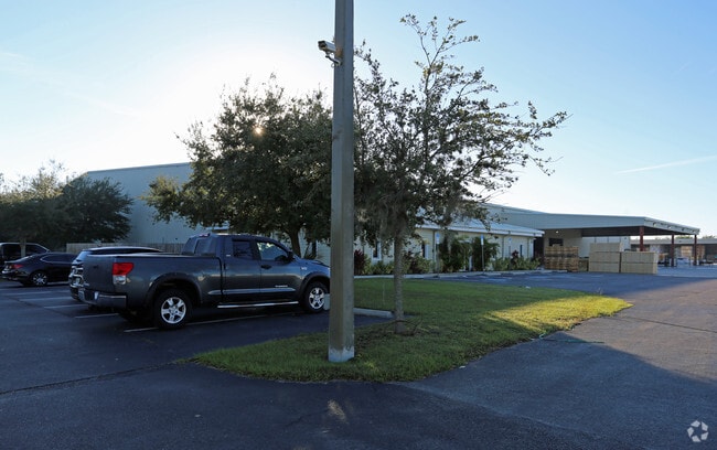
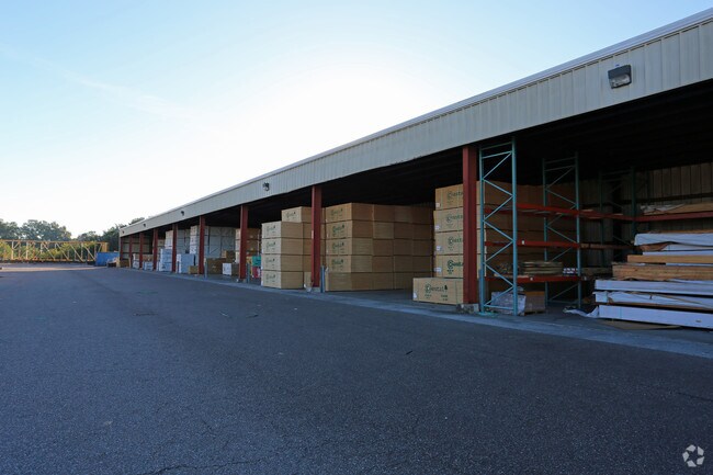
Property Record
6509 Powell Rd, Gibsonton, FL 33534

NEARBY LISTINGS FOR SALE OR LEASE
Property Detail
6509 Powell Rd
Tampa-St. Petersburg-Clearwater, FL
Unplatted
U-11-31-19-ZZZ-000001-73960.1
TRACT LAND BEING PT SE 1/4 OF NW 1/4 AND PT SW 1/4 OF NE 1/4 LYING IN SEC 11 TWN 31 S RGE 19 E DESC AS FOLL: COMM AT NE COR OF SE 1/4 OF NW 1/4 OF SD SEC RUN S 00 DEG 48 MIN 11 SEC W 25 FT TO POB THN S 87 DEG 54 MIN 34 SEC E 172.08 FT THN S 00 DEG 25
Warehouse
Hillsborough
AE
Florida
12057C0492J
73960
2024
9.99 AC
2025
SE Hillsborough
013801
Tampa/St Petersburg
98,522 SF
DEMOGRAPHICS near 6509 Powell Rd
1 mile
3 mile
5 mile
2024 Total Population
2,886
47,934
142,147
2029 Population
3,140
53,318
158,087
Pop Growth 2024-2029
+ 8.80%
+ 11.23%
+ 11.21%
Average Age
34
36
38
2024 Total Households
956
16,234
49,533
HH Growth 2024-2029
+ 9.00%
+ 11.49%
+ 11.44%
Median Household Inc
$98,332
$89,387
$88,833
Avg Household Size
3.00
2.90
2.80
2024 Avg HH Vehicles
2.00
2.00
2.00
Median Home Value
$243,471
$280,522
$295,102
Median Year Built
2004
2008
2008
Nearby Places
Map Layers
Map Styles
 Street
 Aerial
Transit
 Traffic
 Biking
Places
Listings with unknown addresses are not visible on the map
- Restaurants
- Banks
- Shops
- Fitness
- Groceries
PUBLIC TRANSPORTATION
AIRPORT
Tampa International
Drive
Walk
Distance
Tampa International
37 min
23.3 mi
St Pete-Clearwater International
Drive
Walk
Distance
St Pete-Clearwater International
54 min
32.5 mi
Freight Ports
Port of Tampa Bay
Drive
Walk
Distance
Port of Tampa Bay
21 min
12.6 mi
Nearby Properties
Address
Land Use
TOTAL SIZE
Lot Size
Zoning
Address
Land Use
TOTAL SIZE
Lot Size
Zoning
688,390 SF
68.52 AC
PD
Address
Land Use
TOTAL SIZE
Lot Size
Zoning
503,703 SF
21 AC
PD
Address
Land Use
TOTAL SIZE
Lot Size
Zoning
369,777 SF
21.49 AC
PD
Address
Land Use
TOTAL SIZE
Lot Size
Zoning
493,204 SF
65.35 AC
M
Address
Land Use
TOTAL SIZE
Lot Size
Zoning
317,172 SF
36.54 AC
PD
Address
Land Use
TOTAL SIZE
Lot Size
Zoning
593,167 SF
416.07 AC
M
Address
Land Use
TOTAL SIZE
Lot Size
Zoning
382,614 SF
23.72 AC
IPD-1
Address
Land Use
TOTAL SIZE
Lot Size
Zoning
334,871 SF
15 AC
PD
Address
Land Use
TOTAL SIZE
Lot Size
Zoning
251,817 SF
13.82 AC
PD
Address
Land Use
TOTAL SIZE
Lot Size
Zoning
154,232 SF
17.40 AC
PD
Address
Land Use
TOTAL SIZE
Lot Size
Zoning
347,147 SF
258.94 AC
PD
Address
Land Use
TOTAL SIZE
Lot Size
Zoning
425,231 SF
23.78 AC
M
Address
Land Use
TOTAL SIZE
Lot Size
Zoning
101,768 SF
17.95 AC
PD
Address
Land Use
TOTAL SIZE
Lot Size
Zoning
146,440 SF
18.56 AC
PD
Address
Land Use
TOTAL SIZE
Lot Size
Zoning
48,968 SF
10 AC
PD
Address
Land Use
TOTAL SIZE
Lot Size
Zoning
441,257 SF
107.09 AC
AR
Address
Land Use
TOTAL SIZE
Lot Size
Zoning
520,366 SF
122.24 AC
PD
Address
Land Use
TOTAL SIZE
Lot Size
Zoning
178,496 SF
17.63 AC
PD
Address
Land Use
TOTAL SIZE
Lot Size
Zoning
102,925 SF
24.56 AC
PD
Address
Land Use
TOTAL SIZE
Lot Size
Zoning
64,512 SF
22.32 AC
PD
Address
Land Use
TOTAL SIZE
Lot Size
Zoning
64,248 SF
17.86 AC
PD
Address
Land Use
TOTAL SIZE
Lot Size
Zoning
157,883 SF
18.57 AC
PD
Address
Land Use
TOTAL SIZE
Lot Size
Zoning
74,246 SF
9.75 AC
AR
Address
Land Use
TOTAL SIZE
Lot Size
Zoning
67,026 SF
21.92 AC
PD
Address
Land Use
TOTAL SIZE
Lot Size
Zoning
137,570 SF
12.42 AC
M
Address
Land Use
TOTAL SIZE
Lot Size
Zoning
108,036 SF
11.70 AC
PD
Address
Land Use
TOTAL SIZE
Lot Size
Zoning
93,256 SF
14.82 AC
PD
Address
Land Use
TOTAL SIZE
Lot Size
Zoning
75,207 SF
8.57 AC
PD
Address
Land Use
TOTAL SIZE
Lot Size
Zoning
113,296 SF
23.90 AC
PD
Address
Land Use
TOTAL SIZE
Lot Size
Zoning
88,445 SF
14.41 AC
PD
The World's #1 Commercial Real Estate Marketplace
Connect with us
© 2026 CoStar Group
The information above has been obtained from sources believed reliable. While we do not doubt its accuracy we have not verified it and make no guarantee, warranty or representation about it. It is your responsibility to independently confirm its accuracy and completeness. Any projections, opinions, assumptions, or estimates used are for example only and do not represent the current or future performance of the property. The value of this transaction to you depends on tax and other factors which should be evaluated by your tax, financial, and legal advisors. You and your advisors should conduct a careful, independent investigation of the property to determine to your satisfaction the suitability of the property for your needs.