Property Record
6509 Queens Blvd, Woodside, NY 11377


NEARBY LISTINGS FOR SALE OR LEASE
Property Detail
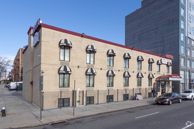
6509 Queens Blvd
01342-0001
Winfield
Motel
Queens
X
New York
3604970207F
1
2024
0.18 AC
2025
La Guardia/Queens North
024700
Long Island (New York)
12,000 SF
New York-Jersey City-White Plains, NY-NJ
DEMOGRAPHICS near 6509 Queens Blvd
1 mile
3 mile
5 mile
2024 Total Population
139,930
958,847
2,752,067
2029 Population
131,829
900,607
2,572,792
Pop Growth 2024-2029
(5.79%)
(6.07%)
(6.51%)
Average Age
41
40
40
2024 Total Households
49,167
362,193
1,123,008
HH Growth 2024-2029
(5.97%)
(6.12%)
(6.76%)
Median Household Inc
$65,664
$75,639
$77,836
Avg Household Size
2.80
2.60
2.30
2024 Avg HH Vehicles
1.00
1.00
.00
Median Home Value
$650,490
$701,977
$798,758
Median Year Built
1953
1951
1954
Nearby Places
Map Layers
Map Styles
 Street
 Aerial
Transit
 Traffic
 Biking
Places
Listings with unknown addresses are not visible on the map
- Restaurants
- Banks
- Shops
- Fitness
- Groceries
PUBLIC TRANSPORTATION
TRANSIT/SUBWAY
Woodside-61 Street (7 - New York MTA Subway (The Subway))
Drive
Walk
Distance
Woodside-61 Street (7 - New York MTA Subway (The Subway))
2 min
8 min
0.4 mi
Woodside Station (Babylon Branch - Long Island Rail Road, Far Rockaway Branch - Long Island Rail Road, Hempstead Branch - Long Island Rail Road, Long Beach Branch - Long Island Rail Road, Montauk Branch - Long Island Rail Road, Port Jefferson Branch - Long Island Rail Road, Port Washington Branch - Long Island Rail Road, Ronkonkoma Branch - Long Island Rail Road)
Drive
Walk
Distance
Woodside Station (Babylon Branch - Long Island Rail Road, Far Rockaway Branch - Long Island Rail Road, Hempstead Branch - Long Island Rail Road, Long Beach Branch - Long Island Rail Road, Montauk Branch - Long Island Rail Road, Port Jefferson Branch - Long Island Rail Road, Port Washington Branch - Long Island Rail Road, Ronkonkoma Branch - Long Island Rail Road)
2 min
9 min
0.5 mi
69 Street (7 - New York MTA Subway (The Subway))
Drive
Walk
Distance
69 Street (7 - New York MTA Subway (The Subway))
2 min
9 min
0.5 mi
65 Street (E - New York MTA Subway (The Subway), M - New York MTA Subway (The Subway), R - New York MTA Subway (The Subway))
Drive
Walk
Distance
65 Street (E - New York MTA Subway (The Subway), M - New York MTA Subway (The Subway), R - New York MTA Subway (The Subway))
3 min
11 min
0.6 mi
Roosevelt Avenue-74 Street (7 - New York MTA Subway (The Subway), E - New York MTA Subway (The Subway), F - New York MTA Subway (The Subway), M - New York MTA Subway (The Subway), R - New York MTA Subway (The Subway))
Drive
Walk
Distance
Roosevelt Avenue-74 Street (7 - New York MTA Subway (The Subway), E - New York MTA Subway (The Subway), F - New York MTA Subway (The Subway), M - New York MTA Subway (The Subway), R - New York MTA Subway (The Subway))
2 min
14 min
0.7 mi
COMMUTER RAIL
Woodside Station (Babylon Branch - Long Island Rail Road, Far Rockaway Branch - Long Island Rail Road, Hempstead Branch - Long Island Rail Road, Long Beach Branch - Long Island Rail Road, Montauk Branch - Long Island Rail Road, Port Jefferson Branch - Long Island Rail Road, Port Washington Branch - Long Island Rail Road, Ronkonkoma Branch - Long Island Rail Road)
Drive
Walk
Distance
Woodside Station (Babylon Branch - Long Island Rail Road, Far Rockaway Branch - Long Island Rail Road, Hempstead Branch - Long Island Rail Road, Long Beach Branch - Long Island Rail Road, Montauk Branch - Long Island Rail Road, Port Jefferson Branch - Long Island Rail Road, Port Washington Branch - Long Island Rail Road, Ronkonkoma Branch - Long Island Rail Road)
2 min
9 min
0.4 mi
Hunterspoint Avenue Station (Hempstead Branch - Long Island Rail Road, Oyster Bay Branch - Long Island Rail Road)
Drive
Walk
Distance
Hunterspoint Avenue Station (Hempstead Branch - Long Island Rail Road, Oyster Bay Branch - Long Island Rail Road)
7 min
2.6 mi
AIRPORT
LaGuardia
Drive
Walk
Distance
LaGuardia
9 min
3.4 mi
John F Kennedy International
Drive
Walk
Distance
John F Kennedy International
21 min
12.2 mi
Newark Liberty International
Drive
Walk
Distance
Newark Liberty International
31 min
19.8 mi
Freight Ports
NY - Red Hook Container Terminal
Drive
Walk
Distance
NY - Red Hook Container Terminal
16 min
8.6 mi
Nearby Properties
Address
Land Use
TOTAL SIZE
Lot Size
Zoning
Address
Land Use
TOTAL SIZE
Lot Size
Zoning
97.14 AC
R7-2
Address
Land Use
TOTAL SIZE
Lot Size
Zoning
1.22 AC
R7-2
Address
Land Use
TOTAL SIZE
Lot Size
Zoning
0.92 AC
R7-2
Address
Land Use
TOTAL SIZE
Lot Size
Zoning
97.14 AC
R7-2
Address
Land Use
TOTAL SIZE
Lot Size
Zoning
4,380,201 SF
97.06 AC
R7-2
Address
Land Use
TOTAL SIZE
Lot Size
Zoning
1,258,350 SF
410.24 AC
PARK
Address
Land Use
TOTAL SIZE
Lot Size
Zoning
1,065,915 SF
2.13 AC
M16R10
Address
Land Use
TOTAL SIZE
Lot Size
Zoning
700,000 SF
2.25 AC
R7-2
Address
Land Use
TOTAL SIZE
Lot Size
Zoning
700,000 SF
2.25 AC
R7-2
Address
Land Use
TOTAL SIZE
Lot Size
Zoning
700,000 SF
2.25 AC
R7-2
Address
Land Use
TOTAL SIZE
Lot Size
Zoning
700,000 SF
2.25 AC
R7-2
Address
Land Use
TOTAL SIZE
Lot Size
Zoning
700,000 SF
2.25 AC
R7-2
Address
Land Use
TOTAL SIZE
Lot Size
Zoning
700,000 SF
2.25 AC
R7-2
Address
Land Use
TOTAL SIZE
Lot Size
Zoning
700,000 SF
2.25 AC
R7-2
Address
Land Use
TOTAL SIZE
Lot Size
Zoning
700,000 SF
2.25 AC
R7-2
Address
Land Use
TOTAL SIZE
Lot Size
Zoning
700,000 SF
2.25 AC
R7-2
Address
Land Use
TOTAL SIZE
Lot Size
Zoning
700,000 SF
2.25 AC
R7-2
Address
Land Use
TOTAL SIZE
Lot Size
Zoning
1,502,532 SF
6.35 AC
R7B
Address
Land Use
TOTAL SIZE
Lot Size
Zoning
772,163 SF
5.24 AC
C4-5X
Address
Land Use
TOTAL SIZE
Lot Size
Zoning
984,760 SF
2.04 AC
M3-1
Address
Land Use
TOTAL SIZE
Lot Size
Zoning
661,538 SF
11.26 AC
R7-2
Address
Land Use
TOTAL SIZE
Lot Size
Zoning
1,030,238 SF
2.94 AC
M15R73
Address
Land Use
TOTAL SIZE
Lot Size
Zoning
1,359,110 SF
1.89 AC
C5-3
Address
Land Use
TOTAL SIZE
Lot Size
Zoning
1,292,074 SF
C4-2F
Address
Land Use
TOTAL SIZE
Lot Size
Zoning
234,891 SF
3.17 AC
C4-5X
Address
Land Use
TOTAL SIZE
Lot Size
Zoning
751,223 SF
2.57 AC
R6
Address
Land Use
TOTAL SIZE
Lot Size
Zoning
804,200 SF
5.28 AC
R7-2
Address
Land Use
TOTAL SIZE
Lot Size
Zoning
724,475 SF
1.85 AC
M3-1
Address
Land Use
TOTAL SIZE
Lot Size
Zoning
724,475 SF
1.85 AC
M3-1
Address
Land Use
TOTAL SIZE
Lot Size
Zoning
724,475 SF
1.85 AC
M3-1
The World's #1 Commercial Real Estate Marketplace
Connect with us
© 2026 CoStar Group
The information above has been obtained from sources believed reliable. While we do not doubt its accuracy we have not verified it and make no guarantee, warranty or representation about it. It is your responsibility to independently confirm its accuracy and completeness. Any projections, opinions, assumptions, or estimates used are for example only and do not represent the current or future performance of the property. The value of this transaction to you depends on tax and other factors which should be evaluated by your tax, financial, and legal advisors. You and your advisors should conduct a careful, independent investigation of the property to determine to your satisfaction the suitability of the property for your needs.