Property Record
651 Azalea Rd, Mobile, AL 36609
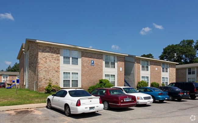

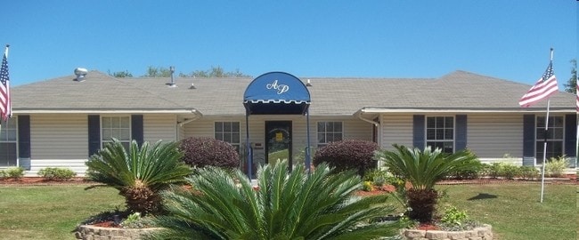
Property Detail
651 Azalea Rd
Mobile, AL
LOT 1 VILLAGE GREEN UNIT 1 MBK 23/93 #SEC 35 T4S R2W #MP28 07 35 1 002
28-07-35-1-002-023
Mobile
Apartment
Alabama
B and X Area of moderate flood hazard, usually the area between the limits of the 100-year and 500-year floods.
1
2025
12.96 AC
2025
Airmont
003205
Mobile
15,480 SF
NEARBY LISTINGS FOR SALE OR LEASE
-
-
View all Mobile listings for sale on LoopNet.com
DEMOGRAPHICS near 651 Azalea Rd
1 mile
3 mile
5 mile
2024 Total Population
10,900
65,836
159,494
2029 Population
10,833
64,735
157,711
Pop Growth 2024-2029
(0.61%)
(1.67%)
(1.12%)
Average Age
35
38
39
2024 Total Households
4,678
27,834
66,217
HH Growth 2024-2029
(0.92%)
(1.79%)
(1.21%)
Median Household Inc
$39,406
$47,657
$47,652
Avg Household Size
2.30
2.30
2.30
2024 Avg HH Vehicles
2.00
2.00
2.00
Median Home Value
$165,138
$180,136
$169,176
Median Year Built
1978
1975
1974
Nearby Places
Map Layers
Map Styles
 Street
 Aerial
Transit
 Traffic
 Biking
Places
Listings with unknown addresses are not visible on the map
- Restaurants
- Banks
- Shops
- Fitness
- Groceries
PUBLIC TRANSPORTATION
AIRPORT
Mobile International
Drive
Walk
Distance
Mobile International
15 min
7.6 mi
Mobile Regional
Drive
Walk
Distance
Mobile Regional
21 min
8.9 mi
Freight Ports
Port of Mobile
Drive
Walk
Distance
Port of Mobile
18 min
11.0 mi
The World's #1 Commercial Real Estate Marketplace
Connect with us
© 2026 CoStar Group
The information above has been obtained from sources believed reliable. While we do not doubt its accuracy we have not verified it and make no guarantee, warranty or representation about it. It is your responsibility to independently confirm its accuracy and completeness. Any projections, opinions, assumptions, or estimates used are for example only and do not represent the current or future performance of the property. The value of this transaction to you depends on tax and other factors which should be evaluated by your tax, financial, and legal advisors. You and your advisors should conduct a careful, independent investigation of the property to determine to your satisfaction the suitability of the property for your needs.