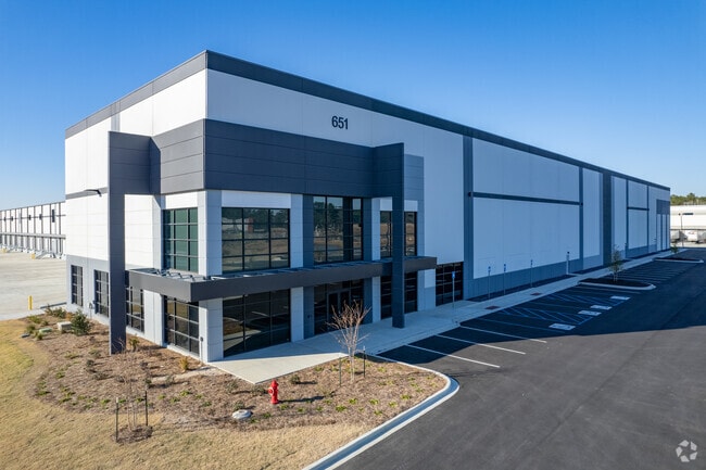
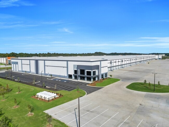
Property Record
701 Bloomingdale Rd, Bloomingdale, GA 31302
Current Lease Availabilities
NEARBY LISTINGS FOR SALE OR LEASE
Property Detail
701 Bloomingdale Rd
8000401009
West Side 1
Sfr
PT OF TRACT 2 PAVLETICH TRACT B LOOMINGDALE
AE
Chatham
13051C0106G
Georgia
2024
1.04 AC
2025
Bloomingdale/Pooler
010801
Savannah
1,088 SF
Savannah, GA
DEMOGRAPHICS near 701 Bloomingdale Rd
1 Mile
3 Mile
5 Mile
2024 Total Population
859
11,452
41,468
2029 Population
974
13,251
47,526
Pop Growth 2024-2029
+ 13.39%
+ 15.71%
+ 14.61%
Average Age
41
41
39
2024 Total Households
349
4,671
16,492
HH Growth 2024-2029
+ 13.18%
+ 15.61%
+ 14.56%
Median Household Inc
$64,632
$73,199
$80,252
Avg Household Size
2.50
2.40
2.50
2024 Avg HH Vehicles
2.00
2.00
2.00
Median Home Value
$278,571
$255,405
$235,254
Median Year Built
1998
2003
2005
Nearby Places
Map Layers
Map Styles
 Street
 Aerial
- Restaurants
- Banks
- Shops
- Fitness
- Groceries
PUBLIC TRANSPORTATION
AIRPORT
Savannah/Hilton Head International
DRIVE
WALK
Distance
Savannah/Hilton Head International
22 min
10.8 mi
Freight Ports
Georgia Ports - Savannah
DRIVE
WALK
Distance
Georgia Ports - Savannah
24 min
14.8 mi
Nearby Properties
Address
Land Use
TOTAL SIZE
Lot Size
Zoning
Address
Land Use
TOTAL SIZE
Lot Size
Zoning
1,080,000 SF
71.17 AC
PUD
Address
Land Use
TOTAL SIZE
Lot Size
Zoning
1,460,340 SF
89.96 AC
RA-1
Address
Land Use
TOTAL SIZE
Lot Size
Zoning
1,193,920 SF
84.08 AC
PUD
Address
Land Use
TOTAL SIZE
Lot Size
Zoning
707,608 SF
78.02 AC
PUD
Address
Land Use
TOTAL SIZE
Lot Size
Zoning
920,550 SF
50.12 AC
I-1
Address
Land Use
TOTAL SIZE
Lot Size
Zoning
66.01 AC
Address
Land Use
TOTAL SIZE
Lot Size
Zoning
710,881 SF
44.98 AC
I-1
Address
Land Use
TOTAL SIZE
Lot Size
Zoning
4,656 SF
80.38 AC
PUD
Address
Land Use
TOTAL SIZE
Lot Size
Zoning
683,796 SF
57.50 AC
PUD
Address
Land Use
TOTAL SIZE
Lot Size
Zoning
4,800 SF
35.20 AC
I-1
Address
Land Use
TOTAL SIZE
Lot Size
Zoning
25,358 SF
10.67 AC
PUD
Address
Land Use
TOTAL SIZE
Lot Size
Zoning
234,700 SF
52.22 AC
PUD
Address
Land Use
TOTAL SIZE
Lot Size
Zoning
17,406 SF
18.27 AC
R-3C
Address
Land Use
TOTAL SIZE
Lot Size
Zoning
27,000 SF
15.11 AC
PUD
Address
Land Use
TOTAL SIZE
Lot Size
Zoning
33.46 AC
PUD
Address
Land Use
TOTAL SIZE
Lot Size
Zoning
33.42 AC
PUD
Address
Land Use
TOTAL SIZE
Lot Size
Zoning
39,720 SF
16.18 AC
PUD
Address
Land Use
TOTAL SIZE
Lot Size
Zoning
8,464 SF
32.62 AC
RA1
Address
Land Use
TOTAL SIZE
Lot Size
Zoning
290,524 SF
21.52 AC
Address
Land Use
TOTAL SIZE
Lot Size
Zoning
345,600 SF
22.22 AC
PUD
Address
Land Use
TOTAL SIZE
Lot Size
Zoning
357,760 SF
21.19 AC
RA-1
Address
Land Use
TOTAL SIZE
Lot Size
Zoning
324,815 SF
17.88 AC
I-1
Address
Land Use
TOTAL SIZE
Lot Size
Zoning
97,500 SF
18.33 AC
C-2
Address
Land Use
TOTAL SIZE
Lot Size
Zoning
8,464 SF
7.77 AC
C-1
Address
Land Use
TOTAL SIZE
Lot Size
Zoning
215,025 SF
12.90 AC
I1
Address
Land Use
TOTAL SIZE
Lot Size
Zoning
76,894 SF
4.92 AC
R1A
Address
Land Use
TOTAL SIZE
Lot Size
Zoning
150,450 SF
172 AC
RA-1
Address
Land Use
TOTAL SIZE
Lot Size
Zoning
139,488 SF
16.32 AC
C-2
Address
Land Use
TOTAL SIZE
Lot Size
Zoning
5 AC
C2
Address
Land Use
TOTAL SIZE
Lot Size
Zoning
99,042 SF
10.40 AC
PUD
The World's #1 Commercial Real Estate Marketplace
Connect with us
© 2025 CoStar Group
The information above has been obtained from sources believed reliable. While we do not doubt its accuracy we have not verified it and make no guarantee, warranty or representation about it. It is your responsibility to independently confirm its accuracy and completeness. Any projections, opinions, assumptions, or estimates used are for example only and do not represent the current or future performance of the property. The value of this transaction to you depends on tax and other factors which should be evaluated by your tax, financial, and legal advisors. You and your advisors should conduct a careful, independent investigation of the property to determine to your satisfaction the suitability of the property for your needs.