Property Record
651 Chase Rd, Lunenburg, MA 01462

NEARBY LISTINGS FOR SALE OR LEASE
-
-
View all Lunenburg listings for sale on LoopNet.com
Property Detail
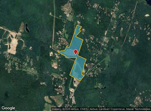
651 Chase Rd
Privateutilityelectricwatergasnuclearsolarwindetc
Worcester
X
Massachusetts
25027C0140F
110.40 AC
2025
Fitchburg/Leominster
2025
Boston
712101
Worcester, MA-CT
16,644 SF
LUNE-000210-000002
DEMOGRAPHICS near 651 Chase Rd
1 Mile
3 Mile
5 Mile
2024 Total Population
706
11,187
61,436
2029 Population
709
11,198
61,251
Pop Growth 2024-2029
+ 0.42%
+ 0.10%
(0.30%)
Average Age
42
42
40
2024 Total Households
252
4,146
23,693
HH Growth 2024-2029
+ 0.40%
+ 0.05%
(0.30%)
Median Household Inc
$110,267
$104,710
$74,746
Avg Household Size
2.70
2.50
2.50
2024 Avg HH Vehicles
2.00
2.00
2.00
Median Home Value
$411,644
$370,605
$336,719
Median Year Built
1959
1970
1962
Nearby Places
Map Layers
Map Styles
 Street
 Aerial
- Restaurants
- Banks
- Shops
- Fitness
- Groceries
PUBLIC TRANSPORTATION
COMMUTER RAIL
Fitchburg (Fitchburg/South Acton Line - Massachusetts Bay Transportation Authority Commuter Rail (Purple Line))
DRIVE
WALK
Distance
Fitchburg (Fitchburg/South Acton Line - Massachusetts Bay Transportation Authority Commuter Rail (Purple Line))
12 min
5.2 mi
North Leominster (Fitchburg/South Acton Line - Massachusetts Bay Transportation Authority Commuter Rail (Purple Line))
DRIVE
WALK
Distance
North Leominster (Fitchburg/South Acton Line - Massachusetts Bay Transportation Authority Commuter Rail (Purple Line))
13 min
6.5 mi
AIRPORT
Manchester Boston Regional
DRIVE
WALK
Distance
Manchester Boston Regional
56 min
31.9 mi
Worcester Regional
DRIVE
WALK
Distance
Worcester Regional
51 min
33.4 mi
Freight Ports
Port of Boston
DRIVE
WALK
Distance
Port of Boston
80 min
51.0 mi
Nearby Properties
Address
Land Use
TOTAL SIZE
Lot Size
Zoning
Address
Land Use
TOTAL SIZE
Lot Size
Zoning
57,459 SF
37.03 AC
RA
Address
Land Use
TOTAL SIZE
Lot Size
Zoning
52,300 SF
48.84 AC
C
Address
Land Use
TOTAL SIZE
Lot Size
Zoning
50,200 SF
16.34 AC
RA
Address
Land Use
TOTAL SIZE
Lot Size
Zoning
27,248 SF
25 AC
RA
Address
Land Use
TOTAL SIZE
Lot Size
Zoning
25,531 SF
4.69 AC
C
Address
Land Use
TOTAL SIZE
Lot Size
Zoning
15,694 SF
1.77 AC
RA
Address
Land Use
TOTAL SIZE
Lot Size
Zoning
4,420 SF
41.65 AC
RR
Address
Land Use
TOTAL SIZE
Lot Size
Zoning
1,296 SF
6 AC
RA
Address
Land Use
TOTAL SIZE
Lot Size
Zoning
24,678 SF
4 AC
C
Address
Land Use
TOTAL SIZE
Lot Size
Zoning
26,460 SF
12.60 AC
RR
Address
Land Use
TOTAL SIZE
Lot Size
Zoning
4,685 SF
209.74 AC
RA
Address
Land Use
TOTAL SIZE
Lot Size
Zoning
8,996 SF
7.19 AC
C
Address
Land Use
TOTAL SIZE
Lot Size
Zoning
90.70 AC
O
Address
Land Use
TOTAL SIZE
Lot Size
Zoning
170.33 AC
O
Address
Land Use
TOTAL SIZE
Lot Size
Zoning
280 AC
O
Address
Land Use
TOTAL SIZE
Lot Size
Zoning
7,092 SF
7.20 AC
LB
Address
Land Use
TOTAL SIZE
Lot Size
Zoning
Address
Land Use
TOTAL SIZE
Lot Size
Zoning
1.79 AC
RA
Address
Land Use
TOTAL SIZE
Lot Size
Zoning
3.37 AC
RR
Address
Land Use
TOTAL SIZE
Lot Size
Zoning
17,220 SF
16.93 AC
C
Address
Land Use
TOTAL SIZE
Lot Size
Zoning
9,274 SF
10.50 AC
C
Address
Land Use
TOTAL SIZE
Lot Size
Zoning
6,500 SF
0.15 AC
C
Address
Land Use
TOTAL SIZE
Lot Size
Zoning
0.71 AC
RB
Address
Land Use
TOTAL SIZE
Lot Size
Zoning
12,944 SF
2.16 AC
C
Address
Land Use
TOTAL SIZE
Lot Size
Zoning
853 SF
0.46 AC
RA
Address
Land Use
TOTAL SIZE
Lot Size
Zoning
3,584 SF
1.10 AC
RA
Address
Land Use
TOTAL SIZE
Lot Size
Zoning
4,623 SF
3.67 AC
C
Address
Land Use
TOTAL SIZE
Lot Size
Zoning
4,444 SF
3.20 AC
LB
Address
Land Use
TOTAL SIZE
Lot Size
Zoning
2,664 SF
25 AC
C
Address
Land Use
TOTAL SIZE
Lot Size
Zoning
6,904 SF
3.70 AC
RA
The World's #1 Commercial Real Estate Marketplace
Connect with us
© 2026 CoStar Group
The information above has been obtained from sources believed reliable. While we do not doubt its accuracy we have not verified it and make no guarantee, warranty or representation about it. It is your responsibility to independently confirm its accuracy and completeness. Any projections, opinions, assumptions, or estimates used are for example only and do not represent the current or future performance of the property. The value of this transaction to you depends on tax and other factors which should be evaluated by your tax, financial, and legal advisors. You and your advisors should conduct a careful, independent investigation of the property to determine to your satisfaction the suitability of the property for your needs.