Property Record
651 Sleater Kinney Rd Se, Lacey, WA 98503


NEARBY LISTINGS FOR SALE OR LEASE
Property Detail
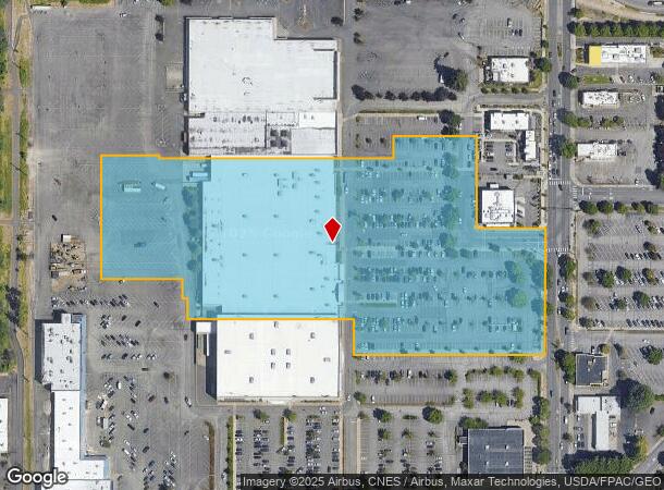
651 Sleater Kinney Rd Se
Olympia-Lacey-Tumwater, WA
New State Addition To Olympia
65101700500
SECTION 17 TOWNSHIP 18 RANGE 1W QUARTER SW PLAT NEW STATE TR B BLA00009LA 3309033
Storebuilding
Thurston
X
Washington
53067C0187F
5
2024
9.93 AC
2024
Eastside
011200
Olympia
124,802 SF
DEMOGRAPHICS near 651 Sleater Kinney Rd Se
1 Mile
3 Mile
5 Mile
2024 Total Population
9,932
72,464
171,279
2029 Population
10,504
76,534
181,073
Pop Growth 2024-2029
+ 5.76%
+ 5.62%
+ 5.72%
Average Age
42
41
41
2024 Total Households
4,546
29,627
69,309
HH Growth 2024-2029
+ 5.85%
+ 5.77%
+ 5.84%
Median Household Inc
$47,176
$74,616
$78,075
Avg Household Size
2.10
2.30
2.40
2024 Avg HH Vehicles
1.00
2.00
2.00
Median Home Value
$337,190
$387,376
$401,352
Median Year Built
1984
1982
1988
Nearby Places
Map Layers
Map Styles
 Street
 Aerial
- Restaurants
- Banks
- Shops
- Fitness
- Groceries
PUBLIC TRANSPORTATION
COMMUTER RAIL
Olympia-Lacey Amtrak Station (Amtrak Cascades - Amtrak, Coast Starlight - Amtrak)
DRIVE
WALK
Distance
Olympia-Lacey Amtrak Station (Amtrak Cascades - Amtrak, Coast Starlight - Amtrak)
13 min
5.1 mi
Freight Ports
Port of Tacoma
DRIVE
WALK
Distance
Port of Tacoma
39 min
28.2 mi
Nearby Properties
Address
Land Use
TOTAL SIZE
Lot Size
Zoning
Address
Land Use
TOTAL SIZE
Lot Size
Zoning
1,446,648 SF
8.29 AC
CAP
Address
Land Use
TOTAL SIZE
Lot Size
Zoning
874,760 SF
28.63 AC
MS
Address
Land Use
TOTAL SIZE
Lot Size
Zoning
485,918 SF
6.64 AC
CAP
Address
Land Use
TOTAL SIZE
Lot Size
Zoning
6,928 SF
1.33 AC
UW
Address
Land Use
TOTAL SIZE
Lot Size
Zoning
497,558 SF
28.57 AC
CBD 7
Address
Land Use
TOTAL SIZE
Lot Size
Zoning
784,559 SF
13.09 AC
CAP
Address
Land Use
TOTAL SIZE
Lot Size
Zoning
660,544 SF
44.67 AC
MD
Address
Land Use
TOTAL SIZE
Lot Size
Zoning
203,039 SF
38.05 AC
OSI-S
Address
Land Use
TOTAL SIZE
Lot Size
Zoning
272,388 SF
4.69 AC
HD
Address
Land Use
TOTAL SIZE
Lot Size
Zoning
114,331 SF
1.43 AC
CAP
Address
Land Use
TOTAL SIZE
Lot Size
Zoning
171,420 SF
63.61 AC
SMU
Address
Land Use
TOTAL SIZE
Lot Size
Zoning
204,136 SF
11.91 AC
RM-24
Address
Land Use
TOTAL SIZE
Lot Size
Zoning
94,349 SF
6.02 AC
CAP
Address
Land Use
TOTAL SIZE
Lot Size
Zoning
147,156 SF
18.75 AC
MS
Address
Land Use
TOTAL SIZE
Lot Size
Zoning
180,132 SF
6.66 AC
HD
Address
Land Use
TOTAL SIZE
Lot Size
Zoning
173,239 SF
7.66 AC
HD
Address
Land Use
TOTAL SIZE
Lot Size
Zoning
115,977 SF
35.61 AC
OSI-S
Address
Land Use
TOTAL SIZE
Lot Size
Zoning
197,571 SF
52.35 AC
R-4-8
Address
Land Use
TOTAL SIZE
Lot Size
Zoning
62.35 AC
HPBDBC
Address
Land Use
TOTAL SIZE
Lot Size
Zoning
159,103 SF
8.44 AC
HD
Address
Land Use
TOTAL SIZE
Lot Size
Zoning
185,054 SF
6.29 AC
HD
Address
Land Use
TOTAL SIZE
Lot Size
Zoning
347,361 SF
1.38 AC
DB
Address
Land Use
TOTAL SIZE
Lot Size
Zoning
221,642 SF
4.96 AC
CBD 5
Address
Land Use
TOTAL SIZE
Lot Size
Zoning
357,949 SF
28.17 AC
WD
Address
Land Use
TOTAL SIZE
Lot Size
Zoning
185,762 SF
9.43 AC
CO
Address
Land Use
TOTAL SIZE
Lot Size
Zoning
123,538 SF
6.36 AC
RM-18
Address
Land Use
TOTAL SIZE
Lot Size
Zoning
163,167 SF
8.20 AC
CBD 5
Address
Land Use
TOTAL SIZE
Lot Size
Zoning
69,898 SF
19.70 AC
CBD 7
Address
Land Use
TOTAL SIZE
Lot Size
Zoning
273,214 SF
19.54 AC
WD
Address
Land Use
TOTAL SIZE
Lot Size
Zoning
192,392 SF
16.15 AC
MD
The World's #1 Commercial Real Estate Marketplace
Connect with us
© 2026 CoStar Group
The information above has been obtained from sources believed reliable. While we do not doubt its accuracy we have not verified it and make no guarantee, warranty or representation about it. It is your responsibility to independently confirm its accuracy and completeness. Any projections, opinions, assumptions, or estimates used are for example only and do not represent the current or future performance of the property. The value of this transaction to you depends on tax and other factors which should be evaluated by your tax, financial, and legal advisors. You and your advisors should conduct a careful, independent investigation of the property to determine to your satisfaction the suitability of the property for your needs.