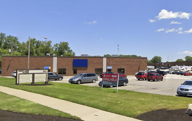
Property Record
6511 Eastland Rd, Brookpark, OH 44142


Current Lease Availabilities
NEARBY LISTINGS FOR SALE OR LEASE
Property Detail
6511 Eastland Rd
Cleveland-Elyria, OH
Pt Add
342-15-006
FF 446.94 D 1606.30 8.461AC OL 12 / 4 PT ADD TO ROAD 2010S/R
Multitenantindustrial
Cuyahoga
A
Ohio
39035C0164E
12
2024
8.46 AC
2024
Airport
138106
Cleveland
97,500 SF
DEMOGRAPHICS near 6511 Eastland Rd
1 Mile
3 Mile
5 Mile
2024 Total Population
3,905
51,547
199,469
2029 Population
3,811
50,044
194,031
Pop Growth 2024-2029
(2.41%)
(2.92%)
(2.73%)
Average Age
42
43
43
2024 Total Households
1,590
21,778
87,204
HH Growth 2024-2029
(2.58%)
(3.10%)
(2.93%)
Median Household Inc
$55,499
$63,913
$66,052
Avg Household Size
2.30
2.20
2.20
2024 Avg HH Vehicles
2.00
2.00
2.00
Median Home Value
$159,969
$162,705
$172,188
Median Year Built
1965
1961
1962
Nearby Places
Map Layers
Map Styles
 Street
 Aerial
- Restaurants
- Banks
- Shops
- Fitness
- Groceries
PUBLIC TRANSPORTATION
AIRPORT
Cleveland-Hopkins International
DRIVE
WALK
Distance
Cleveland-Hopkins International
10 min
4.2 mi
Freight Ports
Port of Toledo
DRIVE
WALK
Distance
Port of Toledo
126 min
105.4 mi
Nearby Properties
Address
Land Use
TOTAL SIZE
Lot Size
Zoning
Address
Land Use
TOTAL SIZE
Lot Size
Zoning
748.88 AC
GI
Address
Land Use
TOTAL SIZE
Lot Size
Zoning
1,669,041 SF
169.42 AC
U6
Address
Land Use
TOTAL SIZE
Lot Size
Zoning
1,490,538 SF
19.29 AC
PF
Address
Land Use
TOTAL SIZE
Lot Size
Zoning
754.68 AC
GI
Address
Land Use
TOTAL SIZE
Lot Size
Zoning
526.33 AC
GI
Address
Land Use
TOTAL SIZE
Lot Size
Zoning
237,144 SF
2.12 AC
PG
Address
Land Use
TOTAL SIZE
Lot Size
Zoning
1,514 SF
23.65 AC
RSF-B
Address
Land Use
TOTAL SIZE
Lot Size
Zoning
208.22 AC
U5-A
Address
Land Use
TOTAL SIZE
Lot Size
Zoning
657,013 SF
48.88 AC
SI
Address
Land Use
TOTAL SIZE
Lot Size
Zoning
289,215 SF
20.56 AC
RSF-B
Address
Land Use
TOTAL SIZE
Lot Size
Zoning
Address
Land Use
TOTAL SIZE
Lot Size
Zoning
Address
Land Use
TOTAL SIZE
Lot Size
Zoning
768,485 SF
14.53 AC
R1-A
Address
Land Use
TOTAL SIZE
Lot Size
Zoning
88.28 AC
U5-A
Address
Land Use
TOTAL SIZE
Lot Size
Zoning
299,114 SF
23.65 AC
RSF-B
Address
Land Use
TOTAL SIZE
Lot Size
Zoning
126,000 SF
3.02 AC
PG
Address
Land Use
TOTAL SIZE
Lot Size
Zoning
1,391,445 SF
136.05 AC
GI
Address
Land Use
TOTAL SIZE
Lot Size
Zoning
3.53 AC
SI
Address
Land Use
TOTAL SIZE
Lot Size
Zoning
49.67 AC
SI
Address
Land Use
TOTAL SIZE
Lot Size
Zoning
364,000 SF
33.27 AC
U5-A
Address
Land Use
TOTAL SIZE
Lot Size
Zoning
174.94 AC
U5-A
Address
Land Use
TOTAL SIZE
Lot Size
Zoning
14.60 AC
1F-4
Address
Land Use
TOTAL SIZE
Lot Size
Zoning
300,120 SF
20.18 AC
GI
Address
Land Use
TOTAL SIZE
Lot Size
Zoning
263,867 SF
59.28 AC
PF
Address
Land Use
TOTAL SIZE
Lot Size
Zoning
25,814 SF
64.97 AC
2F
Address
Land Use
TOTAL SIZE
Lot Size
Zoning
90,324 SF
6.71 AC
GR
Address
Land Use
TOTAL SIZE
Lot Size
Zoning
103.89 AC
U5-A
Address
Land Use
TOTAL SIZE
Lot Size
Zoning
166,104 SF
4.70 AC
CC
Address
Land Use
TOTAL SIZE
Lot Size
Zoning
24.55 AC
GI
Address
Land Use
TOTAL SIZE
Lot Size
Zoning
20.99 AC
2F
The World's #1 Commercial Real Estate Marketplace
Connect with us
© 2026 CoStar Group
The information above has been obtained from sources believed reliable. While we do not doubt its accuracy we have not verified it and make no guarantee, warranty or representation about it. It is your responsibility to independently confirm its accuracy and completeness. Any projections, opinions, assumptions, or estimates used are for example only and do not represent the current or future performance of the property. The value of this transaction to you depends on tax and other factors which should be evaluated by your tax, financial, and legal advisors. You and your advisors should conduct a careful, independent investigation of the property to determine to your satisfaction the suitability of the property for your needs.