Property Record
6508 S 78Th St, Riverview, FL 33578
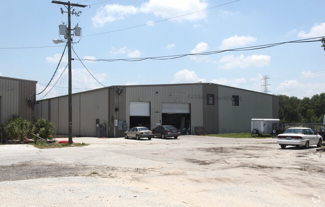
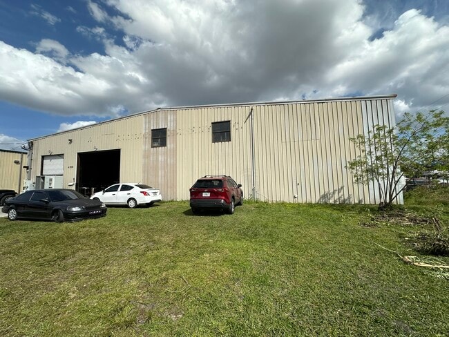
Property Detail
6508 S 78Th St
U-12-30-19-663-000001-68480.0
SOUTH TAMPA SUBDIVISION S 149.5 FT OF N 299.5 FT OF TRACT 4 IN SW 1/4 LESS W 35 FT FOR 78TH STREET
Warehouse
Hillsborough
M
Florida
AE The base floodplain where base flood elevations are provided. AE Zones are now used on new format FIRMs instead of A1-A30 Zones.
68480
2024
2.22 AC
2025
East Side
013702
Tampa/St Petersburg
26,250 SF
Tampa-St. Petersburg-Clearwater, FL
NEARBY LISTINGS FOR SALE OR LEASE
DEMOGRAPHICS near 6508 S 78Th St
1 mile
3 mile
5 mile
2025 Total Population
5,543
62,945
163,780
2030 Population
6,054
68,263
177,341
Pop Growth 2025-2030
+ 9.22%
+ 8.45%
+ 8.28%
Average Age
36
37
38
2025 Total Households
2,174
24,920
63,240
HH Growth 2025-2030
+ 9.34%
+ 8.57%
+ 8.45%
Median Household Inc
$80,581
$75,043
$76,644
Avg Household Size
2.50
2.50
2.50
2025 Avg HH Vehicles
2.00
2.00
2.00
Median Home Value
$308,819
$336,407
$345,654
Median Year Built
2010
2004
2001
Nearby Places
Map Layers
Map Styles
 Street
 Aerial
Layers
 Traffic
 Biking
Places
Listings with unknown addresses are not visible on the map
- Restaurants
- Banks
- Shops
- Fitness
- Groceries
PUBLIC TRANSPORTATION
AIRPORT
Tampa International
Drive
Walk
Distance
Tampa International
32 min
18.0 mi
St Pete-Clearwater International
Drive
Walk
Distance
St Pete-Clearwater International
49 min
28.0 mi
Sarasota/Bradenton International
Drive
Walk
Distance
Sarasota/Bradenton International
64 min
44.1 mi
Nearby Properties
Address
Land Use
TOTAL SIZE
Lot Size
Zoning
Address
Land Use
TOTAL SIZE
Lot Size
Zoning
991,388 SF
99.01 AC
M
Address
Land Use
TOTAL SIZE
Lot Size
Zoning
325,857 SF
16.32 AC
PD
Address
Land Use
TOTAL SIZE
Lot Size
Zoning
406,097 SF
25.82 AC
PD
Address
Land Use
TOTAL SIZE
Lot Size
Zoning
399,150 SF
26.32 AC
PD
Address
Land Use
TOTAL SIZE
Lot Size
Zoning
366,971 SF
33.26 AC
PD
Address
Land Use
TOTAL SIZE
Lot Size
Zoning
363,226 SF
27.91 AC
PD
Address
Land Use
TOTAL SIZE
Lot Size
Zoning
378,775 SF
16 AC
PD
Address
Land Use
TOTAL SIZE
Lot Size
Zoning
349,531 SF
17.15 AC
PD
Address
Land Use
TOTAL SIZE
Lot Size
Zoning
423,284 SF
20.91 AC
PD
Address
Land Use
TOTAL SIZE
Lot Size
Zoning
338,628 SF
14.60 AC
PD
Address
Land Use
TOTAL SIZE
Lot Size
Zoning
339,482 SF
19.15 AC
PD
Address
Land Use
TOTAL SIZE
Lot Size
Zoning
284,156 SF
19.32 AC
PD
Address
Land Use
TOTAL SIZE
Lot Size
Zoning
426,236 SF
21.09 AC
PD
Address
Land Use
TOTAL SIZE
Lot Size
Zoning
259,451 SF
13.73 AC
PD
Address
Land Use
TOTAL SIZE
Lot Size
Zoning
301,133 SF
11.56 AC
PD
Address
Land Use
TOTAL SIZE
Lot Size
Zoning
297,529 SF
13.38 AC
PD
Address
Land Use
TOTAL SIZE
Lot Size
Zoning
476,371 SF
41.23 AC
PD
Address
Land Use
TOTAL SIZE
Lot Size
Zoning
248,749 SF
14.83 AC
PD
Address
Land Use
TOTAL SIZE
Lot Size
Zoning
232,492 SF
51.94 AC
AR
Address
Land Use
TOTAL SIZE
Lot Size
Zoning
370,924 SF
73.35 AC
PD
Address
Land Use
TOTAL SIZE
Lot Size
Zoning
628,730 SF
952.51 AC
M
Address
Land Use
TOTAL SIZE
Lot Size
Zoning
257,382 SF
52.57 AC
PD
Address
Land Use
TOTAL SIZE
Lot Size
Zoning
240,305 SF
20.01 AC
RMC-20
Address
Land Use
TOTAL SIZE
Lot Size
Zoning
284,185 SF
15.31 AC
PD
Address
Land Use
TOTAL SIZE
Lot Size
Zoning
384,604 SF
21.63 AC
M
Address
Land Use
TOTAL SIZE
Lot Size
Zoning
222,325 SF
19.70 AC
PD
Address
Land Use
TOTAL SIZE
Lot Size
Zoning
384,728 SF
20.14 AC
PD
Address
Land Use
TOTAL SIZE
Lot Size
Zoning
178,972 SF
16.28 AC
PD
Address
Land Use
TOTAL SIZE
Lot Size
Zoning
297,904 SF
20.16 AC
M
Address
Land Use
TOTAL SIZE
Lot Size
Zoning
92,133 SF
13.05 AC
IPD-1
The World's #1 Commercial Real Estate Marketplace
Connect with us
© 2026 CoStar Group
The information above has been obtained from sources believed reliable. While we do not doubt its accuracy we have not verified it and make no guarantee, warranty or representation about it. It is your responsibility to independently confirm its accuracy and completeness. Any projections, opinions, assumptions, or estimates used are for example only and do not represent the current or future performance of the property. The value of this transaction to you depends on tax and other factors which should be evaluated by your tax, financial, and legal advisors. You and your advisors should conduct a careful, independent investigation of the property to determine to your satisfaction the suitability of the property for your needs.