Property Record
6518 20Th Ave, Hugo, MN 55038

NEARBY LISTINGS FOR SALE OR LEASE
Property Detail
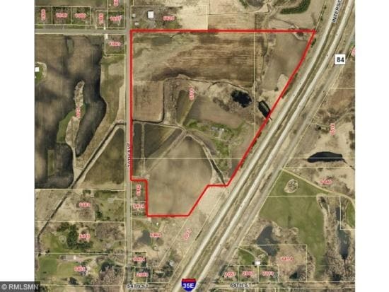
6518 20Th Ave
Minneapolis-St. Paul-Bloomington, MN-WI
Lino Lakes
25-31-22-33-0001
THE NW1/4 OF SW1/4 OF SEC 25 TWP 31 RGE 22, EX RD, SUBJ TO EASE OF REC
Agriculturalland
Anoka
A
Minnesota
27003C0370E
11.37 AC
2025
Suburban St Paul
2025
Minneapolis/St Paul
050230
DEMOGRAPHICS near 6518 20Th Ave
1 Mile
3 Mile
5 Mile
2024 Total Population
2,229
27,133
62,618
2029 Population
2,338
28,569
64,241
Pop Growth 2024-2029
+ 4.89%
+ 5.29%
+ 2.59%
Average Age
37
40
42
2024 Total Households
699
9,980
23,768
HH Growth 2024-2029
+ 5.01%
+ 5.32%
+ 2.30%
Median Household Inc
$157,979
$124,716
$114,251
Avg Household Size
3.20
2.70
2.60
2024 Avg HH Vehicles
3.00
2.00
2.00
Median Home Value
$431,737
$381,452
$371,213
Median Year Built
1996
1998
1990
Nearby Places
Map Layers
Map Styles
 Street
 Aerial
- Restaurants
- Banks
- Shops
- Fitness
- Groceries
PUBLIC TRANSPORTATION
AIRPORT
Minneapolis-St Paul International/Wold-Chamberlain
DRIVE
WALK
Distance
Minneapolis-St Paul International/Wold-Chamberlain
35 min
24.3 mi
Freight Ports
Port Milwaukee
DRIVE
WALK
Distance
Port Milwaukee
377 min
340.7 mi
SALE & LEASE HISTORY
LISTING DATE
SALE/LEASE

Sep 05, 2017
For Sale
Jun 14, 2018
For Sale
Apr 23, 2021
For Sale
Nearby Properties
Address
Land Use
TOTAL SIZE
Lot Size
Zoning
Address
Land Use
TOTAL SIZE
Lot Size
Zoning
175,536 SF
7.60 AC
Address
Land Use
TOTAL SIZE
Lot Size
Zoning
141,360 SF
Address
Land Use
TOTAL SIZE
Lot Size
Zoning
402,000 SF
27.86 AC
Address
Land Use
TOTAL SIZE
Lot Size
Zoning
78,920 SF
7.50 AC
Address
Land Use
TOTAL SIZE
Lot Size
Zoning
13,358 SF
311.47 AC
W8OPSP
Address
Land Use
TOTAL SIZE
Lot Size
Zoning
Address
Land Use
TOTAL SIZE
Lot Size
Zoning
99,207 SF
5 AC
Address
Land Use
TOTAL SIZE
Lot Size
Zoning
100,794 SF
Address
Land Use
TOTAL SIZE
Lot Size
Zoning
82,403 SF
41.35 AC
Address
Land Use
TOTAL SIZE
Lot Size
Zoning
57,522 SF
8.63 AC
Address
Land Use
TOTAL SIZE
Lot Size
Zoning
163,329 SF
11.36 AC
Address
Land Use
TOTAL SIZE
Lot Size
Zoning
Address
Land Use
TOTAL SIZE
Lot Size
Zoning
136,800 SF
Address
Land Use
TOTAL SIZE
Lot Size
Zoning
65,950 SF
9.68 AC
Address
Land Use
TOTAL SIZE
Lot Size
Zoning
130,104 SF
3.35 AC
Address
Land Use
TOTAL SIZE
Lot Size
Zoning
40,036 SF
18.45 AC
Address
Land Use
TOTAL SIZE
Lot Size
Zoning
1,920 SF
42.80 AC
Address
Land Use
TOTAL SIZE
Lot Size
Zoning
128,364 SF
19.10 AC
Address
Land Use
TOTAL SIZE
Lot Size
Zoning
145,704 SF
7.05 AC
Address
Land Use
TOTAL SIZE
Lot Size
Zoning
60,939 SF
Address
Land Use
TOTAL SIZE
Lot Size
Zoning
137,960 SF
20 AC
Address
Land Use
TOTAL SIZE
Lot Size
Zoning
Address
Land Use
TOTAL SIZE
Lot Size
Zoning
55,000 SF
Address
Land Use
TOTAL SIZE
Lot Size
Zoning
21,671 SF
4.40 AC
Address
Land Use
TOTAL SIZE
Lot Size
Zoning
100,383 SF
5.75 AC
Address
Land Use
TOTAL SIZE
Lot Size
Zoning
202,000 SF
11.43 AC
Address
Land Use
TOTAL SIZE
Lot Size
Zoning
83,351 SF
Address
Land Use
TOTAL SIZE
Lot Size
Zoning
20,904 SF
12.50 AC
Address
Land Use
TOTAL SIZE
Lot Size
Zoning
93,800 SF
13.10 AC
Address
Land Use
TOTAL SIZE
Lot Size
Zoning
111.73 AC
The World's #1 Commercial Real Estate Marketplace
Connect with us
© 2025 CoStar Group
The information above has been obtained from sources believed reliable. While we do not doubt its accuracy we have not verified it and make no guarantee, warranty or representation about it. It is your responsibility to independently confirm its accuracy and completeness. Any projections, opinions, assumptions, or estimates used are for example only and do not represent the current or future performance of the property. The value of this transaction to you depends on tax and other factors which should be evaluated by your tax, financial, and legal advisors. You and your advisors should conduct a careful, independent investigation of the property to determine to your satisfaction the suitability of the property for your needs.