Property Record
652 Peter Jefferson Pky, Charlottesville, VA 22911

Save to a Folder
{{folder.Name}}
{{folder.ListingIds.length}} Properties
{{folder.ListingIds.length}} Property
Create a New Folder
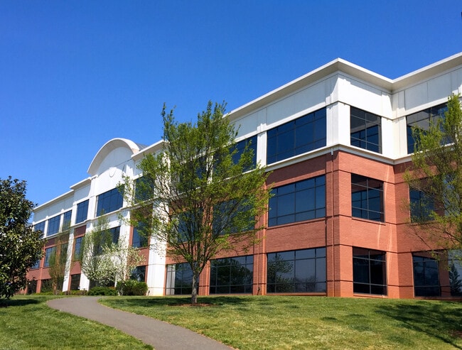
Property Detail
652 Peter Jefferson Pky
07800-00-00-031K0
LOT 13 PJP BUILDING SEVEN
Officebuilding
Albemarle
PLANNED DE
Virginia
B and X Area of moderate flood hazard, usually the area between the limits of the 100-year and 500-year floods.
7.89 AC
2025
Charlottesville
2026
Other Market Areas
010502
Charlottesville, VA
70,022 SF
NEARBY LISTINGS FOR SALE OR LEASE
DEMOGRAPHICS near 652 Peter Jefferson Pky
1 mile
3 mile
5 mile
2025 Total Population
2,748
25,258
91,981
2030 Population
2,867
25,404
92,741
Pop Growth 2025-2030
+ 4.33%
+ 0.58%
+ 0.83%
Average Age
48
42
37
2025 Total Households
1,421
11,990
37,585
HH Growth 2025-2030
+ 4.86%
+ 0.65%
+ 0.94%
Median Household Inc
$145,598
$98,740
$78,271
Avg Household Size
1.90
2.10
2.20
2025 Avg HH Vehicles
1.00
2.00
2.00
Median Home Value
$433,502
$486,822
$474,608
Median Year Built
2006
1990
1985
Nearby Places
Map Layers
Map Styles
 Street
 Aerial
Layers
 Traffic
 Biking
Places
Listings with unknown addresses are not visible on the map
- Restaurants
- Banks
- Shops
- Fitness
- Groceries
PUBLIC TRANSPORTATION
COMMUTER RAIL
Charlottesville (Cardinal - Amtrak, Crescent - Amtrak, Northeast Regional - Amtrak)
Drive
Walk
Distance
Charlottesville (Cardinal - Amtrak, Crescent - Amtrak, Northeast Regional - Amtrak)
11 min
5.1 mi
AIRPORT
Charlottesville-Albemarle
Drive
Walk
Distance
Charlottesville-Albemarle
25 min
11.8 mi
Freight Ports
Virginia Port Authority - Richmond
Drive
Walk
Distance
Virginia Port Authority - Richmond
89 min
74.2 mi
SALE & LEASE HISTORY
LISTING DATE
SALE/LEASE

Sep 25, 2016
For Lease
Sep 06, 2017
For Lease
Oct 20, 2017
For Lease
Jan 31, 2018
For Lease
Nearby Properties
Address
Land Use
TOTAL SIZE
Lot Size
Zoning
Address
Land Use
TOTAL SIZE
Lot Size
Zoning
429,500 SF
38.49 AC
PDMC
Address
Land Use
TOTAL SIZE
Lot Size
Zoning
160,621 SF
55.78 AC
PLANNED RE
Address
Land Use
TOTAL SIZE
Lot Size
Zoning
3,803 SF
266.70 AC
CV
Address
Land Use
TOTAL SIZE
Lot Size
Zoning
14,000 SF
6.45 AC
CX-5
Address
Land Use
TOTAL SIZE
Lot Size
Zoning
30,896 SF
0.97 AC
DX
Address
Land Use
TOTAL SIZE
Lot Size
Zoning
240,936 SF
1.26 AC
NX-10
Address
Land Use
TOTAL SIZE
Lot Size
Zoning
20.41 AC
Address
Land Use
TOTAL SIZE
Lot Size
Zoning
336,000 SF
20.20 AC
R15 RESIDE
Address
Land Use
TOTAL SIZE
Lot Size
Zoning
222,253 SF
0.73 AC
NX-10
Address
Land Use
TOTAL SIZE
Lot Size
Zoning
82,308 SF
97.43 AC
R1 RESIDEN
Address
Land Use
TOTAL SIZE
Lot Size
Zoning
173,868 SF
4.39 AC
DX
Address
Land Use
TOTAL SIZE
Lot Size
Zoning
73,068 SF
13.39 AC
PLANNED DE
Address
Land Use
TOTAL SIZE
Lot Size
Zoning
42,336 SF
0.90 AC
CV
Address
Land Use
TOTAL SIZE
Lot Size
Zoning
223,492 SF
35 AC
COMMERCIAL
Address
Land Use
TOTAL SIZE
Lot Size
Zoning
100 SF
51.71 AC
LIGHT INDU
Address
Land Use
TOTAL SIZE
Lot Size
Zoning
12,495 SF
4.50 AC
NX-10
Address
Land Use
TOTAL SIZE
Lot Size
Zoning
117,270 SF
14.62 AC
CV
Address
Land Use
TOTAL SIZE
Lot Size
Zoning
58,821 SF
0.64 AC
CV
Address
Land Use
TOTAL SIZE
Lot Size
Zoning
1,195,052 SF
1.05 AC
DX
Address
Land Use
TOTAL SIZE
Lot Size
Zoning
75,760 SF
1.15 AC
CV
Address
Land Use
TOTAL SIZE
Lot Size
Zoning
118,694 SF
1.12 AC
NX-10
Address
Land Use
TOTAL SIZE
Lot Size
Zoning
81,569 SF
0.63 AC
DX
Address
Land Use
TOTAL SIZE
Lot Size
Zoning
85,000 SF
3.49 AC
NX-10
Address
Land Use
TOTAL SIZE
Lot Size
Zoning
15,000 SF
10.75 AC
NX-8
Address
Land Use
TOTAL SIZE
Lot Size
Zoning
3,066 SF
0.38 AC
CX-5
Address
Land Use
TOTAL SIZE
Lot Size
Zoning
1,200 SF
14.92 AC
LIGHT INDU
Address
Land Use
TOTAL SIZE
Lot Size
Zoning
28,392 SF
10.38 AC
C1 COMMERC
Address
Land Use
TOTAL SIZE
Lot Size
Zoning
74,900 SF
7.42 AC
PLANNED DE
Address
Land Use
TOTAL SIZE
Lot Size
Zoning
92,044 SF
15.70 AC
R-A
Address
Land Use
TOTAL SIZE
Lot Size
Zoning
84,156 SF
7.90 AC
PLANNED DE
The World's #1 Commercial Real Estate Marketplace
Connect with us
© 2026 CoStar Group
The information above has been obtained from sources believed reliable. While we do not doubt its accuracy we have not verified it and make no guarantee, warranty or representation about it. It is your responsibility to independently confirm its accuracy and completeness. Any projections, opinions, assumptions, or estimates used are for example only and do not represent the current or future performance of the property. The value of this transaction to you depends on tax and other factors which should be evaluated by your tax, financial, and legal advisors. You and your advisors should conduct a careful, independent investigation of the property to determine to your satisfaction the suitability of the property for your needs.