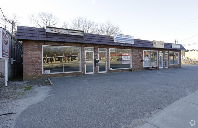
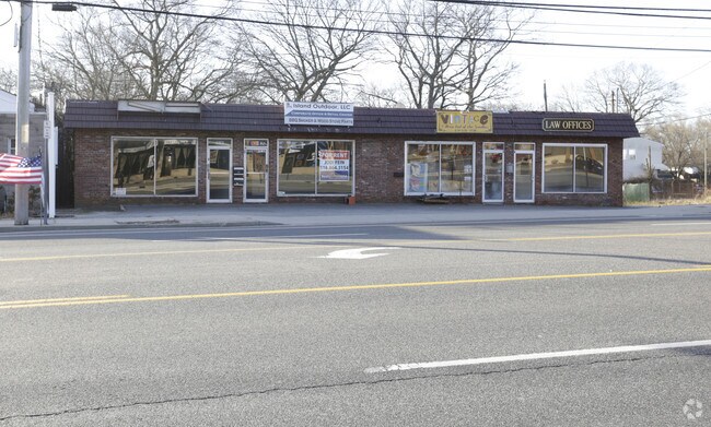
Property Record
652 Portion Rd, Ronkonkoma, NY 11779
NEARBY LISTINGS FOR SALE OR LEASE
Property Detail
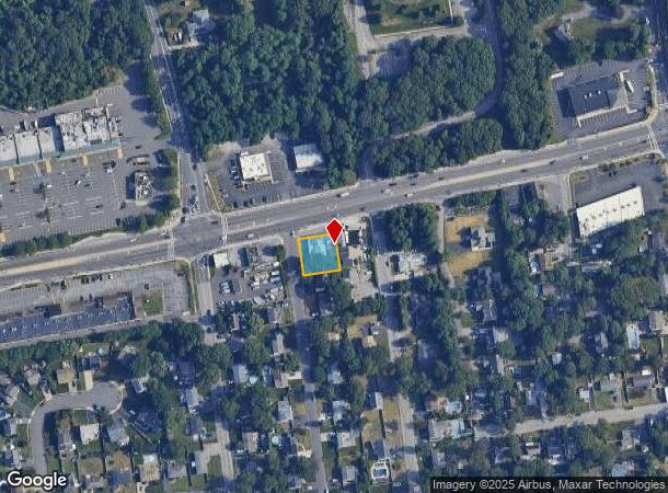
652 Portion Rd
Nassau County-Suffolk County, NY
Webster T A R
0200-650-00-01-00-060-000
T A R WEBSTER 31 B40 45 TO 48 INC
Commercialnec
Suffolk
X
New York
36103C0680H
60
2024
0.24 AC
2024
Central Suffolk
158604
Long Island (New York)
DEMOGRAPHICS near 652 Portion Rd
1 Mile
3 Mile
5 Mile
2024 Total Population
11,201
93,630
236,374
2029 Population
10,958
92,137
232,729
Pop Growth 2024-2029
(2.17%)
(1.59%)
(1.54%)
Average Age
43
41
42
2024 Total Households
3,907
30,881
81,376
HH Growth 2024-2029
(2.28%)
(1.78%)
(1.70%)
Median Household Inc
$105,678
$118,583
$115,181
Avg Household Size
2.80
2.90
2.80
2024 Avg HH Vehicles
2.00
2.00
2.00
Median Home Value
$427,987
$443,543
$452,357
Median Year Built
1969
1970
1972
Nearby Places
- Restaurants
- Banks
- Shops
- Fitness
- Groceries
PUBLIC TRANSPORTATION
COMMUTER RAIL
Ronkonkoma Station (Greenport Branch - Long Island Rail Road, Ronkonkoma Branch - Long Island Rail Road)
DRIVE
WALK
Distance
Ronkonkoma Station (Greenport Branch - Long Island Rail Road, Ronkonkoma Branch - Long Island Rail Road)
9 min
3.6 mi
Medford Station (Greenport Branch - Long Island Rail Road)
DRIVE
WALK
Distance
Medford Station (Greenport Branch - Long Island Rail Road)
11 min
6.2 mi
AIRPORT
Long Island MacArthur
DRIVE
WALK
Distance
Long Island MacArthur
13 min
5.6 mi
Freight Ports
Port of New Haven
DRIVE
WALK
Distance
Port of New Haven
128 min
47.0 mi
Nearby Properties
Address
Land Use
TOTAL SIZE
Lot Size
Zoning
Address
Land Use
TOTAL SIZE
Lot Size
Zoning
1,207.60 AC
Address
Land Use
TOTAL SIZE
Lot Size
Zoning
95.19 AC
Address
Land Use
TOTAL SIZE
Lot Size
Zoning
23.50 AC
AA
Address
Land Use
TOTAL SIZE
Lot Size
Zoning
25.90 AC
Address
Land Use
TOTAL SIZE
Lot Size
Zoning
140.10 AC
Address
Land Use
TOTAL SIZE
Lot Size
Zoning
19.70 AC
AA
Address
Land Use
TOTAL SIZE
Lot Size
Zoning
Address
Land Use
TOTAL SIZE
Lot Size
Zoning
6,486 SF
0.55 AC
VILLA
Address
Land Use
TOTAL SIZE
Lot Size
Zoning
8.60 AC
IND1
Address
Land Use
TOTAL SIZE
Lot Size
Zoning
6.12 AC
AA
Address
Land Use
TOTAL SIZE
Lot Size
Zoning
0.55 AC
VILLA
Address
Land Use
TOTAL SIZE
Lot Size
Zoning
7.33 AC
Address
Land Use
TOTAL SIZE
Lot Size
Zoning
10.60 AC
A
Address
Land Use
TOTAL SIZE
Lot Size
Zoning
32.41 AC
AA
Address
Land Use
TOTAL SIZE
Lot Size
Zoning
21.20 AC
AA
Address
Land Use
TOTAL SIZE
Lot Size
Zoning
0.49 AC
VILLA
Address
Land Use
TOTAL SIZE
Lot Size
Zoning
17.76 AC
Address
Land Use
TOTAL SIZE
Lot Size
Zoning
Address
Land Use
TOTAL SIZE
Lot Size
Zoning
2.10 AC
CAA
Address
Land Use
TOTAL SIZE
Lot Size
Zoning
7.10 AC
IND1
Address
Land Use
TOTAL SIZE
Lot Size
Zoning
Address
Land Use
TOTAL SIZE
Lot Size
Zoning
32.41 AC
AA
Address
Land Use
TOTAL SIZE
Lot Size
Zoning
9.80 AC
Address
Land Use
TOTAL SIZE
Lot Size
Zoning
2,515 SF
0.13 AC
B1
Address
Land Use
TOTAL SIZE
Lot Size
Zoning
4.75 AC
BUS3
Address
Land Use
TOTAL SIZE
Lot Size
Zoning
4.48 AC
IND1
Address
Land Use
TOTAL SIZE
Lot Size
Zoning
0.12 AC
HC
Address
Land Use
TOTAL SIZE
Lot Size
Zoning
44.94 AC
Address
Land Use
TOTAL SIZE
Lot Size
Zoning
1.46 AC
IND1
Address
Land Use
TOTAL SIZE
Lot Size
Zoning
36 AC
AA
The World's #1 Commercial Real Estate Marketplace
Connect with us
© 2025 CoStar Group
The information above has been obtained from sources believed reliable. While we do not doubt its accuracy we have not verified it and make no guarantee, warranty or representation about it. It is your responsibility to independently confirm its accuracy and completeness. Any projections, opinions, assumptions, or estimates used are for example only and do not represent the current or future performance of the property. The value of this transaction to you depends on tax and other factors which should be evaluated by your tax, financial, and legal advisors. You and your advisors should conduct a careful, independent investigation of the property to determine to your satisfaction the suitability of the property for your needs.