Property Record
652 W Dutton Rd, Eagle Point, OR 97524


Save to a Folder
{{folder.Name}}
{{folder.ListingIds.length}} Properties
{{folder.ListingIds.length}} Property
Create a New Folder
Current Lease Availabilities
Property Detail
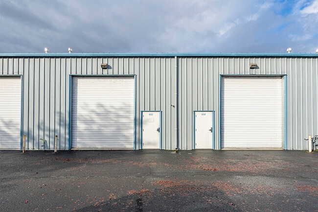
652 W Dutton Rd
Industrialgeneral
Jackson
GI
Oregon
B and X Area of moderate flood hazard, usually the area between the limits of the 100-year and 500-year floods.
0.03 AC
2025
Medford/Grants Pass
2026
Other Market Areas
001301
Medford, OR
1,471 SF
10987120
NEARBY LISTINGS FOR SALE OR LEASE
DEMOGRAPHICS near 652 W Dutton Rd
1 mile
3 mile
5 mile
2025 Total Population
2,147
19,877
28,181
2030 Population
2,106
19,775
27,948
Pop Growth 2025-2030
(1.91%)
(0.51%)
(0.83%)
Average Age
38
41
41
2025 Total Households
701
7,081
10,014
HH Growth 2025-2030
(2.14%)
(0.56%)
(0.92%)
Median Household Inc
$72,154
$78,755
$79,445
Avg Household Size
2.90
2.70
2.70
2025 Avg HH Vehicles
2.00
2.00
2.00
Median Home Value
$312,731
$368,472
$379,069
Median Year Built
1983
1993
1993
Nearby Places
Map Layers
Map Styles
 Street
 Aerial
Layers
 Traffic
 Biking
Places
Listings with unknown addresses are not visible on the map
- Restaurants
- Banks
- Shops
- Fitness
- Groceries
PUBLIC TRANSPORTATION
AIRPORT
Rogue Valley International - Medford
Drive
Walk
Distance
Rogue Valley International - Medford
16 min
9.2 mi
Freight Ports
Port of Coos Bay, OR
Drive
Walk
Distance
Port of Coos Bay, OR
223 min
167.1 mi
Nearby Properties
Address
Land Use
TOTAL SIZE
Lot Size
Zoning
Address
Land Use
TOTAL SIZE
Lot Size
Zoning
145.26 AC
GI
Address
Land Use
TOTAL SIZE
Lot Size
Zoning
28.59 AC
R-1-8
Address
Land Use
TOTAL SIZE
Lot Size
Zoning
69.89 AC
GI
Address
Land Use
TOTAL SIZE
Lot Size
Zoning
73.48 AC
GI
Address
Land Use
TOTAL SIZE
Lot Size
Zoning
2,088 SF
41.88 AC
OSR
Address
Land Use
TOTAL SIZE
Lot Size
Zoning
35,272 SF
10.01 AC
GI
Address
Land Use
TOTAL SIZE
Lot Size
Zoning
170,304 SF
8.37 AC
R-1-8
Address
Land Use
TOTAL SIZE
Lot Size
Zoning
25.77 AC
GI
Address
Land Use
TOTAL SIZE
Lot Size
Zoning
184,368 SF
10.24 AC
BP
Address
Land Use
TOTAL SIZE
Lot Size
Zoning
37.62 AC
GI
Address
Land Use
TOTAL SIZE
Lot Size
Zoning
1,584 SF
2.01 AC
WCUR-30
Address
Land Use
TOTAL SIZE
Lot Size
Zoning
39.24 AC
GI
Address
Land Use
TOTAL SIZE
Lot Size
Zoning
69.90 AC
GI
Address
Land Use
TOTAL SIZE
Lot Size
Zoning
27.49 AC
WCUR-8
Address
Land Use
TOTAL SIZE
Lot Size
Zoning
6,108 SF
7.84 AC
GC
Address
Land Use
TOTAL SIZE
Lot Size
Zoning
82,520 SF
10.05 AC
GC
Address
Land Use
TOTAL SIZE
Lot Size
Zoning
144,500 SF
37.62 AC
GI
Address
Land Use
TOTAL SIZE
Lot Size
Zoning
38,767 SF
1.62 AC
R-4
Address
Land Use
TOTAL SIZE
Lot Size
Zoning
9.97 AC
GI
Address
Land Use
TOTAL SIZE
Lot Size
Zoning
25.77 AC
GI
Address
Land Use
TOTAL SIZE
Lot Size
Zoning
15,331 SF
6.79 AC
GC
Address
Land Use
TOTAL SIZE
Lot Size
Zoning
73.49 AC
GI
Address
Land Use
TOTAL SIZE
Lot Size
Zoning
16 AC
GI
Address
Land Use
TOTAL SIZE
Lot Size
Zoning
7.12 AC
GI
Address
Land Use
TOTAL SIZE
Lot Size
Zoning
85,424 SF
7.44 AC
GI
Address
Land Use
TOTAL SIZE
Lot Size
Zoning
16,602 SF
8.48 AC
GI
Address
Land Use
TOTAL SIZE
Lot Size
Zoning
13,924 SF
7.85 AC
EFU
Address
Land Use
TOTAL SIZE
Lot Size
Zoning
43,732 SF
4.21 AC
GI
Address
Land Use
TOTAL SIZE
Lot Size
Zoning
45,179 SF
1.74 AC
GC
Address
Land Use
TOTAL SIZE
Lot Size
Zoning
5.27 AC
GC
The World's #1 Commercial Real Estate Marketplace
Connect with us
© 2026 CoStar Group
The information above has been obtained from sources believed reliable. While we do not doubt its accuracy we have not verified it and make no guarantee, warranty or representation about it. It is your responsibility to independently confirm its accuracy and completeness. Any projections, opinions, assumptions, or estimates used are for example only and do not represent the current or future performance of the property. The value of this transaction to you depends on tax and other factors which should be evaluated by your tax, financial, and legal advisors. You and your advisors should conduct a careful, independent investigation of the property to determine to your satisfaction the suitability of the property for your needs.