Property Record
6521 River Rd, Harrison, OH 45030


Save to a Folder
{{folder.Name}}
{{folder.ListingIds.length}} Properties
{{folder.ListingIds.length}} Property
Create a New Folder
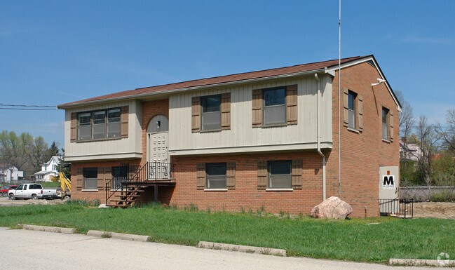
Property Detail
6521 River Rd
165-0003-0097
RIVER RD REAR 3.768 AC R1-T3-S35 - PRS 97-105 CONS
Officebuilding
HAMILTON
RFC
Ohio
AE The base floodplain where base flood elevations are provided. AE Zones are now used on new format FIRMs instead of A1-A30 Zones.
3.77 AC
2025
Forest Park/West
2025
Cincinnati/Dayton
026002
Cincinnati, OH-KY-IN
23,040 SF
NEARBY LISTINGS FOR SALE OR LEASE
DEMOGRAPHICS near 6521 River Rd
1 mile
3 mile
5 mile
2025 Total Population
3,680
31,739
95,968
2030 Population
3,736
32,868
96,940
Pop Growth 2025-2030
+ 1.52%
+ 3.56%
+ 1.01%
Average Age
41
40
40
2025 Total Households
1,484
11,115
35,633
HH Growth 2025-2030
+ 1.35%
+ 3.46%
+ 0.84%
Median Household Inc
$83,812
$112,963
$89,491
Avg Household Size
2.50
2.80
2.60
2025 Avg HH Vehicles
2.00
2.00
2.00
Median Home Value
$232,263
$320,143
$251,424
Median Year Built
1964
1989
1970
Nearby Places
Map Layers
Map Styles
 Street
 Aerial
Layers
 Traffic
 Biking
Places
Listings with unknown addresses are not visible on the map
- Restaurants
- Banks
- Shops
- Fitness
- Groceries
PUBLIC TRANSPORTATION
AIRPORT
Cincinnati/Northern Kentucky International
Drive
Walk
Distance
Cincinnati/Northern Kentucky International
40 min
9.3 mi
Nearby Properties
Address
Land Use
TOTAL SIZE
Lot Size
Zoning
Address
Land Use
TOTAL SIZE
Lot Size
Zoning
127,712 SF
185 AC
Address
Land Use
TOTAL SIZE
Lot Size
Zoning
Address
Land Use
TOTAL SIZE
Lot Size
Zoning
Address
Land Use
TOTAL SIZE
Lot Size
Zoning
Address
Land Use
TOTAL SIZE
Lot Size
Zoning
Address
Land Use
TOTAL SIZE
Lot Size
Zoning
Address
Land Use
TOTAL SIZE
Lot Size
Zoning
39.05 AC
Address
Land Use
TOTAL SIZE
Lot Size
Zoning
520,320 SF
31.99 AC
Address
Land Use
TOTAL SIZE
Lot Size
Zoning
48.90 AC
Address
Land Use
TOTAL SIZE
Lot Size
Zoning
21.76 AC
Address
Land Use
TOTAL SIZE
Lot Size
Zoning
520,000 SF
26.09 AC
Address
Land Use
TOTAL SIZE
Lot Size
Zoning
646,912 SF
25.34 AC
Address
Land Use
TOTAL SIZE
Lot Size
Zoning
605,850 SF
29.71 AC
Address
Land Use
TOTAL SIZE
Lot Size
Zoning
713,360 SF
50.53 AC
Address
Land Use
TOTAL SIZE
Lot Size
Zoning
522,500 SF
25.10 AC
Address
Land Use
TOTAL SIZE
Lot Size
Zoning
3.90 AC
RFC
Address
Land Use
TOTAL SIZE
Lot Size
Zoning
26.62 AC
Address
Land Use
TOTAL SIZE
Lot Size
Zoning
460,200 SF
28.39 AC
Address
Land Use
TOTAL SIZE
Lot Size
Zoning
25.80 AC
Address
Land Use
TOTAL SIZE
Lot Size
Zoning
525,000 SF
28.84 AC
Address
Land Use
TOTAL SIZE
Lot Size
Zoning
493,680 SF
25 AC
Address
Land Use
TOTAL SIZE
Lot Size
Zoning
458,800 SF
49.35 AC
Address
Land Use
TOTAL SIZE
Lot Size
Zoning
Address
Land Use
TOTAL SIZE
Lot Size
Zoning
426,420 SF
20.59 AC
Address
Land Use
TOTAL SIZE
Lot Size
Zoning
396,000 SF
24 AC
Address
Land Use
TOTAL SIZE
Lot Size
Zoning
136,000 SF
20.52 AC
Address
Land Use
TOTAL SIZE
Lot Size
Zoning
Address
Land Use
TOTAL SIZE
Lot Size
Zoning
9.47 AC
Address
Land Use
TOTAL SIZE
Lot Size
Zoning
15,672 SF
20.74 AC
Address
Land Use
TOTAL SIZE
Lot Size
Zoning
14.89 AC
The World's #1 Commercial Real Estate Marketplace
Connect with us
© 2026 CoStar Group
The information above has been obtained from sources believed reliable. While we do not doubt its accuracy we have not verified it and make no guarantee, warranty or representation about it. It is your responsibility to independently confirm its accuracy and completeness. Any projections, opinions, assumptions, or estimates used are for example only and do not represent the current or future performance of the property. The value of this transaction to you depends on tax and other factors which should be evaluated by your tax, financial, and legal advisors. You and your advisors should conduct a careful, independent investigation of the property to determine to your satisfaction the suitability of the property for your needs.