Property Record
6531 Wilkinson Blvd, , NC
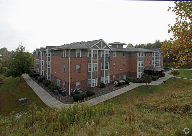

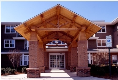
Property Detail
6531 Wilkinson Blvd
209102
SISTERS OF MERCY TRACT 1 04 003 009 00 000
Charitableorganization
GASTON
HCAR3
North Carolina
AE The base floodplain where base flood elevations are provided. AE Zones are now used on new format FIRMs instead of A1-A30 Zones.
5.47 AC
0
Outlying Gaston County
2025
Charlotte
0323021006
Charlotte-Concord-Gastonia, NC-SC
37,905 SF
NEARBY LISTINGS FOR SALE OR LEASE
-
-
View all listings for sale on LoopNet.com
DEMOGRAPHICS near 6531 Wilkinson Blvd
1 mile
3 mile
5 mile
2025 Total Population
4,674
35,757
86,832
2030 Population
4,952
37,954
92,394
Pop Growth 2025-2030
+ 5.95%
+ 6.14%
+ 6.41%
Average Age
40
40
40
2025 Total Households
1,949
15,173
34,669
HH Growth 2025-2030
+ 6.21%
+ 6.35%
+ 6.52%
Median Household Inc
$62,943
$75,532
$81,106
Avg Household Size
2.10
2.30
2.40
2025 Avg HH Vehicles
2.00
2.00
2.00
Median Home Value
$338,495
$339,895
$343,720
Median Year Built
1984
1987
1990
Nearby Places
Map Layers
Map Styles
 Street
 Aerial
Transit
 Traffic
 Biking
Places
Listings with unknown addresses are not visible on the map
- Restaurants
- Banks
- Shops
- Fitness
- Groceries
PUBLIC TRANSPORTATION
COMMUTER RAIL
Gastonia Amtrak Station (Crescent - Amtrak)
Drive
Walk
Distance
Gastonia Amtrak Station (Crescent - Amtrak)
13 min
8.4 mi
AIRPORT
Charlotte/Douglas International
Drive
Walk
Distance
Charlotte/Douglas International
20 min
7.8 mi
Concord-Padgett Regional
Drive
Walk
Distance
Concord-Padgett Regional
35 min
25.4 mi
Freight Ports
North Charleston Terminal
Drive
Walk
Distance
North Charleston Terminal
233 min
204.2 mi
Nearby Properties
Address
Land Use
TOTAL SIZE
Lot Size
Zoning
Address
Land Use
TOTAL SIZE
Lot Size
Zoning
37.49 AC
Address
Land Use
TOTAL SIZE
Lot Size
Zoning
41,508 SF
29.70 AC
Address
Land Use
TOTAL SIZE
Lot Size
Zoning
25,137 SF
34.81 AC
Address
Land Use
TOTAL SIZE
Lot Size
Zoning
503,550 SF
59.24 AC
I-1(CD)
Address
Land Use
TOTAL SIZE
Lot Size
Zoning
1,066 SF
70.67 AC
PUB01
Address
Land Use
TOTAL SIZE
Lot Size
Zoning
6.09 AC
Address
Land Use
TOTAL SIZE
Lot Size
Zoning
43.38 AC
Address
Land Use
TOTAL SIZE
Lot Size
Zoning
1,966 SF
36.06 AC
OFF01
Address
Land Use
TOTAL SIZE
Lot Size
Zoning
30,906 SF
14.19 AC
Address
Land Use
TOTAL SIZE
Lot Size
Zoning
25.64 AC
Address
Land Use
TOTAL SIZE
Lot Size
Zoning
23,899 SF
14.57 AC
HC
Address
Land Use
TOTAL SIZE
Lot Size
Zoning
98.12 AC
Address
Land Use
TOTAL SIZE
Lot Size
Zoning
171,037 SF
4.37 AC
Address
Land Use
TOTAL SIZE
Lot Size
Zoning
78.54 AC
GR
Address
Land Use
TOTAL SIZE
Lot Size
Zoning
25.14 AC
Address
Land Use
TOTAL SIZE
Lot Size
Zoning
4,552 SF
9.22 AC
R1
Address
Land Use
TOTAL SIZE
Lot Size
Zoning
358,450 SF
23.50 AC
STOR2
Address
Land Use
TOTAL SIZE
Lot Size
Zoning
3,536 SF
12.07 AC
APT02
Address
Land Use
TOTAL SIZE
Lot Size
Zoning
190,498 SF
20.10 AC
RET05
Address
Land Use
TOTAL SIZE
Lot Size
Zoning
48,452 SF
18.08 AC
PUB03
Address
Land Use
TOTAL SIZE
Lot Size
Zoning
46,998 SF
30.47 AC
HCAR1
Address
Land Use
TOTAL SIZE
Lot Size
Zoning
171,646 SF
13.19 AC
Address
Land Use
TOTAL SIZE
Lot Size
Zoning
2,000 SF
2.19 AC
Address
Land Use
TOTAL SIZE
Lot Size
Zoning
160,225 SF
9.68 AC
I-2(CD)
Address
Land Use
TOTAL SIZE
Lot Size
Zoning
516,688 SF
36.23 AC
STOR2
Address
Land Use
TOTAL SIZE
Lot Size
Zoning
1,596 SF
5.73 AC
OFF01
Address
Land Use
TOTAL SIZE
Lot Size
Zoning
184,319 SF
19.61 AC
I1
Address
Land Use
TOTAL SIZE
Lot Size
Zoning
65,513 SF
3.07 AC
Address
Land Use
TOTAL SIZE
Lot Size
Zoning
8,512 SF
102.15 AC
R-3
Address
Land Use
TOTAL SIZE
Lot Size
Zoning
139,155 SF
15.13 AC
RET05
The World's #1 Commercial Real Estate Marketplace
Connect with us
© 2026 CoStar Group
The information above has been obtained from sources believed reliable. While we do not doubt its accuracy we have not verified it and make no guarantee, warranty or representation about it. It is your responsibility to independently confirm its accuracy and completeness. Any projections, opinions, assumptions, or estimates used are for example only and do not represent the current or future performance of the property. The value of this transaction to you depends on tax and other factors which should be evaluated by your tax, financial, and legal advisors. You and your advisors should conduct a careful, independent investigation of the property to determine to your satisfaction the suitability of the property for your needs.