Property Record
6535 Grayson Rd, Harrisburg, PA 17111

NEARBY LISTINGS FOR SALE OR LEASE
-
-
View all Harrisburg listings for sale on LoopNet.com
Property Detail
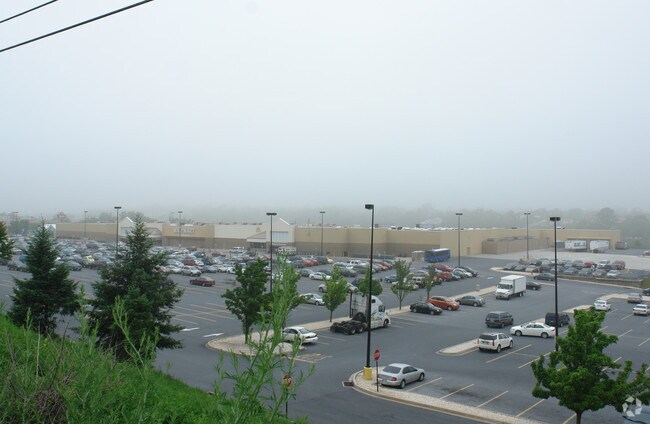
6535 Grayson Rd
63-018-112
Rutherford Indust Center
Storebuilding
Dauphin
X
Pennsylvania
42043C0345D
17.49 AC
0
Harrisburg Area East
2025
Philadelphia
022800
Harrisburg-Carlisle, PA
128,924 SF
DEMOGRAPHICS near 6535 Grayson Rd
1 Mile
3 Mile
5 Mile
2024 Total Population
6,831
46,946
147,435
2029 Population
6,922
47,787
150,203
Pop Growth 2024-2029
+ 1.33%
+ 1.79%
+ 1.88%
Average Age
39
40
39
2024 Total Households
2,600
18,909
58,536
HH Growth 2024-2029
+ 1.46%
+ 1.91%
+ 1.96%
Median Household Inc
$78,062
$77,829
$65,715
Avg Household Size
2.60
2.40
2.40
2024 Avg HH Vehicles
2.00
2.00
2.00
Median Home Value
$179,752
$200,836
$183,542
Median Year Built
1978
1977
1968
Nearby Places
Map Layers
Map Styles
 Street
 Aerial
- Restaurants
- Banks
- Shops
- Fitness
- Groceries
PUBLIC TRANSPORTATION
COMMUTER RAIL
Harrisburg (Keystone Service - Amtrak, Pennsylvanian - Amtrak)
DRIVE
WALK
Distance
Harrisburg (Keystone Service - Amtrak, Pennsylvanian - Amtrak)
11 min
6.5 mi
Middletown (Keystone Service - Amtrak)
DRIVE
WALK
Distance
Middletown (Keystone Service - Amtrak)
17 min
9.5 mi
AIRPORT
Harrisburg International
DRIVE
WALK
Distance
Harrisburg International
15 min
9.5 mi
Freight Ports
Port of Baltimore
DRIVE
WALK
Distance
Port of Baltimore
116 min
85.7 mi
Nearby Properties
Address
Land Use
TOTAL SIZE
Lot Size
Zoning
Address
Land Use
TOTAL SIZE
Lot Size
Zoning
74,032 SF
74.81 AC
Address
Land Use
TOTAL SIZE
Lot Size
Zoning
4,176 SF
192.96 AC
Address
Land Use
TOTAL SIZE
Lot Size
Zoning
47,022 SF
47.55 AC
Address
Land Use
TOTAL SIZE
Lot Size
Zoning
Address
Land Use
TOTAL SIZE
Lot Size
Zoning
172,289 SF
86.54 AC
Address
Land Use
TOTAL SIZE
Lot Size
Zoning
142,010 SF
53.46 AC
Address
Land Use
TOTAL SIZE
Lot Size
Zoning
9,188 SF
46.70 AC
Address
Land Use
TOTAL SIZE
Lot Size
Zoning
2,913 SF
24.28 AC
Address
Land Use
TOTAL SIZE
Lot Size
Zoning
50,963 SF
46.61 AC
Address
Land Use
TOTAL SIZE
Lot Size
Zoning
651,250 SF
47.13 AC
Address
Land Use
TOTAL SIZE
Lot Size
Zoning
247,216 SF
46.91 AC
Address
Land Use
TOTAL SIZE
Lot Size
Zoning
1,196 SF
50.34 AC
Address
Land Use
TOTAL SIZE
Lot Size
Zoning
2,000 SF
21.13 AC
Address
Land Use
TOTAL SIZE
Lot Size
Zoning
507,000 SF
32.82 AC
Address
Land Use
TOTAL SIZE
Lot Size
Zoning
2,068 SF
19.26 AC
Address
Land Use
TOTAL SIZE
Lot Size
Zoning
24,567 SF
15.33 AC
Address
Land Use
TOTAL SIZE
Lot Size
Zoning
13,348 SF
25.38 AC
Address
Land Use
TOTAL SIZE
Lot Size
Zoning
167,713 SF
11.50 AC
Address
Land Use
TOTAL SIZE
Lot Size
Zoning
348,615 SF
38.98 AC
Address
Land Use
TOTAL SIZE
Lot Size
Zoning
165,549 SF
65.10 AC
Address
Land Use
TOTAL SIZE
Lot Size
Zoning
1,254 SF
25.34 AC
Address
Land Use
TOTAL SIZE
Lot Size
Zoning
97,887 SF
11.90 AC
Address
Land Use
TOTAL SIZE
Lot Size
Zoning
18.43 AC
Address
Land Use
TOTAL SIZE
Lot Size
Zoning
233,427 SF
20.38 AC
Address
Land Use
TOTAL SIZE
Lot Size
Zoning
196,000 SF
12.42 AC
Address
Land Use
TOTAL SIZE
Lot Size
Zoning
61,198 SF
11.12 AC
Address
Land Use
TOTAL SIZE
Lot Size
Zoning
107,853 SF
12 AC
Address
Land Use
TOTAL SIZE
Lot Size
Zoning
300,000 SF
17.71 AC
Address
Land Use
TOTAL SIZE
Lot Size
Zoning
280,000 SF
19.58 AC
Address
Land Use
TOTAL SIZE
Lot Size
Zoning
132,588 SF
18.49 AC
The World's #1 Commercial Real Estate Marketplace
Connect with us
© 2025 CoStar Group
The information above has been obtained from sources believed reliable. While we do not doubt its accuracy we have not verified it and make no guarantee, warranty or representation about it. It is your responsibility to independently confirm its accuracy and completeness. Any projections, opinions, assumptions, or estimates used are for example only and do not represent the current or future performance of the property. The value of this transaction to you depends on tax and other factors which should be evaluated by your tax, financial, and legal advisors. You and your advisors should conduct a careful, independent investigation of the property to determine to your satisfaction the suitability of the property for your needs.