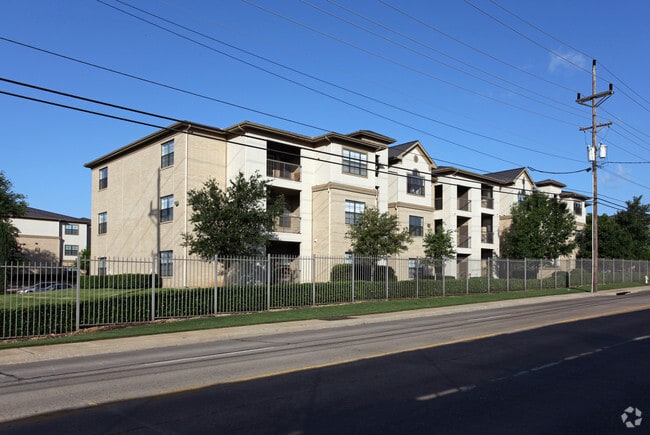
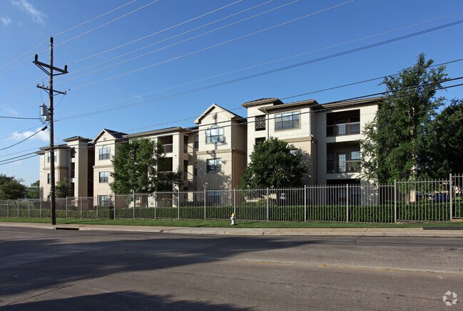
Property Record
6535 Maple Ave, Dallas, TX 75235

Property Detail
6535 Maple Ave
00236800B10020000
SMP BLK B1/2368 LT 2 ACS 0.658 VOL99218/5105 DD11081999 CO-DC 2368 0B1 00200 6DA2368 0B1
Warehouse
DALLAS
Z150
Texas
B and X Area of moderate flood hazard, usually the area between the limits of the 100-year and 500-year floods.
2
0
0.66 AC
2025
Love Field
000409
Dallas/Ft Worth
1,680 SF
Dallas-Fort Worth-Arlington, TX
NEARBY LISTINGS FOR SALE OR LEASE
DEMOGRAPHICS near 6535 Maple Ave
1 mile
3 mile
5 mile
2025 Total Population
12,060
115,248
348,134
2030 Population
12,614
120,302
363,455
Pop Growth 2025-2030
+ 4.59%
+ 4.39%
+ 4.40%
Average Age
36
38
37
2025 Total Households
5,810
56,714
164,417
HH Growth 2025-2030
+ 4.89%
+ 4.49%
+ 4.73%
Median Household Inc
$65,513
$87,665
$92,988
Avg Household Size
2.00
2.00
2.00
2025 Avg HH Vehicles
1.00
1.00
2.00
Median Home Value
$318,254
$656,652
$671,102
Median Year Built
2006
1994
1994
Nearby Places
Map Layers
Map Styles
 Street
 Aerial
Layers
 Traffic
 Biking
Places
Listings with unknown addresses are not visible on the map
- Restaurants
- Banks
- Shops
- Fitness
- Groceries
PUBLIC TRANSPORTATION
TRANSIT/SUBWAY
Inwood/Love Field Station (DART LIGHT RAIL - GREEN LINE - Dallas Area Rapid Transit (DART), DART LIGHT RAIL - ORANGE LINE - Dallas Area Rapid Transit (DART))
Drive
Walk
Distance
Inwood/Love Field Station (DART LIGHT RAIL - GREEN LINE - Dallas Area Rapid Transit (DART), DART LIGHT RAIL - ORANGE LINE - Dallas Area Rapid Transit (DART))
2 min
13 min
0.7 mi
Southwest Medical District/Parkland (DART LIGHT RAIL - GREEN LINE - Dallas Area Rapid Transit (DART), DART LIGHT RAIL - ORANGE LINE - Dallas Area Rapid Transit (DART))
Drive
Walk
Distance
Southwest Medical District/Parkland (DART LIGHT RAIL - GREEN LINE - Dallas Area Rapid Transit (DART), DART LIGHT RAIL - ORANGE LINE - Dallas Area Rapid Transit (DART))
3 min
20 min
1.1 mi
COMMUTER RAIL
Medical/Market Ctr Station (TRINITY RAILWAY - Dallas Area Rapid Transit (DART))
Drive
Walk
Distance
Medical/Market Ctr Station (TRINITY RAILWAY - Dallas Area Rapid Transit (DART))
4 min
1.9 mi
Victory Station (DART LIGHT RAIL - GREEN LINE - Dallas Area Rapid Transit (DART), DART LIGHT RAIL - ORANGE LINE - Dallas Area Rapid Transit (DART), TRINITY RAILWAY - Dallas Area Rapid Transit (DART))
Drive
Walk
Distance
Victory Station (DART LIGHT RAIL - GREEN LINE - Dallas Area Rapid Transit (DART), DART LIGHT RAIL - ORANGE LINE - Dallas Area Rapid Transit (DART), TRINITY RAILWAY - Dallas Area Rapid Transit (DART))
9 min
4.3 mi
AIRPORT
Dallas Love Field
Drive
Walk
Distance
Dallas Love Field
4 min
1.8 mi
Dallas-Fort Worth International
Drive
Walk
Distance
Dallas-Fort Worth International
24 min
17.8 mi
Freight Ports
Port of Shreveport
Drive
Walk
Distance
Port of Shreveport
220 min
200.2 mi
Nearby Properties
Address
Land Use
TOTAL SIZE
Lot Size
Zoning
Address
Land Use
TOTAL SIZE
Lot Size
Zoning
2,658,374 SF
37.70 AC
Z116
Address
Land Use
TOTAL SIZE
Lot Size
Zoning
2,476 SF
1,203.03 AC
Z116
Address
Land Use
TOTAL SIZE
Lot Size
Zoning
2,271,924 SF
Address
Land Use
TOTAL SIZE
Lot Size
Zoning
4,407,366 SF
1,300 AC
IR
Address
Land Use
TOTAL SIZE
Lot Size
Zoning
1,003,498 SF
22.15 AC
Z116
Address
Land Use
TOTAL SIZE
Lot Size
Zoning
1,896,570 SF
18.08 AC
Z151
Address
Land Use
TOTAL SIZE
Lot Size
Zoning
299,170 SF
9.71 AC
Z97
Address
Land Use
TOTAL SIZE
Lot Size
Zoning
1,291,660 SF
2.56 AC
Z248
Address
Land Use
TOTAL SIZE
Lot Size
Zoning
504,533 SF
9.95 AC
Z151
Address
Land Use
TOTAL SIZE
Lot Size
Zoning
1,228,418 SF
24.51 AC
Z151
Address
Land Use
TOTAL SIZE
Lot Size
Zoning
724,979 SF
1.05 AC
Z239
Address
Land Use
TOTAL SIZE
Lot Size
Zoning
602,716 SF
11.21 AC
Z239
Address
Land Use
TOTAL SIZE
Lot Size
Zoning
906,627 SF
3.83 AC
Z239
Address
Land Use
TOTAL SIZE
Lot Size
Zoning
525,016 SF
6.51 AC
Z151
Address
Land Use
TOTAL SIZE
Lot Size
Zoning
512,667 SF
16.10 AC
Z151
Address
Land Use
TOTAL SIZE
Lot Size
Zoning
818,188 SF
2.89 AC
Z239
Address
Land Use
TOTAL SIZE
Lot Size
Zoning
1,870,348 SF
12.70 AC
Z151
Address
Land Use
TOTAL SIZE
Lot Size
Zoning
806,107 SF
0.40 AC
Z239
Address
Land Use
TOTAL SIZE
Lot Size
Zoning
584,652 SF
22.90 AC
Z150
Address
Land Use
TOTAL SIZE
Lot Size
Zoning
446,593 SF
0.93 AC
Address
Land Use
TOTAL SIZE
Lot Size
Zoning
146,302 SF
5.66 AC
Z60
Address
Land Use
TOTAL SIZE
Lot Size
Zoning
569,836 SF
2.18 AC
Z239
Address
Land Use
TOTAL SIZE
Lot Size
Zoning
615,910 SF
2.31 AC
Z239
Address
Land Use
TOTAL SIZE
Lot Size
Zoning
446,367 SF
3.35 AC
Z151
Address
Land Use
TOTAL SIZE
Lot Size
Zoning
352,834 SF
Address
Land Use
TOTAL SIZE
Lot Size
Zoning
502,134 SF
1.05 AC
Address
Land Use
TOTAL SIZE
Lot Size
Zoning
1,898,977 SF
42.38 AC
Z239
Address
Land Use
TOTAL SIZE
Lot Size
Zoning
723,546 SF
16.98 AC
Z46
Address
Land Use
TOTAL SIZE
Lot Size
Zoning
574,842 SF
2.22 AC
Z248
Address
Land Use
TOTAL SIZE
Lot Size
Zoning
226,948 SF
20.73 AC
Z239
The World's #1 Commercial Real Estate Marketplace
Connect with us
© 2026 CoStar Group
The information above has been obtained from sources believed reliable. While we do not doubt its accuracy we have not verified it and make no guarantee, warranty or representation about it. It is your responsibility to independently confirm its accuracy and completeness. Any projections, opinions, assumptions, or estimates used are for example only and do not represent the current or future performance of the property. The value of this transaction to you depends on tax and other factors which should be evaluated by your tax, financial, and legal advisors. You and your advisors should conduct a careful, independent investigation of the property to determine to your satisfaction the suitability of the property for your needs.