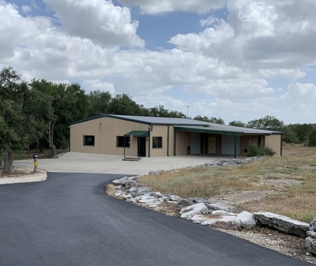
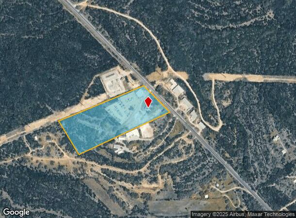
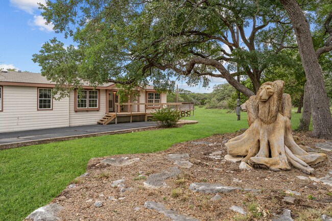
Property Record
6535 W State Highway 46 W, New Braunfels, TX 78132

NEARBY LISTINGS FOR SALE OR LEASE
Property Detail
6535 W State Highway 46 W
73-0499-0003-00
A-499 Sur-742 C Reis
Commercialnec
A-499 SUR-742 C REIS, ACRES 15.974, A-697 SUR-837 GWT & P RR, A-272 SUR-424 A M HOLBROOK A-697 SUR-837 GWT & P RR, A-272 SUR-424 A M HOLBROOK
X
Comal
48091C0265F
Texas
2024
15.97 AC
2025
Comal County
310707
San Antonio
3,094 SF
San Antonio-New Braunfels, TX
DEMOGRAPHICS near 6535 W State Highway 46 W
1 Mile
3 Mile
5 Mile
2024 Total Population
775
9,209
17,901
2029 Population
1,092
12,928
25,021
Pop Growth 2024-2029
+ 40.90%
+ 40.38%
+ 39.77%
Average Age
45
44
43
2024 Total Households
290
3,360
6,492
HH Growth 2024-2029
+ 40.34%
+ 40.21%
+ 39.59%
Median Household Inc
$109,722
$139,202
$144,262
Avg Household Size
2.60
2.70
2.70
2024 Avg HH Vehicles
3.00
3.00
3.00
Median Home Value
$560,000
$636,685
$618,219
Median Year Built
2010
2011
2010
Nearby Places
Map Layers
Map Styles
 Street
 Aerial
- Restaurants
- Banks
- Shops
- Fitness
- Groceries
PUBLIC TRANSPORTATION
AIRPORT
San Antonio International
DRIVE
WALK
Distance
San Antonio International
42 min
32.3 mi
Freight Ports
Calhoun Port
DRIVE
WALK
Distance
Calhoun Port
185 min
154.3 mi
SALE & LEASE HISTORY
LISTING DATE
SALE/LEASE

Oct 17, 2022
For Lease
Jun 15, 2022
For Sale
Aug 13, 2020
For Lease
Nearby Properties
Address
Land Use
TOTAL SIZE
Lot Size
Zoning
Address
Land Use
TOTAL SIZE
Lot Size
Zoning
18,600 SF
12.62 AC
Address
Land Use
TOTAL SIZE
Lot Size
Zoning
20,150 SF
12.49 AC
Address
Land Use
TOTAL SIZE
Lot Size
Zoning
1,602 SF
9 AC
Address
Land Use
TOTAL SIZE
Lot Size
Zoning
9,800 SF
3.58 AC
Address
Land Use
TOTAL SIZE
Lot Size
Zoning
Address
Land Use
TOTAL SIZE
Lot Size
Zoning
11,876 SF
5.58 AC
Address
Land Use
TOTAL SIZE
Lot Size
Zoning
17,657 SF
18.59 AC
Address
Land Use
TOTAL SIZE
Lot Size
Zoning
6,418 SF
5.73 AC
Address
Land Use
TOTAL SIZE
Lot Size
Zoning
10,843 SF
17.87 AC
Address
Land Use
TOTAL SIZE
Lot Size
Zoning
5,824 SF
14.07 AC
Address
Land Use
TOTAL SIZE
Lot Size
Zoning
11,924 SF
6.08 AC
Address
Land Use
TOTAL SIZE
Lot Size
Zoning
4,800 SF
6.53 AC
Address
Land Use
TOTAL SIZE
Lot Size
Zoning
7,852 SF
5.60 AC
Address
Land Use
TOTAL SIZE
Lot Size
Zoning
420 SF
3.38 AC
Address
Land Use
TOTAL SIZE
Lot Size
Zoning
7,998 SF
42.69 AC
Address
Land Use
TOTAL SIZE
Lot Size
Zoning
6,283 SF
30.70 AC
Address
Land Use
TOTAL SIZE
Lot Size
Zoning
12,640 SF
5.87 AC
Address
Land Use
TOTAL SIZE
Lot Size
Zoning
544 SF
14.02 AC
Address
Land Use
TOTAL SIZE
Lot Size
Zoning
8,640 SF
8 AC
Address
Land Use
TOTAL SIZE
Lot Size
Zoning
Address
Land Use
TOTAL SIZE
Lot Size
Zoning
1,500 SF
5.66 AC
Address
Land Use
TOTAL SIZE
Lot Size
Zoning
4,992 SF
10.71 AC
Address
Land Use
TOTAL SIZE
Lot Size
Zoning
5,651 SF
9.58 AC
Address
Land Use
TOTAL SIZE
Lot Size
Zoning
8,395 SF
32.14 AC
Address
Land Use
TOTAL SIZE
Lot Size
Zoning
6,105 SF
2 AC
Address
Land Use
TOTAL SIZE
Lot Size
Zoning
7.83 AC
Address
Land Use
TOTAL SIZE
Lot Size
Zoning
3,855 SF
1.40 AC
Address
Land Use
TOTAL SIZE
Lot Size
Zoning
12.48 AC
Address
Land Use
TOTAL SIZE
Lot Size
Zoning
4,634 SF
47.37 AC
The World's #1 Commercial Real Estate Marketplace
Connect with us
© 2026 CoStar Group
The information above has been obtained from sources believed reliable. While we do not doubt its accuracy we have not verified it and make no guarantee, warranty or representation about it. It is your responsibility to independently confirm its accuracy and completeness. Any projections, opinions, assumptions, or estimates used are for example only and do not represent the current or future performance of the property. The value of this transaction to you depends on tax and other factors which should be evaluated by your tax, financial, and legal advisors. You and your advisors should conduct a careful, independent investigation of the property to determine to your satisfaction the suitability of the property for your needs.