Property Record
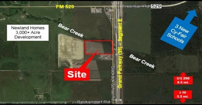
6545 Stockdick School Rd, Katy, TX 77449

Property Detail
6545 Stockdick School Rd
0431120000006
TR 1C ABST 446 H&TCRR SEC 31 BLK 2
Outdoorrecreationbeachmountaindesert
HARRIS
AE The base floodplain where base flood elevations are provided. AE Zones are now used on new format FIRMs instead of A1-A30 Zones.
Texas
2024
11.47 AC
2025
Katy/Grand Parkway West
542202
Houston
45,875 SF
Houston-Pasadena-The Woodlands, TX
NEARBY LISTINGS FOR SALE OR LEASE
DEMOGRAPHICS near 6545 Stockdick School Rd
1 mile
3 mile
5 mile
2025 Total Population
1,264
71,627
242,726
2030 Population
1,398
78,243
262,653
Pop Growth 2025-2030
+ 10.60%
+ 9.24%
+ 8.21%
Average Age
34
34
35
2025 Total Households
374
20,719
72,123
HH Growth 2025-2030
+ 10.96%
+ 9.48%
+ 8.40%
Median Household Inc
$95,081
$99,089
$101,206
Avg Household Size
3.40
3.40
3.30
2025 Avg HH Vehicles
2.00
2.00
2.00
Median Home Value
$267,676
$283,847
$297,486
Median Year Built
2010
2010
2009
Nearby Places
Map Layers
Map Styles
 Street
 Aerial
Transit
 Traffic
 Biking
Places
Listings with unknown addresses are not visible on the map
- Restaurants
- Banks
- Shops
- Fitness
- Groceries
PUBLIC TRANSPORTATION
AIRPORT
George Bush Intcntl/Houston
Drive
Walk
Distance
George Bush Intcntl/Houston
47 min
31.6 mi
Freight Ports
Port of Houston
Drive
Walk
Distance
Port of Houston
57 min
37.8 mi
SALE & LEASE HISTORY
LISTING DATE
SALE/LEASE

Sep 24, 2016
For Sale
Mar 19, 2018
For Lease
Nearby Properties
Address
Land Use
TOTAL SIZE
Lot Size
Zoning
Address
Land Use
TOTAL SIZE
Lot Size
Zoning
851,991 SF
229.30 AC
Address
Land Use
TOTAL SIZE
Lot Size
Zoning
807,360 SF
54.15 AC
Address
Land Use
TOTAL SIZE
Lot Size
Zoning
838,700 SF
36.68 AC
Address
Land Use
TOTAL SIZE
Lot Size
Zoning
355,721 SF
13 AC
Address
Land Use
TOTAL SIZE
Lot Size
Zoning
323,609 SF
12.71 AC
Address
Land Use
TOTAL SIZE
Lot Size
Zoning
347,834 SF
15.25 AC
Address
Land Use
TOTAL SIZE
Lot Size
Zoning
292,645 SF
12.71 AC
Address
Land Use
TOTAL SIZE
Lot Size
Zoning
439,808 SF
23.75 AC
Address
Land Use
TOTAL SIZE
Lot Size
Zoning
236,406 SF
11.40 AC
Address
Land Use
TOTAL SIZE
Lot Size
Zoning
267,766 SF
12.96 AC
Address
Land Use
TOTAL SIZE
Lot Size
Zoning
147,923 SF
11.60 AC
Address
Land Use
TOTAL SIZE
Lot Size
Zoning
171,000 SF
7.08 AC
Address
Land Use
TOTAL SIZE
Lot Size
Zoning
117,860 SF
12.44 AC
Address
Land Use
TOTAL SIZE
Lot Size
Zoning
228,152 SF
22.61 AC
Address
Land Use
TOTAL SIZE
Lot Size
Zoning
119,086 SF
18.61 AC
Address
Land Use
TOTAL SIZE
Lot Size
Zoning
191,575 SF
17.98 AC
Address
Land Use
TOTAL SIZE
Lot Size
Zoning
122,880 SF
15 AC
Address
Land Use
TOTAL SIZE
Lot Size
Zoning
99,096 SF
27.51 AC
Address
Land Use
TOTAL SIZE
Lot Size
Zoning
143,950 SF
10.30 AC
Address
Land Use
TOTAL SIZE
Lot Size
Zoning
67,250 SF
7.37 AC
Address
Land Use
TOTAL SIZE
Lot Size
Zoning
2,939 SF
330.19 AC
Address
Land Use
TOTAL SIZE
Lot Size
Zoning
144,736 SF
2.55 AC
Address
Land Use
TOTAL SIZE
Lot Size
Zoning
84.23 AC
Address
Land Use
TOTAL SIZE
Lot Size
Zoning
83,750 SF
4.88 AC
Address
Land Use
TOTAL SIZE
Lot Size
Zoning
57,453 SF
6.74 AC
Address
Land Use
TOTAL SIZE
Lot Size
Zoning
105,500 SF
5.49 AC
Address
Land Use
TOTAL SIZE
Lot Size
Zoning
67,312 SF
6.95 AC
Address
Land Use
TOTAL SIZE
Lot Size
Zoning
46,400 SF
2.78 AC
Address
Land Use
TOTAL SIZE
Lot Size
Zoning
11,431 SF
4.60 AC
Address
Land Use
TOTAL SIZE
Lot Size
Zoning
136.37 AC
The World's #1 Commercial Real Estate Marketplace
Connect with us
© 2026 CoStar Group
The information above has been obtained from sources believed reliable. While we do not doubt its accuracy we have not verified it and make no guarantee, warranty or representation about it. It is your responsibility to independently confirm its accuracy and completeness. Any projections, opinions, assumptions, or estimates used are for example only and do not represent the current or future performance of the property. The value of this transaction to you depends on tax and other factors which should be evaluated by your tax, financial, and legal advisors. You and your advisors should conduct a careful, independent investigation of the property to determine to your satisfaction the suitability of the property for your needs.