Property Record
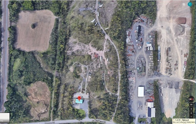
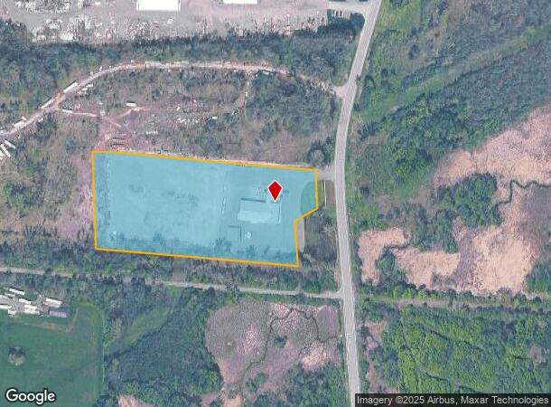
6539 Herman Rd, Warners, NY 13164
NEARBY LISTINGS FOR SALE OR LEASE
Property Detail
6539 Herman Rd
312089-006-000-0003-001-000-0000
FL 54
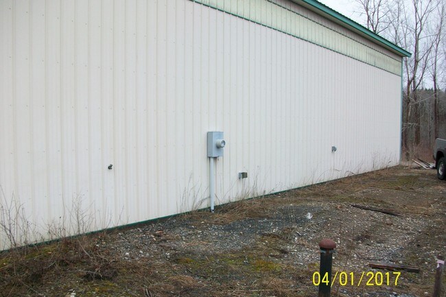
Distributionwarehouseregional
Onondaga
X
New York
36067C0183F
1.000
2025
4.86 AC
2024
W Outer Onondaga County
012100
Syracuse
8,800 SF
Syracuse, NY
DEMOGRAPHICS near 6539 Herman Rd
1 Mile
3 Mile
5 Mile
2024 Total Population
445
8,997
48,719
2029 Population
432
8,732
47,470
Pop Growth 2024-2029
(2.92%)
(2.95%)
(2.56%)
Average Age
41
42
43
2024 Total Households
155
3,574
20,955
HH Growth 2024-2029
(3.23%)
(3.16%)
(2.76%)
Median Household Inc
$99,166
$73,114
$73,056
Avg Household Size
2.90
2.40
2.30
2024 Avg HH Vehicles
2.00
2.00
2.00
Median Home Value
$219,231
$176,265
$168,849
Median Year Built
1963
1969
1967
Nearby Places
Map Layers
Map Styles
 Street
 Aerial
- Restaurants
- Banks
- Shops
- Fitness
- Groceries
PUBLIC TRANSPORTATION
COMMUTER RAIL
Nyf (Empire Service - Amtrak, Maple Leaf - Amtrak)
DRIVE
WALK
Distance
Nyf (Empire Service - Amtrak, Maple Leaf - Amtrak)
11 min
6.4 mi
AIRPORT
Syracuse Hancock International
DRIVE
WALK
Distance
Syracuse Hancock International
23 min
14.3 mi
Freight Ports
Albany, NY Port
DRIVE
WALK
Distance
Albany, NY Port
183 min
153.4 mi
SALE & LEASE HISTORY
LISTING DATE
SALE/LEASE

Dec 14, 2018
For Lease
Dec 14, 2018
For Sale
Apr 12, 2019
For Lease
Nearby Properties
Address
Land Use
TOTAL SIZE
Lot Size
Zoning
Address
Land Use
TOTAL SIZE
Lot Size
Zoning
257,617 SF
50.74 AC
INA
Address
Land Use
TOTAL SIZE
Lot Size
Zoning
359,422 SF
25.50 AC
INA
Address
Land Use
TOTAL SIZE
Lot Size
Zoning
157,675 SF
12.88 AC
Address
Land Use
TOTAL SIZE
Lot Size
Zoning
13,032 SF
7.63 AC
Address
Land Use
TOTAL SIZE
Lot Size
Zoning
3,640 SF
27.54 AC
INC
Address
Land Use
TOTAL SIZE
Lot Size
Zoning
72,768 SF
2.70 AC
6
Address
Land Use
TOTAL SIZE
Lot Size
Zoning
3.79 AC
02 - SINGL
Address
Land Use
TOTAL SIZE
Lot Size
Zoning
2,580 SF
48.74 AC
06 - INDUS
Address
Land Use
TOTAL SIZE
Lot Size
Zoning
77,978 SF
21.91 AC
INA
Address
Land Use
TOTAL SIZE
Lot Size
Zoning
86,741 SF
44.76 AC
02 - SINGL
Address
Land Use
TOTAL SIZE
Lot Size
Zoning
8,624 SF
8.91 AC
PUD
Address
Land Use
TOTAL SIZE
Lot Size
Zoning
56,548 SF
17 AC
R10
Address
Land Use
TOTAL SIZE
Lot Size
Zoning
69.49 AC
02
Address
Land Use
TOTAL SIZE
Lot Size
Zoning
8,624 SF
5.32 AC
PUD
Address
Land Use
TOTAL SIZE
Lot Size
Zoning
61,204 SF
8.19 AC
INA
Address
Land Use
TOTAL SIZE
Lot Size
Zoning
150,353 SF
12.26 AC
02 - SINGL
Address
Land Use
TOTAL SIZE
Lot Size
Zoning
16,216 SF
62.78 AC
RHD
Address
Land Use
TOTAL SIZE
Lot Size
Zoning
12.72 AC
06 - INDUS
Address
Land Use
TOTAL SIZE
Lot Size
Zoning
16,000 SF
0.94 AC
Address
Land Use
TOTAL SIZE
Lot Size
Zoning
1,800 SF
30.92 AC
INC
Address
Land Use
TOTAL SIZE
Lot Size
Zoning
50,856 SF
3 AC
INA
Address
Land Use
TOTAL SIZE
Lot Size
Zoning
73,730 SF
11.45 AC
INA
Address
Land Use
TOTAL SIZE
Lot Size
Zoning
19,200 SF
3.79 AC
02 - SINGL
Address
Land Use
TOTAL SIZE
Lot Size
Zoning
18,400 SF
91.14 AC
06 - INDUS
Address
Land Use
TOTAL SIZE
Lot Size
Zoning
51,030 SF
5.89 AC
PUD
Address
Land Use
TOTAL SIZE
Lot Size
Zoning
57,600 SF
3.46 AC
02 - SINGL
Address
Land Use
TOTAL SIZE
Lot Size
Zoning
39.07 AC
Address
Land Use
TOTAL SIZE
Lot Size
Zoning
30.45 AC
Address
Land Use
TOTAL SIZE
Lot Size
Zoning
2,008 SF
21 AC
PUD
Address
Land Use
TOTAL SIZE
Lot Size
Zoning
64.13 AC
The World's #1 Commercial Real Estate Marketplace
Connect with us
© 2025 CoStar Group
The information above has been obtained from sources believed reliable. While we do not doubt its accuracy we have not verified it and make no guarantee, warranty or representation about it. It is your responsibility to independently confirm its accuracy and completeness. Any projections, opinions, assumptions, or estimates used are for example only and do not represent the current or future performance of the property. The value of this transaction to you depends on tax and other factors which should be evaluated by your tax, financial, and legal advisors. You and your advisors should conduct a careful, independent investigation of the property to determine to your satisfaction the suitability of the property for your needs.