Property Record
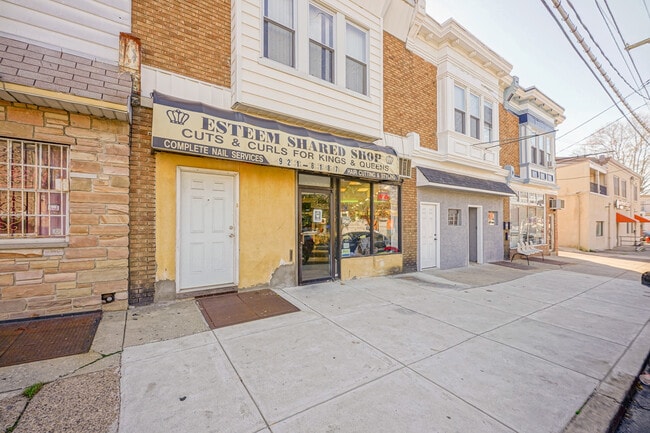
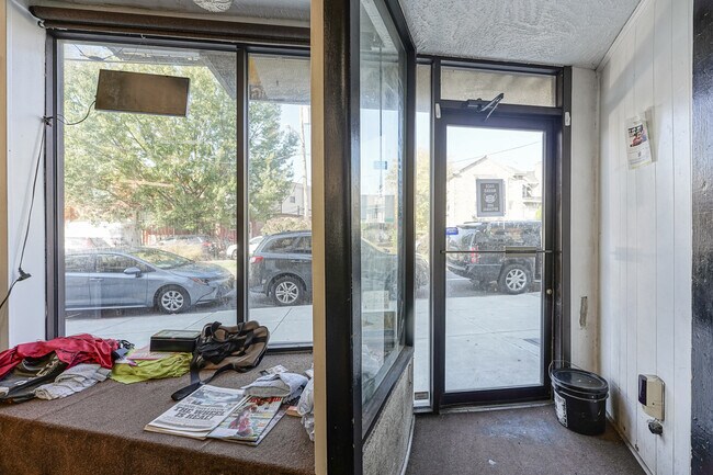
6546 Lebanon Ave, Philadelphia, PA 19151

NEARBY LISTINGS FOR SALE OR LEASE
Property Detail
6546 Lebanon Ave
Philadelphia-Camden-Wilmington, PA-NJ-DE-MD
Plan & Survey Made George W Hyde Esquire
871546750
43 010/1000 W OF
Commercialnec
Philadelphia
X
Pennsylvania
42091C0432G
148
2024
0.05 AC
2026
West Philadelphia
011500
Philadelphia
1,964 SF
DEMOGRAPHICS near 6546 Lebanon Ave
1 Mile
3 Mile
5 Mile
2024 Total Population
43,552
313,175
780,407
2029 Population
42,104
308,033
768,896
Pop Growth 2024-2029
(3.32%)
(1.64%)
(1.47%)
Average Age
40
39
38
2024 Total Households
17,358
124,300
324,520
HH Growth 2024-2029
(3.59%)
(1.87%)
(1.71%)
Median Household Inc
$49,127
$52,368
$59,569
Avg Household Size
2.40
2.40
2.30
2024 Avg HH Vehicles
1.00
1.00
1.00
Median Home Value
$159,336
$198,328
$248,673
Median Year Built
1947
1947
1949
Nearby Places
Map Layers
Map Styles
 Street
 Aerial
- Restaurants
- Banks
- Shops
- Fitness
- Groceries
PUBLIC TRANSPORTATION
TRANSIT/SUBWAY
63Rd And Jefferson (Route 10 - Southeastern Pennsylvania Transportation Authority Rapid Transit (SEPTA Subway & Trolley))
DRIVE
WALK
Distance
63Rd And Jefferson (Route 10 - Southeastern Pennsylvania Transportation Authority Rapid Transit (SEPTA Subway & Trolley))
1 min
6 min
0.4 mi
63Rd Street And Columbia Avenue (Route 10 - Southeastern Pennsylvania Transportation Authority Rapid Transit (SEPTA Subway & Trolley))
DRIVE
WALK
Distance
63Rd Street And Columbia Avenue (Route 10 - Southeastern Pennsylvania Transportation Authority Rapid Transit (SEPTA Subway & Trolley))
2 min
7 min
0.4 mi
Lansdowne Avenue And 63Rd Street (Route 10 - Southeastern Pennsylvania Transportation Authority Rapid Transit (SEPTA Subway & Trolley))
DRIVE
WALK
Distance
Lansdowne Avenue And 63Rd Street (Route 10 - Southeastern Pennsylvania Transportation Authority Rapid Transit (SEPTA Subway & Trolley))
1 min
8 min
0.4 mi
Lansdowne Avenue And 62Nd Street (Route 10 - Southeastern Pennsylvania Transportation Authority Rapid Transit (SEPTA Subway & Trolley))
DRIVE
WALK
Distance
Lansdowne Avenue And 62Nd Street (Route 10 - Southeastern Pennsylvania Transportation Authority Rapid Transit (SEPTA Subway & Trolley))
1 min
10 min
0.6 mi
Haverford Av & 63Rd St (Route 15 - SEPTA)
DRIVE
WALK
Distance
Haverford Av & 63Rd St (Route 15 - SEPTA)
2 min
12 min
0.6 mi
COMMUTER RAIL
Overbrook (R5 - Southeastern Pennsylvania Transportation Authority Regional Rail (SEPTA Regional Rail))
DRIVE
WALK
Distance
Overbrook (R5 - Southeastern Pennsylvania Transportation Authority Regional Rail (SEPTA Regional Rail))
4 min
20 min
1.1 mi
Merion (R5 - Southeastern Pennsylvania Transportation Authority Regional Rail (SEPTA Regional Rail))
DRIVE
WALK
Distance
Merion (R5 - Southeastern Pennsylvania Transportation Authority Regional Rail (SEPTA Regional Rail))
6 min
1.9 mi
AIRPORT
Philadelphia International
DRIVE
WALK
Distance
Philadelphia International
24 min
9.5 mi
Freight Ports
South Jersey Port
DRIVE
WALK
Distance
South Jersey Port
20 min
9.6 mi
SALE & LEASE HISTORY
LISTING DATE
SALE/LEASE

Nov 18, 2022
For Sale
Nearby Properties
Address
Land Use
TOTAL SIZE
Lot Size
Zoning
Address
Land Use
TOTAL SIZE
Lot Size
Zoning
2,178,860 SF
48.65 AC
R3
Address
Land Use
TOTAL SIZE
Lot Size
Zoning
158,496 SF
Address
Land Use
TOTAL SIZE
Lot Size
Zoning
Address
Land Use
TOTAL SIZE
Lot Size
Zoning
175,069 SF
2.20 AC
CMX3
Address
Land Use
TOTAL SIZE
Lot Size
Zoning
76,614 SF
1.53 AC
CMX3
Address
Land Use
TOTAL SIZE
Lot Size
Zoning
1,455,130 SF
6.80 AC
RSD3
Address
Land Use
TOTAL SIZE
Lot Size
Zoning
162,000 SF
8.16 AC
SPPOA
Address
Land Use
TOTAL SIZE
Lot Size
Zoning
1,600 SF
177.07 AC
SPPOA
Address
Land Use
TOTAL SIZE
Lot Size
Zoning
253,400 SF
10.90 AC
RM2
Address
Land Use
TOTAL SIZE
Lot Size
Zoning
232,225 SF
0.86 AC
CMX4
Address
Land Use
TOTAL SIZE
Lot Size
Zoning
511,806 SF
1.70 AC
RM4
Address
Land Use
TOTAL SIZE
Lot Size
Zoning
418,017 SF
19.10 AC
CO
Address
Land Use
TOTAL SIZE
Lot Size
Zoning
461,834 SF
4.73 AC
CMX3
Address
Land Use
TOTAL SIZE
Lot Size
Zoning
374,105 SF
5.63 AC
CMX3
Address
Land Use
TOTAL SIZE
Lot Size
Zoning
448,864 SF
32.89 AC
Address
Land Use
TOTAL SIZE
Lot Size
Zoning
343,158 SF
12 AC
CMX4
Address
Land Use
TOTAL SIZE
Lot Size
Zoning
194,304 SF
9.33 AC
RM2
Address
Land Use
TOTAL SIZE
Lot Size
Zoning
1,935,584 SF
11.11 AC
ICMX
Address
Land Use
TOTAL SIZE
Lot Size
Zoning
409,386 SF
33.36 AC
R2
Address
Land Use
TOTAL SIZE
Lot Size
Zoning
479,520 SF
21.26 AC
R1
Address
Land Use
TOTAL SIZE
Lot Size
Zoning
112,268 SF
28.27 AC
Address
Land Use
TOTAL SIZE
Lot Size
Zoning
281,508 SF
18.93 AC
SPINS
Address
Land Use
TOTAL SIZE
Lot Size
Zoning
299,678 SF
14.06 AC
R4
Address
Land Use
TOTAL SIZE
Lot Size
Zoning
530,525 SF
36.29 AC
R3
Address
Land Use
TOTAL SIZE
Lot Size
Zoning
258,000 SF
1.90 AC
CMX2
Address
Land Use
TOTAL SIZE
Lot Size
Zoning
394,649 SF
27.93 AC
C0
Address
Land Use
TOTAL SIZE
Lot Size
Zoning
197,925 SF
1.96 AC
RM4
Address
Land Use
TOTAL SIZE
Lot Size
Zoning
475,984 SF
5.74 AC
ICMX
Address
Land Use
TOTAL SIZE
Lot Size
Zoning
82,153 SF
13.97 AC
Address
Land Use
TOTAL SIZE
Lot Size
Zoning
190,150 SF
0.77 AC
RM1
The World's #1 Commercial Real Estate Marketplace
Connect with us
© 2026 CoStar Group
The information above has been obtained from sources believed reliable. While we do not doubt its accuracy we have not verified it and make no guarantee, warranty or representation about it. It is your responsibility to independently confirm its accuracy and completeness. Any projections, opinions, assumptions, or estimates used are for example only and do not represent the current or future performance of the property. The value of this transaction to you depends on tax and other factors which should be evaluated by your tax, financial, and legal advisors. You and your advisors should conduct a careful, independent investigation of the property to determine to your satisfaction the suitability of the property for your needs.