Property Record
6546 Us Highway 169, Garrison, MN 56450
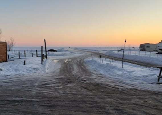

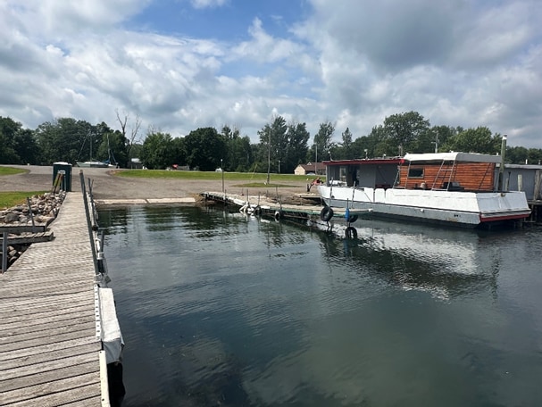
This Property Is For Sale
Property Detail
6546 Us Highway 169
Brainerd, MN
ALL OF THE N'LY 180 FT OF THE S'LY 530 FT OF GOV. LOT 2 SEC. 36 LYING N & E OF THE RIGHT OF WAY U.S.
660361302KA0889
CROW WING
Commercialnec
Minnesota
AE The base floodplain where base flood elevations are provided. AE Zones are now used on new format FIRMs instead of A1-A30 Zones.
2
2026
8.20 AC
2025
Minnesota Central Area
951600
Other Market Areas
1,014 SF
NEARBY LISTINGS FOR SALE OR LEASE
-
-
View all Garrison listings for sale on LoopNet.com
DEMOGRAPHICS near 6546 Us Highway 169
1 mile
3 mile
5 mile
2025 Total Population
246
1,320
2,652
2030 Population
259
1,412
2,821
Pop Growth 2025-2030
+ 5.28%
+ 6.97%
+ 6.37%
Average Age
50
46
46
2025 Total Households
115
585
1,154
HH Growth 2025-2030
+ 4.35%
+ 6.84%
+ 6.24%
Median Household Inc
$76,562
$70,991
$71,886
Avg Household Size
2.10
2.30
2.30
2025 Avg HH Vehicles
2.00
2.00
2.00
Median Home Value
$267,646
$261,855
$260,695
Median Year Built
1980
1986
1985
Nearby Places
Map Layers
Map Styles
 Street
 Aerial
Layers
 Traffic
 Biking
Places
Listings with unknown addresses are not visible on the map
- Restaurants
- Banks
- Shops
- Fitness
- Groceries
Nearby Properties
Address
Land Use
TOTAL SIZE
Lot Size
Zoning
Address
Land Use
TOTAL SIZE
Lot Size
Zoning
102,000 SF
55.98 AC
Address
Land Use
TOTAL SIZE
Lot Size
Zoning
1,560 SF
65.83 AC
Address
Land Use
TOTAL SIZE
Lot Size
Zoning
20,686 SF
4.54 AC
Address
Land Use
TOTAL SIZE
Lot Size
Zoning
8,163 SF
2.66 AC
Address
Land Use
TOTAL SIZE
Lot Size
Zoning
1,744 SF
0.59 AC
Address
Land Use
TOTAL SIZE
Lot Size
Zoning
1,904 SF
0.88 AC
Address
Land Use
TOTAL SIZE
Lot Size
Zoning
3,733 SF
4.31 AC
Address
Land Use
TOTAL SIZE
Lot Size
Zoning
1,232 SF
0.92 AC
Address
Land Use
TOTAL SIZE
Lot Size
Zoning
5,956 SF
0.20 AC
Address
Land Use
TOTAL SIZE
Lot Size
Zoning
28.22 AC
Address
Land Use
TOTAL SIZE
Lot Size
Zoning
1,928 SF
0.95 AC
Address
Land Use
TOTAL SIZE
Lot Size
Zoning
1,156 SF
0.25 AC
Address
Land Use
TOTAL SIZE
Lot Size
Zoning
2,961 SF
1.79 AC
Address
Land Use
TOTAL SIZE
Lot Size
Zoning
1,120 SF
0.16 AC
Address
Land Use
TOTAL SIZE
Lot Size
Zoning
1,536 SF
0.41 AC
Address
Land Use
TOTAL SIZE
Lot Size
Zoning
1,572 SF
1.29 AC
Address
Land Use
TOTAL SIZE
Lot Size
Zoning
3,375 SF
8.40 AC
Address
Land Use
TOTAL SIZE
Lot Size
Zoning
528 SF
1.97 AC
Address
Land Use
TOTAL SIZE
Lot Size
Zoning
Address
Land Use
TOTAL SIZE
Lot Size
Zoning
576 SF
2.42 AC
Address
Land Use
TOTAL SIZE
Lot Size
Zoning
884 SF
0.48 AC
Address
Land Use
TOTAL SIZE
Lot Size
Zoning
7,728 SF
7.88 AC
Address
Land Use
TOTAL SIZE
Lot Size
Zoning
840 SF
0.58 AC
Address
Land Use
TOTAL SIZE
Lot Size
Zoning
1,352 SF
0.66 AC
Address
Land Use
TOTAL SIZE
Lot Size
Zoning
1.08 AC
Address
Land Use
TOTAL SIZE
Lot Size
Zoning
720 SF
0.33 AC
Address
Land Use
TOTAL SIZE
Lot Size
Zoning
1,130 SF
0.51 AC
Address
Land Use
TOTAL SIZE
Lot Size
Zoning
22,000 SF
29.70 AC
The World's #1 Commercial Real Estate Marketplace
Connect with us
© 2026 CoStar Group
The information above has been obtained from sources believed reliable. While we do not doubt its accuracy we have not verified it and make no guarantee, warranty or representation about it. It is your responsibility to independently confirm its accuracy and completeness. Any projections, opinions, assumptions, or estimates used are for example only and do not represent the current or future performance of the property. The value of this transaction to you depends on tax and other factors which should be evaluated by your tax, financial, and legal advisors. You and your advisors should conduct a careful, independent investigation of the property to determine to your satisfaction the suitability of the property for your needs.