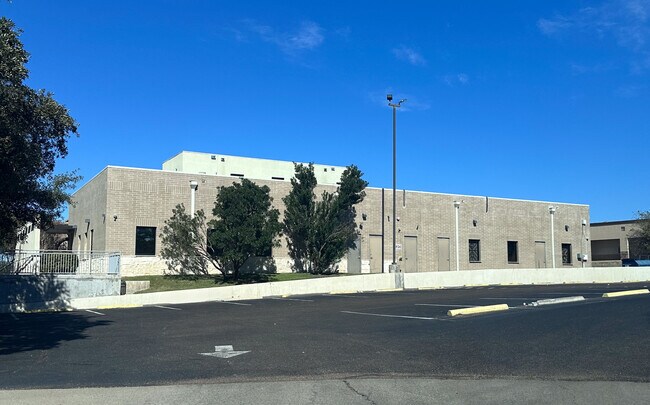
Property Record
6547 Star Ct, Laredo, TX 78041


Current Lease Availabilities
Property Detail
6547 Star Ct
303622
S M LAREDO PROPERTIES LTD, BLOCK 1, LOT 4B, REPLAT
Commercialnec
Webb
B4
Texas
B and X Area of moderate flood hazard, usually the area between the limits of the 100-year and 500-year floods.
d,4b
2024
0.46 AC
2025
Texas South Area
001718
Other Market Areas
5,282 SF
Laredo, TX
NEARBY LISTINGS FOR SALE OR LEASE
DEMOGRAPHICS near 6547 Star Ct
1 mile
3 mile
5 mile
2024 Total Population
15,139
104,248
182,487
2029 Population
15,434
106,168
186,339
Pop Growth 2024-2029
+ 1.95%
+ 1.84%
+ 2.11%
Average Age
38
37
36
2024 Total Households
5,321
33,824
57,070
HH Growth 2024-2029
+ 2.16%
+ 2.05%
+ 2.31%
Median Household Inc
$60,636
$58,090
$61,879
Avg Household Size
2.80
3.00
3.10
2024 Avg HH Vehicles
2.00
2.00
2.00
Median Home Value
$243,550
$215,846
$221,283
Median Year Built
1985
1988
1993
Nearby Places
Map Layers
Map Styles
 Street
 Aerial
Transit
 Traffic
 Biking
Places
Listings with unknown addresses are not visible on the map
- Restaurants
- Banks
- Shops
- Fitness
- Groceries
PUBLIC TRANSPORTATION
AIRPORT
Laredo International
Drive
Walk
Distance
Laredo International
11 min
4.7 mi
Nearby Properties
Address
Land Use
TOTAL SIZE
Lot Size
Zoning
Address
Land Use
TOTAL SIZE
Lot Size
Zoning
668,900 SF
38.32 AC
B4
Address
Land Use
TOTAL SIZE
Lot Size
Zoning
497,463 SF
1.77 AC
R1
Address
Land Use
TOTAL SIZE
Lot Size
Zoning
178,000 SF
23.50 AC
B4
Address
Land Use
TOTAL SIZE
Lot Size
Zoning
489,093 SF
32.23 AC
B4
Address
Land Use
TOTAL SIZE
Lot Size
Zoning
255,819 SF
50 AC
R1
Address
Land Use
TOTAL SIZE
Lot Size
Zoning
152.08 AC
M1
Address
Land Use
TOTAL SIZE
Lot Size
Zoning
224,926 SF
21.49 AC
R3
Address
Land Use
TOTAL SIZE
Lot Size
Zoning
258,114 SF
30.54 AC
B1
Address
Land Use
TOTAL SIZE
Lot Size
Zoning
227,503 SF
19.84 AC
B4
Address
Land Use
TOTAL SIZE
Lot Size
Zoning
164,276 SF
43.92 AC
Address
Land Use
TOTAL SIZE
Lot Size
Zoning
192,176 SF
34.94 AC
Address
Land Use
TOTAL SIZE
Lot Size
Zoning
109,695 SF
3.73 AC
M1
Address
Land Use
TOTAL SIZE
Lot Size
Zoning
194,520 SF
11.18 AC
B3
Address
Land Use
TOTAL SIZE
Lot Size
Zoning
355,229 SF
15.41 AC
M1
Address
Land Use
TOTAL SIZE
Lot Size
Zoning
157,376 SF
25.86 AC
B3
Address
Land Use
TOTAL SIZE
Lot Size
Zoning
218,415 SF
13.41 AC
R3
Address
Land Use
TOTAL SIZE
Lot Size
Zoning
203,922 SF
11 AC
R2
Address
Land Use
TOTAL SIZE
Lot Size
Zoning
122,752 SF
17.16 AC
R2
Address
Land Use
TOTAL SIZE
Lot Size
Zoning
144,522 SF
3.86 AC
B3
Address
Land Use
TOTAL SIZE
Lot Size
Zoning
158,728 SF
7.89 AC
Address
Land Use
TOTAL SIZE
Lot Size
Zoning
50,765 SF
39.73 AC
Address
Land Use
TOTAL SIZE
Lot Size
Zoning
139,521 SF
18.13 AC
M1
Address
Land Use
TOTAL SIZE
Lot Size
Zoning
101,734 SF
1.63 AC
B3
Address
Land Use
TOTAL SIZE
Lot Size
Zoning
100,598 SF
26.22 AC
Address
Land Use
TOTAL SIZE
Lot Size
Zoning
66,567 SF
3.81 AC
M1
Address
Land Use
TOTAL SIZE
Lot Size
Zoning
10,712 SF
745.84 AC
AG
Address
Land Use
TOTAL SIZE
Lot Size
Zoning
113,687 SF
5.58 AC
R3
Address
Land Use
TOTAL SIZE
Lot Size
Zoning
176,926 SF
8.70 AC
R2
Address
Land Use
TOTAL SIZE
Lot Size
Zoning
172,485 SF
9.24 AC
R2
Address
Land Use
TOTAL SIZE
Lot Size
Zoning
138,920 SF
13.06 AC
The World's #1 Commercial Real Estate Marketplace
Connect with us
© 2026 CoStar Group
The information above has been obtained from sources believed reliable. While we do not doubt its accuracy we have not verified it and make no guarantee, warranty or representation about it. It is your responsibility to independently confirm its accuracy and completeness. Any projections, opinions, assumptions, or estimates used are for example only and do not represent the current or future performance of the property. The value of this transaction to you depends on tax and other factors which should be evaluated by your tax, financial, and legal advisors. You and your advisors should conduct a careful, independent investigation of the property to determine to your satisfaction the suitability of the property for your needs.